MyTopo
Holmesville Ohio US Topo Map
Couldn't load pickup availability
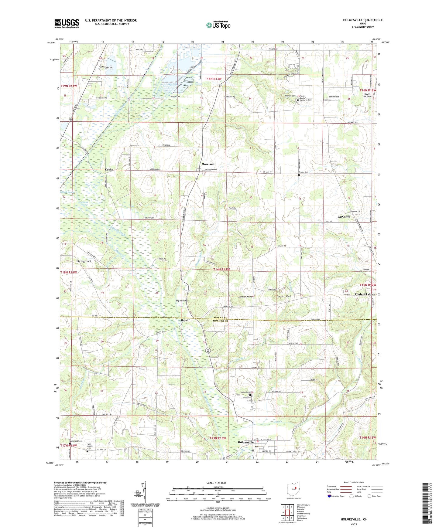
2019 topographic map quadrangle Holmesville in the state of Ohio. Scale: 1:24000. Based on the newly updated USGS 7.5' US Topo map series, this map is in the following counties: Wayne, Holmes. The map contains contour data, water features, and other items you are used to seeing on USGS maps, but also has updated roads and other features. This is the next generation of topographic maps. Printed on high-quality waterproof paper with UV fade-resistant inks.
Quads adjacent to this one:
West: Shreve
Northwest: New Pittsburg
North: Wooster
Northeast: Orrville
East: Fredericksburg
Southeast: Berlin
South: Millersburg
Southwest: Glenmont
Contains the following named places: Big Hollow, Bottom Run Farms, Dalroy Farms, Davies Air Field, Dush Pond, Dush Pond Dam, Franklin Elementary School, Franks Cemetery, Gress Family Farm, Hard, Hard Post Office, Hawk Haven, Hazeldell School, Hermans Cemetery, Holmesville, Holmesville Elementary School, Holmesville Post Office, Jennings Ditch, Kauke, Killbuck Marsh State Wildlife Area, Killbuck Swamp, McCance, Mill Brook Stock Farm, Moorhead Church, Morehead Cemetery, Moreland, Moreland Cemetery, Moreland Fruit Farm, Munson Farm, Munson Knob, Norway Farms, Oak Grove School, Prairie Cemetery, Prairie Township Volunteer Fire Department, Rock Point School, Rush Run, Salt Creek, Savage Run, Scheufler Farm, School Number 1, School Number 2, School Number 4, School Number 5, School Number 6, Shreve Creek, Sterrett Knob, Stine Field, Stoney Meadow Farm, Stringtown, Sunset Meadows, Tea Run, Tea Run School, Township of Franklin, Township of Prairie, Trinity English Lutheran Cemetery, Village of Holmesville, West Prairie Cemetery, Will Del Farm, Wirth Farm, ZIP Code: 44633