MyTopo
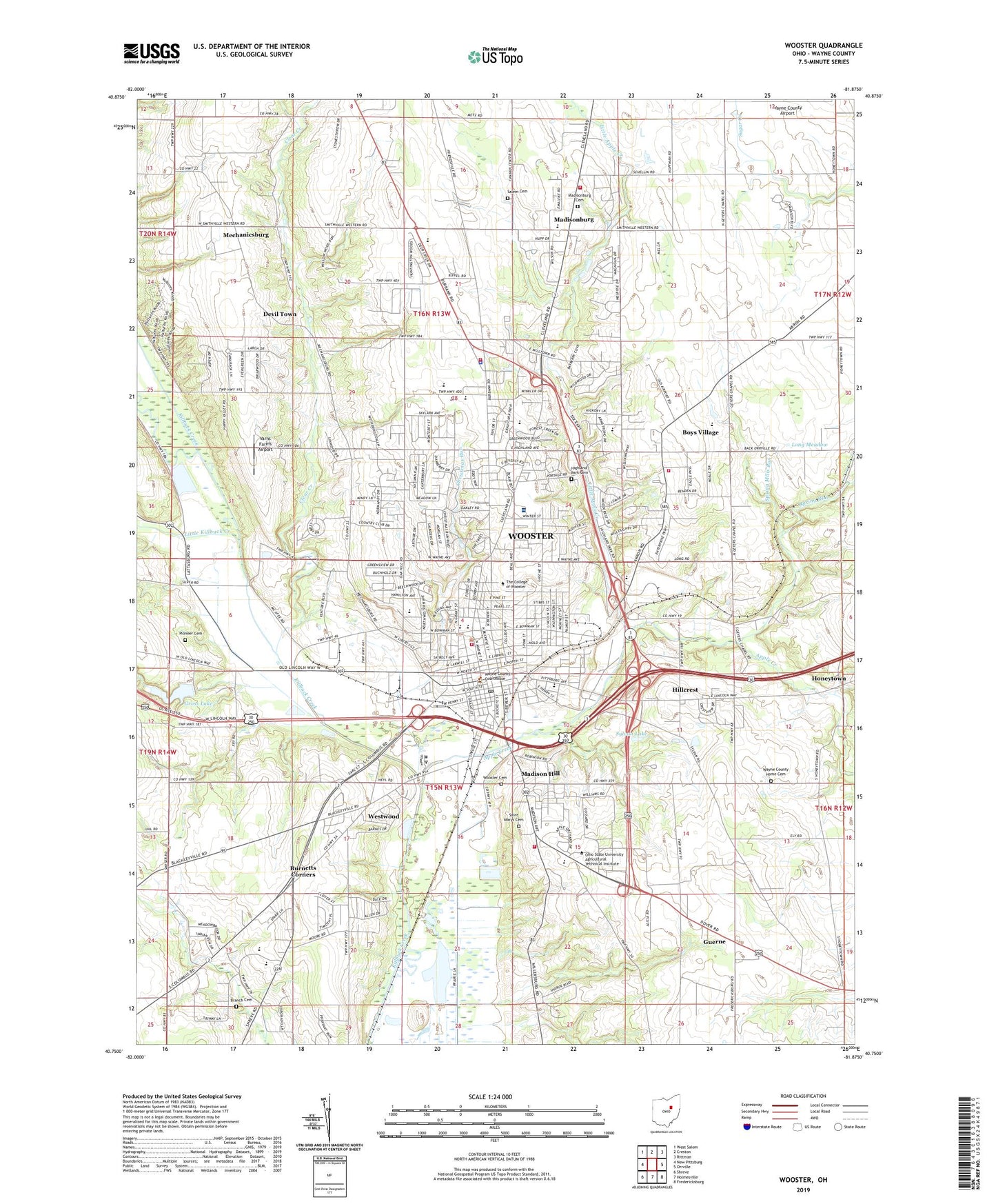
Wooster Ohio US Topo Map
Couldn't load pickup availability
2023 topographic map quadrangle Wooster in the state of Ohio. Scale: 1:24000. Based on the newly updated USGS 7.5' US Topo map series, this map is in the following counties: Wayne. The map contains contour data, water features, and other items you are used to seeing on USGS maps, but also has updated roads and other features. This is the next generation of topographic maps. Printed on high-quality waterproof paper with UV fade-resistant inks.
Quads adjacent to this one:
West: New Pittsburg
Northwest: West Salem
North: Creston
Northeast: Rittman
East: Orrville
Southeast: Fredericksburg
South: Holmesville
Southwest: Shreve
This map covers the same area as the classic USGS quad with code o40081g8.
Contains the following named places: Anderson Farm, Andrews Hall, Andrews Library, Apple Creek, Armington Hall, Armington Physical Education Center, Art Smith Trailer Park, Babcock Hall, Beall Avenue Elementary School, Bissman Hall, Boles Golf Course, Boys Village, Boys Village School, Branch Cemetery, Branstetter, Burbank Road Church of Christ, Burnetts Corners, Burton D Morgan Hall, Carmony Stock Farms, Cebul Farm, Central Christian Church, Central Fire District Station 2, Christian and Missionary Alliance Church, Christmas Run, Christmas Run Park, Cindy Barr Field, City of Wooster, Clear Creek, Cohan Park, College of Wooster, Compton Hall, Concordia Lutheran Church, Cutter Farms, D J Hard Tennis Courts, Dale Soccer Field, Deer Creek, Devil Town, Douglass Hall, Drew Ranch, Ebert Art Center, Edgewood Junior High School, Evangel Assembly of God Church, First Baptist Church, First Church of Christ Scientist, First Church of God, First Presbyterian Church, Firsthaven Farm, Forest Creek, Forest View Mobile Home Park, Freedlander Theatre, Frick Hall, Frycrest Farm, Galpin Hall, Gault Admissions Center, Gault Alumni Center, Gault Library for Independent Study, Grace Church of the Brethren, Grant Street Elementary School, Gross Dam, Gross Lake, Guerne, Highland Park, Highland Park Cemetery, Hillcrest, Holden Hall, Honeytown, Ida Sue School, Kauke Hall, Kittredge Hall, Knesseth Israel Temple, Knights Field, Kuhles Fruit Farm, Lang Farms, Layton Elementary School, Lazy K Ranch, Linwood Heights, Little Apple Creek, Little Killbuck Creek, Long Meadow, Longbrake Student Wellness Center, Lowry Student Center, Luce Residence Hall, Madison Hill, Madisonburg, Madisonburg Cemetery, Maple Lane Farm, Market Street Church of God, Mateer Hall, Maurer Farms, McGaw Chapel, Meadow Brook, Mechanicsburg, Melrose Elementary School, Melrose Village, Memorial Hall, Merz Hall, Miller Lakes, Miller Manor, Miller Park, Milltown Mall Shopping Center, Monitor Ranch, Murray Baseball Field, Nazarene Church, Nichols Shopping Center, Nold Avenue Baptist Church, Ohio Agricultural Research and Development Center, Ohio State Highway Patrol - Wooster Patrol Post, Papp Stadium, Parkview, Parkview Elementary School, Pentecostal Church of God of America, Pioneer Cemetery, Pittsburgh Avenue School, Portage Square Shopping Center, Ramblewood, Rastetter Farm, Rohr Farms, Saint James Episcopal Church, Saint Marys Cemetery, Saint Marys Church of the Immaculate Conception, Saint Marys School, Salem Cemetery, Scheide Music Center, Schellin Park, Schnell Farms, School Number 1, School Number 3, School Number 4, School Number 5, School Number 6, School Number 7, School Number 8, Scovel Hall, Second Baptist Church, Seventh Day Adventist Church, Severance Hall, Shel Mar Mobile Home Park, Spring Run, Spruce Tree Village, Stevenson Hall, Sunset Trailer Park, Sylvan Lake, Taylor Hall, The Meadows, Timken Library, Township of Wayne, Township of Wooster, Trinity United Church of Christ, Trivanovich Farm, Triway High School, Triway Junior High School, Unitarian Universalist Fellowship of Wayne County, Varns Farms Airport, Wagner Hall, Walnut Street School, Warren Tennis Courts, Wayne Center for the Arts, Wayne County, Wayne County Airport, Wayne County Childrens Home, Wayne County Courthouse, Wayne County Fairgrounds, Wayne County Historical Museum, Wayne County Home Cemetery, Wayne County Infirmary, Wayne County Law Library, Wayne County Public Library, Wayne Elementary School, WCWS-FM (Wooster), West Bowman Street Public School, West South Street Church of God, Westminster Hall, Westminster Presbyterian Church, Westwood, Wishart Hall, WKVX-AM (Wooster), Wooster, Wooster Cemetery, Wooster City Hall, Wooster City Water Plant, Wooster Community Hospital, Wooster Fire Department Station 1, Wooster Fire Department Station 2, Wooster High School, Wooster Mennonite Church, Wooster Plaza Shopping Center, Wooster Police Department, Wooster Post Office, Wooster Public Square Historic District, Wooster Township Elementary School, Wooster Township Fire Department, Wooster Trailer Park, Wooster United Methodist Church, WQKT-FM (Wooster), Zion Lutheran Church, ZIP Code: 44691


