MyTopo
Kinsman Ohio US Topo Map
Couldn't load pickup availability
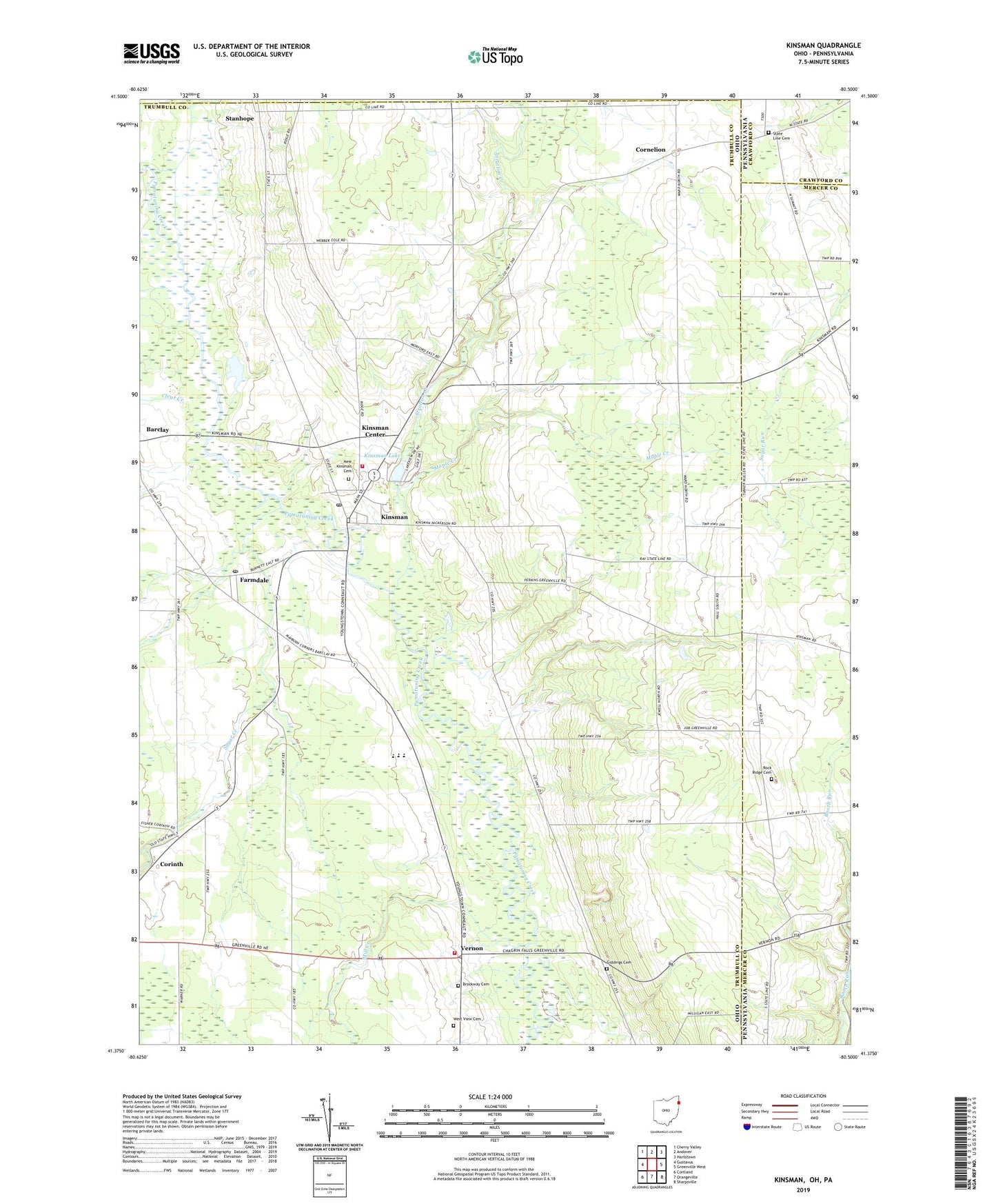
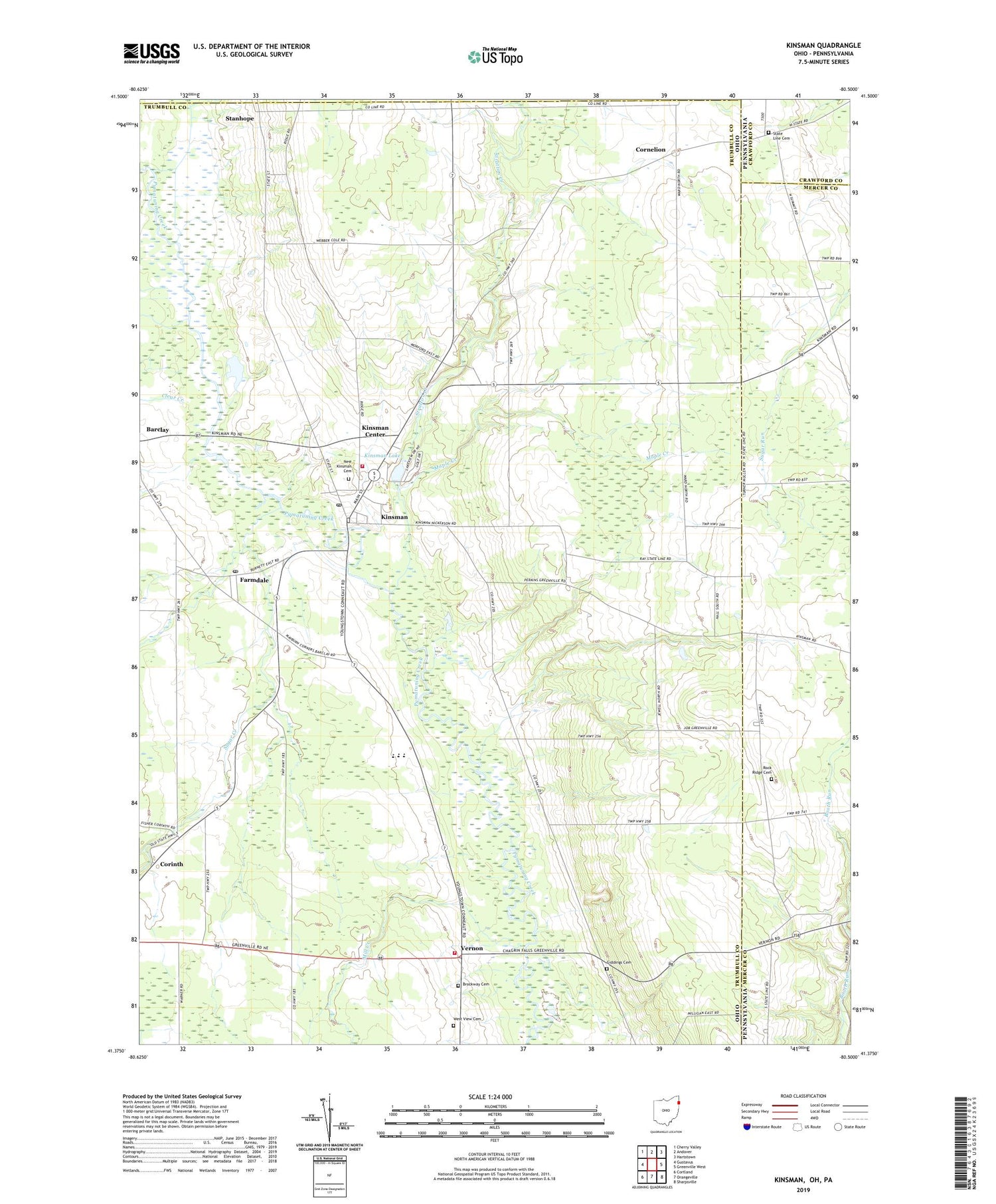
2019 topographic map quadrangle Kinsman in the states of Ohio, Pennsylvania. Scale: 1:24000. Based on the newly updated USGS 7.5' US Topo map series, this map is in the following counties: Trumbull, Mercer, Crawford, Ashtabula. The map contains contour data, water features, and other items you are used to seeing on USGS maps, but also has updated roads and other features. This is the next generation of topographic maps. Printed on high-quality waterproof paper with UV fade-resistant inks.
Quads adjacent to this one:
West: Gustavus
Northwest: Cherry Valley
North: Andover
Northeast: Hartstown
East: Greenville West
Southeast: Sharpsville
South: Orangeville
Southwest: Cortland
Contains the following named places: Allen Corners, Badger High School, Biggin Corners, Burghill Vernon Fire Department Station 19, Camp Sugarbush, Carr Farms, Clear Creek, Corinth, Corinth Post Office, Cornelian Post Office, Cornelion, Dewey, Dewey Post Office, Farmdale, Farmdale Post Office, Giddings Cemetery, Kinsman, Kinsman Center Census Designated Place, Kinsman Lake, Kinsman Post Office, Kinsman Presbyterian Church, Kinsman United Methodist Church, Kinsman Volunteer Fire Department, Maple Creek, Mayburn Corners, Mill Creek, Naturally Yours Farm, New Kinsman Cemetery, Pioneer Cemetery, Rock Ridge Cemetery, Saint Patricks Catholic Church, Sheets Field Airport, Stanhope, Stanhope Post Office, State Line Cemetery, State Line Church, Stratton Creek, Stulls Corners, Sugar Creek, Superior, Superior Post Office, Township of Kinsman, Township of Vernon, Valley View Farms, Vernon, Vernon United Methodist Church, West View Cemetery, ZIP Code: 44428