MyTopo
Orangeville Ohio US Topo Map
Couldn't load pickup availability
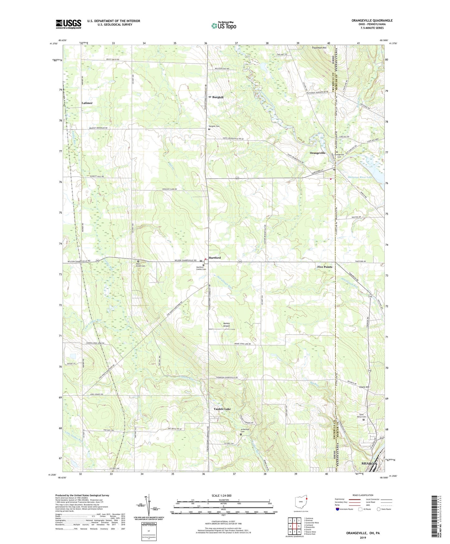
2023 topographic map quadrangle Orangeville in the states of Ohio, Pennsylvania. Scale: 1:24000. Based on the newly updated USGS 7.5' US Topo map series, this map is in the following counties: Trumbull, Mercer. The map contains contour data, water features, and other items you are used to seeing on USGS maps, but also has updated roads and other features. This is the next generation of topographic maps. Printed on high-quality waterproof paper with UV fade-resistant inks.
Quads adjacent to this one:
West: Cortland
Northwest: Gustavus
North: Kinsman
Northeast: Greenville West
East: Sharpsville
Southeast: Sharon East
South: Sharon West
Southwest: Girard
Contains the following named places: Antietam, Antietam Post Office, Artherholt Cemetery, Big Run, Booth Run, Brockway, Brockway Post Office, Burghill, Burghill Baptist Church, Burghill Cemetery, Burghill Post Office, Clark Hill, Five Points, Hartford, Hartford Center Cemetery, Hartford Community Church, Hartford Elementary School, Hartford Orchards, Hartford Post Office, Hartford Township Volunteer Fire Department, Hartford United Methodist Church, Kenley Airport, Latimer, Latimer Post Office, Orangeville, Orangeville Cemetery, Orangeville Post Office, Orangeville Volunteer Fire Department, Port Sember Airport, Saint Marys Cemetery, Sharon Speedway, South Branch Yankee Run, Storeyland Christmas Tree Farm, Thornton Run, Township of Hartford, Trautman Hill, Village of Orangeville, Village of Yankee Lake, Weldon, Weldon Post Office, West Street Cemetery, Yankee Lake, Yankee Lake Dam, ZIP Codes: 44404, 44418