MyTopo
Lockbourne Ohio US Topo Map
Couldn't load pickup availability
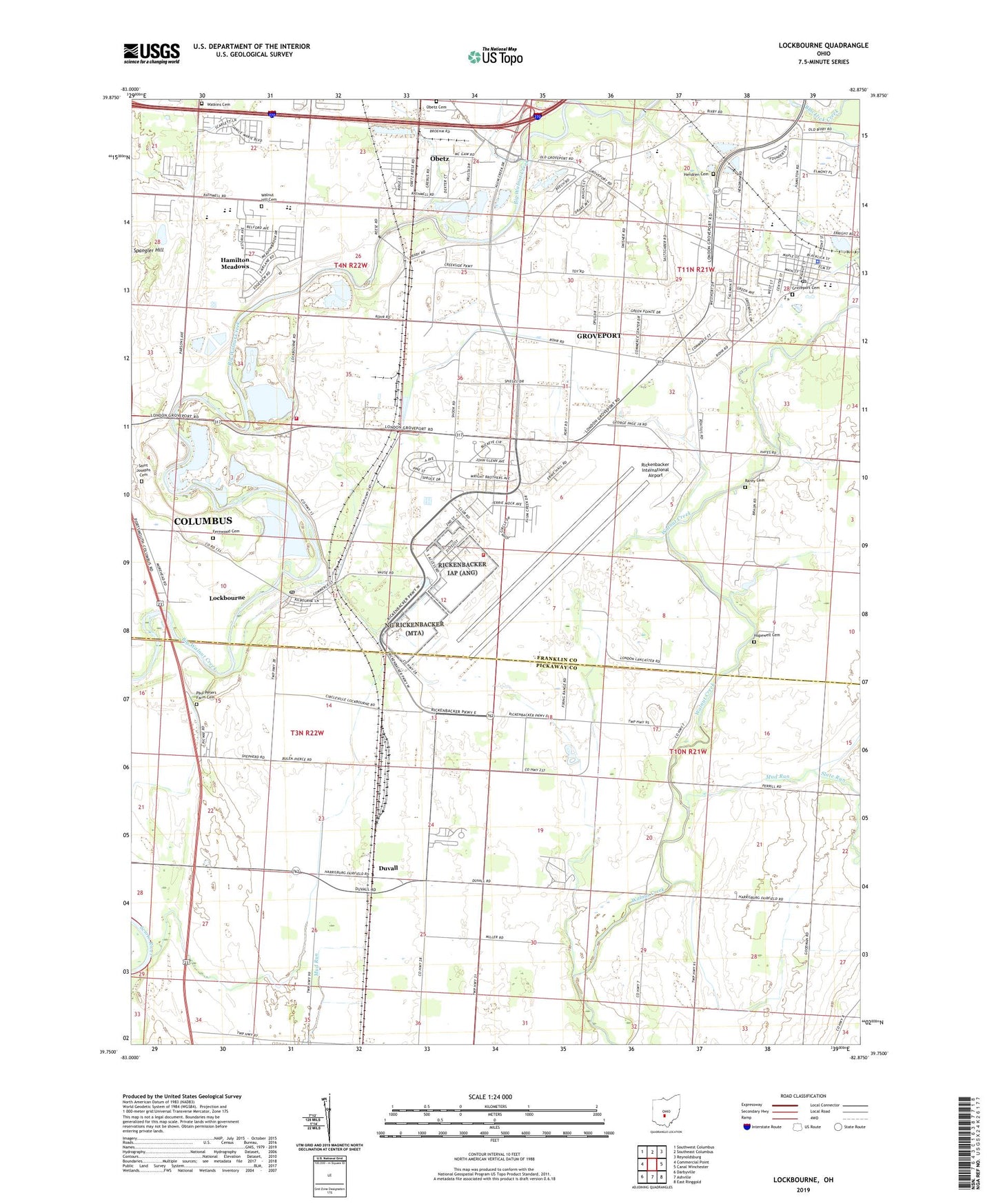
2019 topographic map quadrangle Lockbourne in the state of Ohio. Scale: 1:24000. Based on the newly updated USGS 7.5' US Topo map series, this map is in the following counties: Franklin, Pickaway. The map contains contour data, water features, and other items you are used to seeing on USGS maps, but also has updated roads and other features. This is the next generation of topographic maps. Printed on high-quality waterproof paper with UV fade-resistant inks.
Quads adjacent to this one:
West: Commercial Point
Northwest: Southwest Columbus
North: Southeast Columbus
Northeast: Reynoldsburg
East: Canal Winchester
Southeast: East Ringgold
South: Ashville
Southwest: Darbyville
Contains the following named places: Bright, Camp Saint Joseph, Chapel Number 2, Church of Christ, City of Groveport, Comprix Heliport, Duvall, Duvall Post Office, Fernwood Cemetery, Glendening Elementary School, Groveport Cemetery, Groveport City Hall, Groveport Commerce Center, Groveport Golf Course, Groveport Police Department, Groveport Post Office, Groveport-Madison Elementary School, Groveport-Madison Freshman High School, Groveport-Madison Middle School South, Hamilton Elementary School, Hamilton High School, Hamilton Meadows, Hamilton Middle School, Hamilton South Elementary School, Hamilton Township Fire Department Station 172, Hendren Cemetery, Hopewell Cemetery, Hopewell Church, Lock Meadows Park, Lockbourne, Lockbourne Church of Christ, Lockbourne Municipal Building, Lockbourne Post Office, Lockbourne United Methodist Church, Main Chapel, Mud Run, New Millennium Church, Obetz Industrial Park, Paul Peters Farm Cemetery, Peters Family Farms, Rarey Cemetery, Reese, Reeses Post Office, Resse Chapel Church of Christ, Rickenbacker Air Force Base Fire Department, Rickenbacker Air National Guard Base, Rickenbacker International Airport, Rohr Road Baptist Church, Saint Josephs Cemetery, Saint Marys Roman Catholic Church, Saint Vincents Church, Scioto Downs, Scioto Valley Grange, Shadeville Church of God, Sharp, Slate Run, South Branch Park, Township of Hamilton, Township of Madison, Village of Lockbourne, Village of Obetz, Walnut Hill Cemetery, Walnut Hill Church, Watkins Cemetery, Wesley Chapel Methodist Church, WTVN-AM (Columbus), Zion Evangelical Church, ZIP Codes: 43125, 43137, 43217