MyTopo
Marengo Ohio US Topo Map
Couldn't load pickup availability
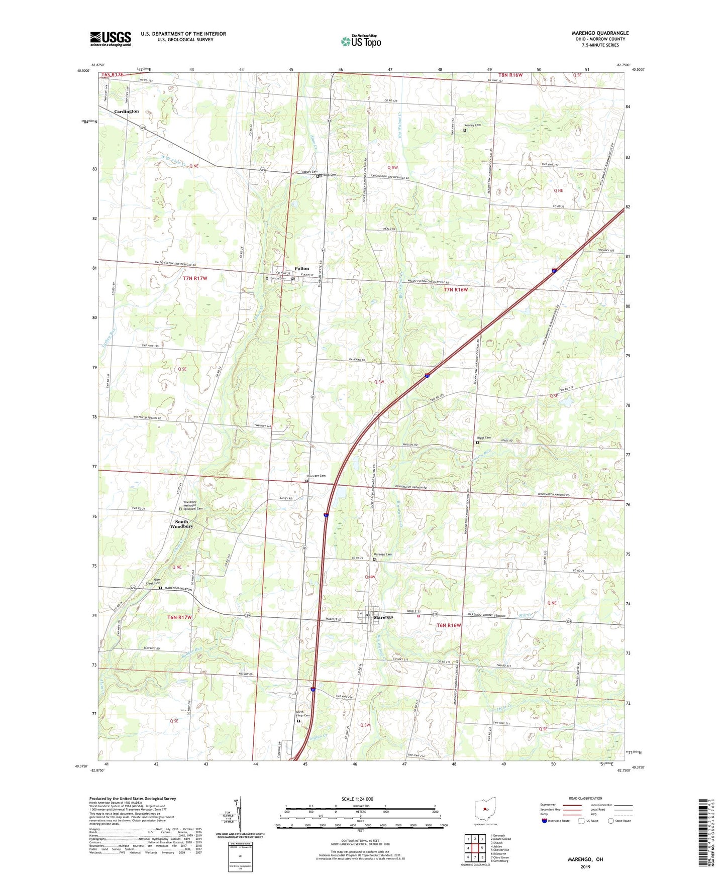
2019 topographic map quadrangle Marengo in the state of Ohio. Scale: 1:24000. Based on the newly updated USGS 7.5' US Topo map series, this map is in the following counties: Morrow. The map contains contour data, water features, and other items you are used to seeing on USGS maps, but also has updated roads and other features. This is the next generation of topographic maps. Printed on high-quality waterproof paper with UV fade-resistant inks.
Quads adjacent to this one:
West: Ashley
Northwest: Denmark
North: Mount Gilead
Northeast: Shauck
East: Chesterville
Southeast: Centerburg
South: Olive Green
Southwest: Kilbourne
Contains the following named places: Alum Creek Cemetery, Alum Creek Church, Asbury Cemetery, Bennington Springs, Big Walnut Joint Fire District, Biggs Cemetery, Blackbird School, Blackhawk School, Brookside Chapel, Buck Cemetery, Bunker Run, Castro Run, Chestnut Grove School, Dudley School, Ebenezer Cemetery, Fulton, Fulton Cemetery, Fulton Church of the Nazarene, Fulton Post Office, Goose Heaven School, Harmony Church, Highland West Elementary School, Kenney Cemetery, Light Creek, Little Ruth Church, Marengo, Marengo Cemetery, Marengo Post Office, Marengo United Methodist Church, Mill Creek, Morrow County Emergency Medical Services, North Fargo Cemetery, Oaklawn School, Oliveroot School, Phillips School, Railroad School, South Woodbury, Stilers Corner School, Township of Bennington, Township of Harmony, Township of Lincoln, Turney Center School, Village of Fulton, Village of Marengo, Walnut Creek Farms, Watson School, West Salem School, Wildcat School, Woodbury Methodist Episcopal Cemetery, ZIP Codes: 43315, 43321, 43334