MyTopo
Kilbourne Ohio US Topo Map
Couldn't load pickup availability
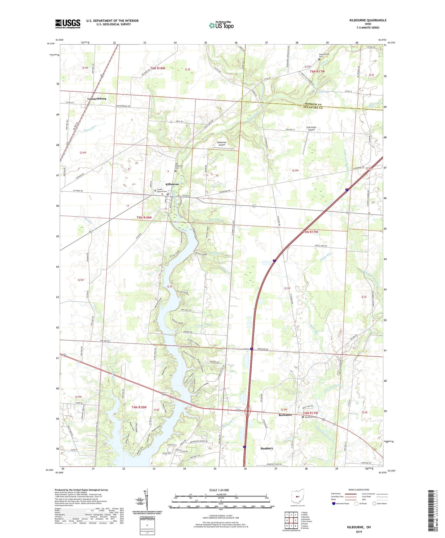
2023 topographic map quadrangle Kilbourne in the state of Ohio. Scale: 1:24000. Based on the newly updated USGS 7.5' US Topo map series, this map is in the following counties: Delaware, Morrow. The map contains contour data, water features, and other items you are used to seeing on USGS maps, but also has updated roads and other features. This is the next generation of topographic maps. Printed on high-quality waterproof paper with UV fade-resistant inks.
Quads adjacent to this one:
West: Delaware
Northwest: Waldo
North: Ashley
Northeast: Marengo
East: Olive Green
Southeast: Sunbury
South: Galena
Southwest: Powell
This map covers the same area as the classic USGS quad with code o40082c8.
Contains the following named places: Alum Creek, Alum Creek Post Office, Alum Creek School, Bald Lick, Berkshire, Berkshire Cemetery, Berkshire Post Office, Berkshire Township Hall, Big Run School, Bohannan Airport, Brown School, Brown's Lakeside Landings Airport, Butler Run, Camp Mahoney, Carter School, Clark Lake, Columbus City Park, Dale Tree Farm, Delaware County Home, East Branch Little Walnut Creek, Elm Valley School, Erdy Farm Airport, Estates At Sherman Lake, Fly-A-Way Farm Airport, Fontanell School, Green Mound Cemetery, Independence Hall School, Indigo Creek, Johnson Run, Kilbourne, Kilbourne Census Designated Place, Kilbourne Post Office, Kingston Center, Kingston Center Post Office, Leonardsburg, Leonardsburg Post Office, Longwell Run, Lott School, Lovat Farm, Oak Hall School, Old Kilbourne Cemetery, Salt Well Run, Scott School, Shadowlake Farm, Sheets School, Sherman Lakes, Slate Lick, Smith School, Stantontown Cemetery, Township of Brown, Township of Kingston, Vansickle School, West Branch Alum Creek, West Branch Little Walnut Creek, Whispering Creek, Whitehall School, ZIP Code: 43032