MyTopo
McArthur Ohio US Topo Map
Couldn't load pickup availability
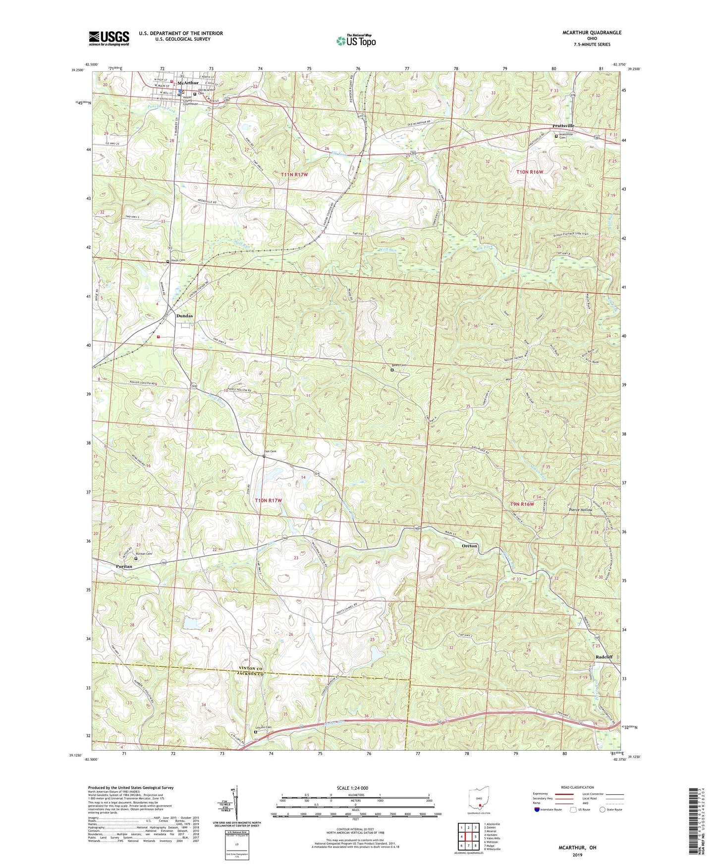
2019 topographic map quadrangle McArthur in the state of Ohio. Scale: 1:24000. Based on the newly updated USGS 7.5' US Topo map series, this map is in the following counties: Vinton, Jackson. The map contains contour data, water features, and other items you are used to seeing on USGS maps, but also has updated roads and other features. This is the next generation of topographic maps. Printed on high-quality waterproof paper with UV fade-resistant inks.
Quads adjacent to this one:
West: Hamden
Northwest: Allensville
North: Zaleski
Northeast: Mineral
East: Vales Mills
Southeast: Wilkesville
South: Mulga
Southwest: Wellston
Contains the following named places: Axtel School, Beard Cemetery, Beech Hollow Sanitary Landfill, Dundas, Dundas Fire Department, Eagle Furnace, First Christian Church, Haburn School, Haggerty School, Herbert Wescoat Memorial Library, Hilltop Church, Hixon Cemetery, Lincoln Cemetery, Lincoln School, Mc Arthur Fire Department, Mc Arthur Post Office, McArthur, McArthur Police Department, McArthur United Methodist Church, Old McArthur Cemetery, Oreton, Oreton Lookout Tower, Prattsville, Prattsville Cemetery, Puncheon Fork, Puritan, Puritan Cemetery, Puritan Freewill Baptist Church, Radcliff, Tar Farm School, Township of Clinton, Trinity Episcopal Church, Village of McArthur, Vinton, Vinton Chapel, Vinton County Consolidated High School, Vinton County Sheriff's Office, Vinton Furnace, Wolf Run, WXMF-FM (McArthur), Zion Cemetery, ZIP Code: 45634