MyTopo
Vales Mills Ohio US Topo Map
Couldn't load pickup availability
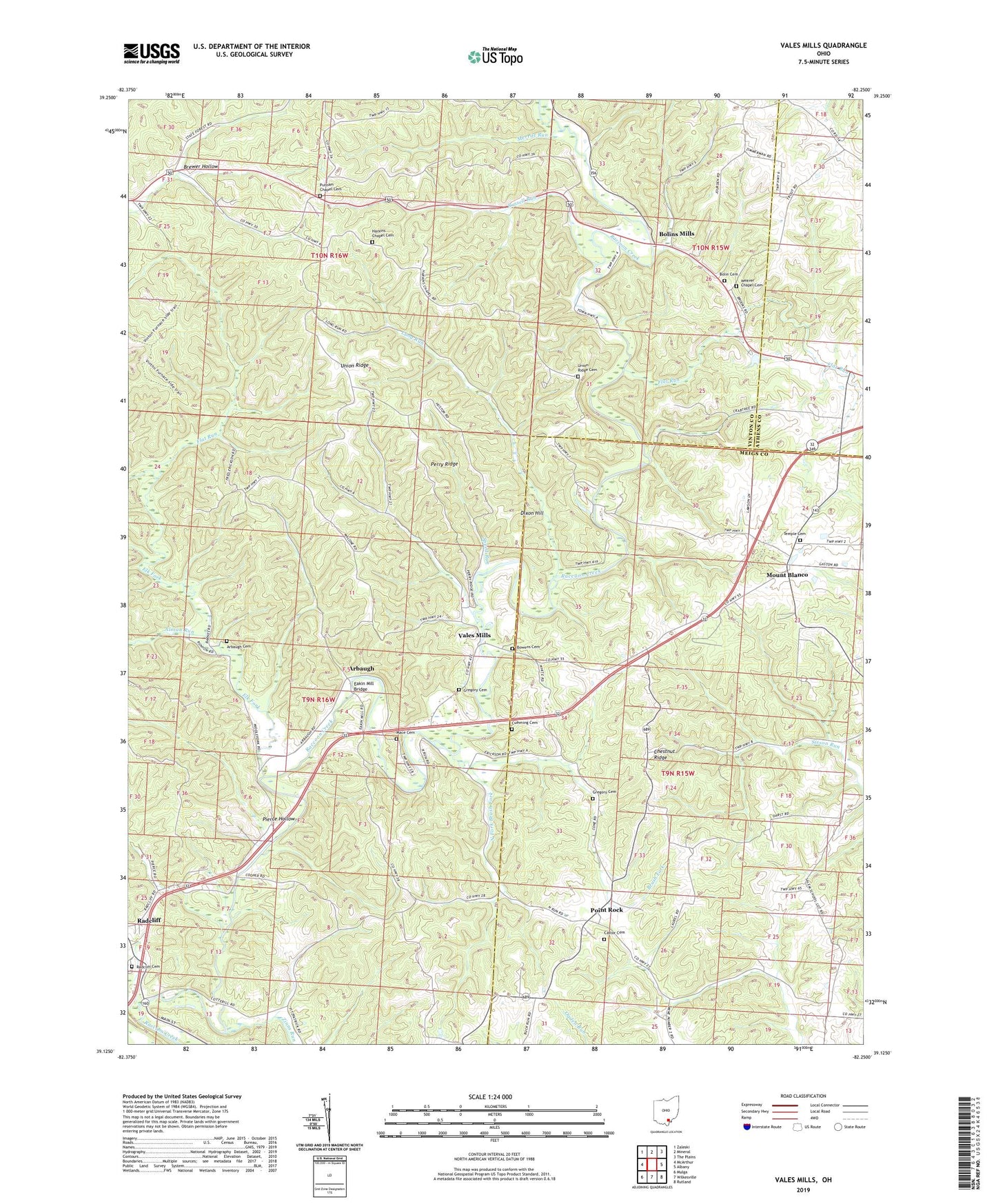
2023 topographic map quadrangle Vales Mills in the state of Ohio. Scale: 1:24000. Based on the newly updated USGS 7.5' US Topo map series, this map is in the following counties: Vinton, Meigs, Athens. The map contains contour data, water features, and other items you are used to seeing on USGS maps, but also has updated roads and other features. This is the next generation of topographic maps. Printed on high-quality waterproof paper with UV fade-resistant inks.
Quads adjacent to this one:
West: McArthur
Northwest: Zaleski
North: Mineral
Northeast: The Plains
East: Albany
Southeast: Rutland
South: Wilkesville
Southwest: Mulga
This map covers the same area as the classic USGS quad with code o39082b3.
Contains the following named places: Alman Run, Arbaugh, Arbaugh Cemetery, Bolin Cemetery, Bolins Mills, Boring Church, Bowens Cemetery, Brewer Hollow, Brush Fork, Buzzard School, Castor Cemetery, Chestnut Ridge, Chestnut Ridge School, Columbia Chapel, Cottrill School, Cumming Cemetery, Dixon Hill, Eakin Mill Bridge, Elk Fork, Flat Run, Flat Run School, Gregory Cemetery, Grim Chapel, Harkins Chapel, Harkins Chapel Cemetery, Hooper Park, Long Run, Mace Cemetery, Merritt Run, Mound School, Mount Blanco, Mount Blanco Post Office, North Fork Brush Fork, Perry Ridge, Pierce Hollow, Pincher, Point Rock, Point Rock Church, Pointrock Post Office, Putnam Chapel, Putnam Chapel Cemetery, Radcliff Cemetery, Radcliff United Brethren Church, Russell Run, Seldom Seen School, Speed Run, Temple Cemetery, Temple United Methodist Church, Township of Columbia, Township of Vinton, Union Ridge, Union Ridge Cemetery, Union Ridge Church, Vales Mills, Weaver Chapel, Weaver Chapel Cemetery, Whiteoak School, Wilton Elementary School, Zeal, Zeal Post Office, Zinns Run, ZIP Code: 45695