MyTopo
Mechanicsburg Ohio US Topo Map
Couldn't load pickup availability
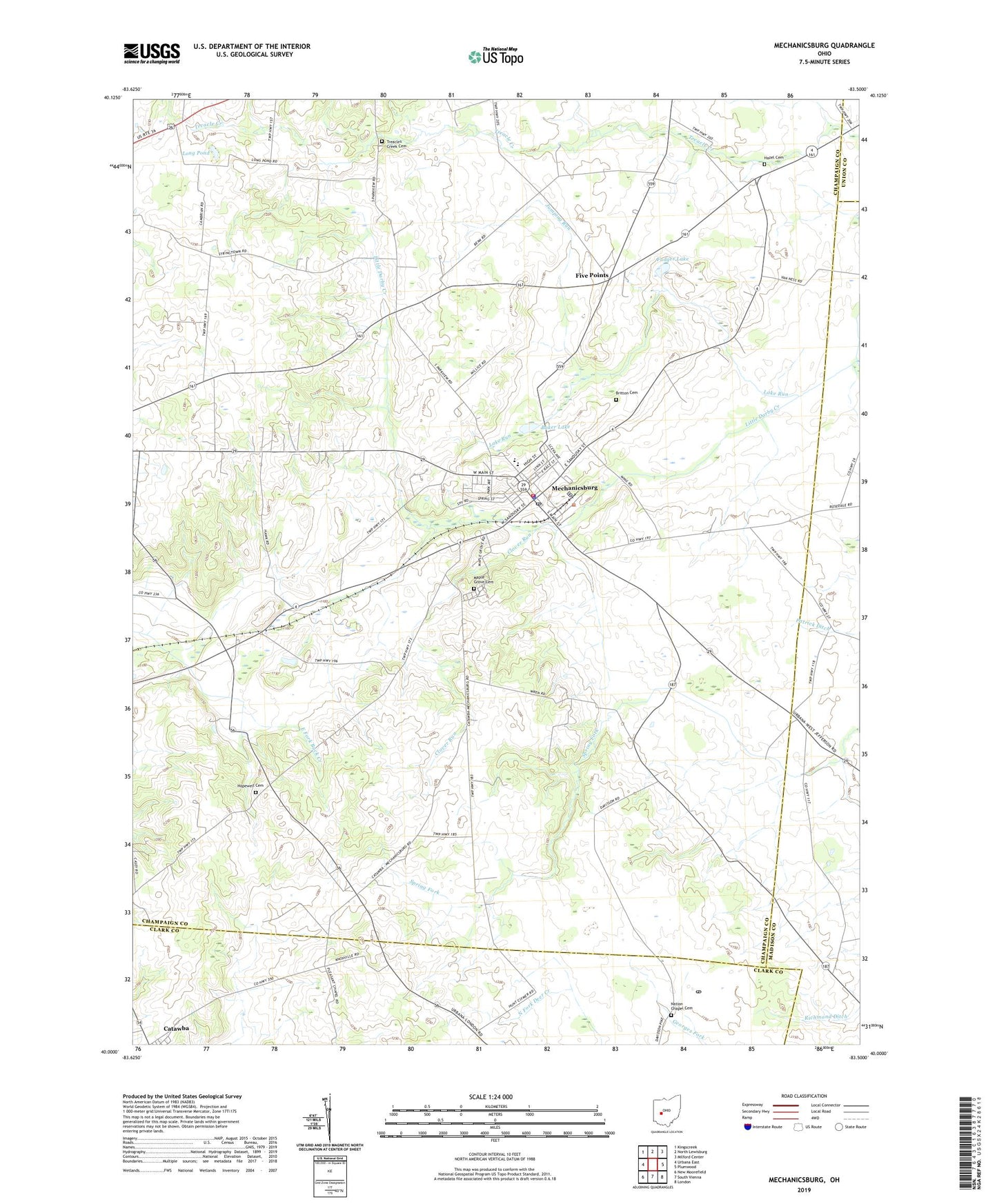
2019 topographic map quadrangle Mechanicsburg in the state of Ohio. Scale: 1:24000. Based on the newly updated USGS 7.5' US Topo map series, this map is in the following counties: Champaign, Clark, Madison, Union. The map contains contour data, water features, and other items you are used to seeing on USGS maps, but also has updated roads and other features. This is the next generation of topographic maps. Printed on high-quality waterproof paper with UV fade-resistant inks.
Quads adjacent to this one:
West: Urbana East
Northwest: Kingscreek
North: North Lewisburg
Northeast: Milford Center
East: Plumwood
Southeast: London
South: South Vienna
Southwest: New Moorefield
Contains the following named places: Baker Lake, Britton Cemetery, Church of Our Savior, Clover Run, Clover Run School, Dohron Wilson Elementary School, Eagle School, East Fork Buck Creek Structure Number 1B Dam, East Fork Buck Creek Structure Number One Reservoir, Enterprise Church, Five Points, Five Points School, Frost Mobile Home Park, Fudger Lake, Goshen School, Hazel Cemetery, Hickory Grove Church, Hopewell Cemetery, Jumping Run, Lake Run, Long Pond, Maple Grove Cemetery, Mechanicsburg, Mechanicsburg Baptist Church, Mechanicsburg Commercial Historic District, Mechanicsburg Fire and EMS Department, Mechanicsburg High School, Mechanicsburg Police Department, Mechanicsburg Post Office, Mechanicsburg United Methodist Church, Memorial Park, Mitchell School, Mustang Valley Farm, Nation Chapel Cemetery, Oak Grove Church, Oakridge School, Reynolds, Saint Michael Catholic Church, School Number 6, Second Baptist Church, Township of Goshen, Treacle Church, Treacles Creek Cemetery, Village of Mechanicsburg, Wild Rose School, ZIP Code: 43044