MyTopo
Kingscreek Ohio US Topo Map
Couldn't load pickup availability
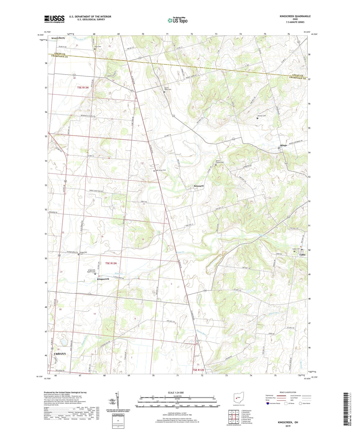
2023 topographic map quadrangle Kingscreek in the state of Ohio. Scale: 1:24000. Based on the newly updated USGS 7.5' US Topo map series, this map is in the following counties: Champaign, Logan. The map contains contour data, water features, and other items you are used to seeing on USGS maps, but also has updated roads and other features. This is the next generation of topographic maps. Printed on high-quality waterproof paper with UV fade-resistant inks.
Quads adjacent to this one:
West: Northville
Northwest: Bellefontaine
North: Zanesfield
Northeast: East Liberty
East: North Lewisburg
Southeast: Mechanicsburg
South: Urbana East
Southwest: Urbana West
This map covers the same area as the classic USGS quad with code o40083b6.
Contains the following named places: Cable, Cable Cemetery, Cable Post Office, Dugan Prairie, Freshwater Farms of Ohio, Grimes Field, Hagenbaugh, Johnson Cemetery, Kennard, Kennard Church of the Nazarene, Kennard Post Office, Kings Creek Mill, Kings Creek Post Office, Kingscreek, Kingscreek Baptist Cemetery, Kingscreek Baptist Church, Kingscreek Cemetery, Kingscreek United Methodist Church, Mackachack, Mar-nel Mobile Home Park, Mingo, Mingo Post Office, Mount Carmel Cemetery, Mount Carmel Church, Mount Tabor Cemetery, Mount Tabor Church, Mount Tabor School, Oak Grove Cemetery, Oak Grove Church, Piatt Cemetery, School Number 12, Township of Salem, Township of Wayne, Union Chapel, Woodland Golf Course, ZIP Code: 43009