MyTopo
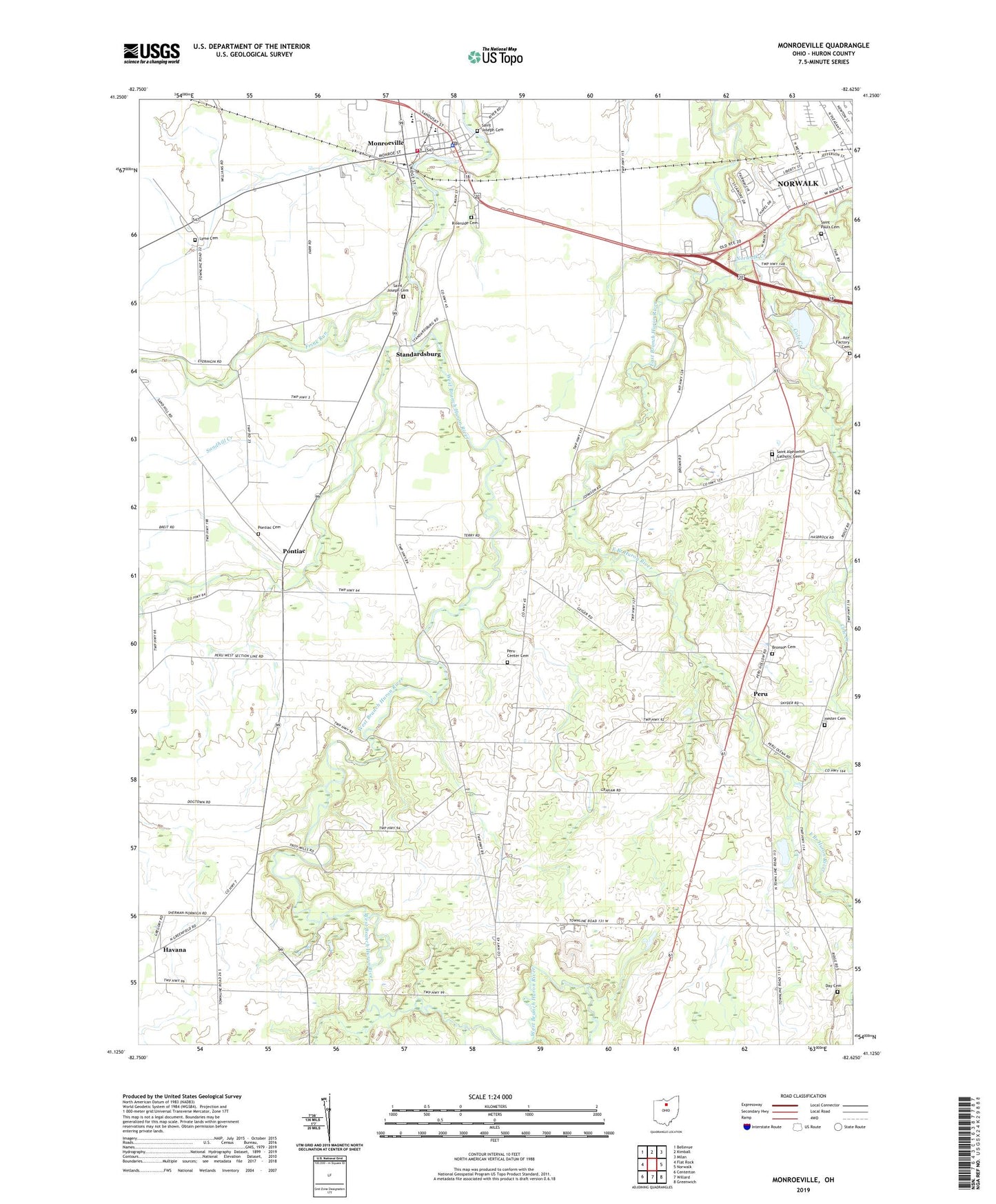
Monroeville Ohio US Topo Map
Couldn't load pickup availability
2019 topographic map quadrangle Monroeville in the state of Ohio. Scale: 1:24000. Based on the newly updated USGS 7.5' US Topo map series, this map is in the following counties: Huron. The map contains contour data, water features, and other items you are used to seeing on USGS maps, but also has updated roads and other features. This is the next generation of topographic maps. Printed on high-quality waterproof paper with UV fade-resistant inks.
Quads adjacent to this one:
West: Flat Rock
Northwest: Bellevue
North: Kimball
Northeast: Milan
East: Norwalk
Southeast: Greenwich
South: Willard
Southwest: Centerton
Contains the following named places: Axe Factory Cemetery, Bronson Cemetery, Cole Creek, Contractors Realty Corporation Pond, Contractors Realty Corporation Pond Dam, Day Cemetery, Frink Run, Greenfield School, Havana, Hester Cemetery, Huron County Landfill, Huron River Joint Fire District, Laurel Hill School, Lyme Cemetery, Martin Farms, Monroeville, Monroeville Low Head Dam, Monroeville Low Head Reservoir, Monroeville Police Department, Monroeville Post Office, Monroeville Public Library, Norwalk Creek, Peru, Peru Center Cemetery, Peru Office, Pontiac, Pontiac Cemetery, Pontiac Post Office, Riverside Cemetery, Saint Alphonse School, Saint Alphonsus Catholic Cemetery, Saint Joseph Cemetery, Saint Joseph School, Saint Josephs Catholic Church, Saint Pauls Cemetery, Saint Peters Church, Sandhill Creek, School Number 1, School Number 10, School Number 4, School Number 6, Shield Dairy Farm, Slate Run, Standardsburg, Star View Drive-In, Township of Peru, Trinity Lutheran Church, Valley View Heliport, Village of Monroeville, Westwood Mobile Estates, Whispering Rain Farm, Zidar Farms, Zion Episcopal Church, ZIP Code: 44847