MyTopo
Norwalk Ohio US Topo Map
Couldn't load pickup availability
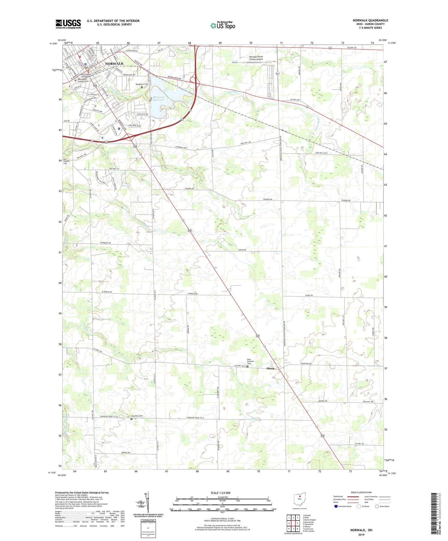
2023 topographic map quadrangle Norwalk in the state of Ohio. Scale: 1:24000. Based on the newly updated USGS 7.5' US Topo map series, this map is in the following counties: Huron. The map contains contour data, water features, and other items you are used to seeing on USGS maps, but also has updated roads and other features. This is the next generation of topographic maps. Printed on high-quality waterproof paper with UV fade-resistant inks.
Quads adjacent to this one:
West: Monroeville
Northwest: Kimball
North: Milan
Northeast: Berlin Heights
East: Clarksfield
Southeast: New London
South: Greenwich
Southwest: Willard
This map covers the same area as the classic USGS quad with code o41082b5.
Contains the following named places: Benedict School, Bronson-norwalk School, Calvary Baptist Church, Chapin Airport, Christian and Missionary Alliance Church, City of Norwalk, East Bronson Cemetery, Eastowne Mobile Home Estates, Firelands Museum, First Baptist Church, First Church of Christ, First Methodist Church, First Presbyterian Church, First Universalist Church, Fisher - Titus Medical Center, Hinckley Cemetery, Huron County, Huron County Childrens Home, Huron County Courthouse, Huron County Fairgrounds, Huron County Home, Huron County Law Library, Huron County Sheriff's Office, Huron Junction, Knight Airport, Knittel Tree Farm And Gardens, League Elementary School, Lower Reservoir, McGuan Park, Memorial Lake Park, Memorial Reservoir, Munson Elementary School, Norwalk, Norwalk City Hall, Norwalk Fire Department, Norwalk High School, Norwalk Lower Reservoir Dam, Norwalk Memorial Reservoir Dam, Norwalk Middle School, Norwalk Police Department, Norwalk Post Office, Norwalk Public Library, Norwalk Upper Reservoir Dam, Norwalk Water Filtration Plant, Norwalk-Huron County Airport, Ohio State Highway Patrol - Norwalk Patrol Post, Olena, Olena Post Office, Pleasant Elementary School, Saint Marys Roman Catholic Church, Saint Marys School, Saint Pauls Episcopal Church, Saint Pauls High School, Saint Pauls Roman Catholic Church, Saint Pauls School, Saint Peter Catholic Cemetery, Saint Peters Lutheran Church, School Number 1, School Number 11, School Number 3, School Number 4, School Number 5, School Number 6, Standish School, Township of Bronson, Upper Reservoir, Wayne Athletic Field, West Hartland, West Hartland Church, West Main Street Historic District, Whitney Park, Woodlawn Cemetery, ZIP Code: 44857