MyTopo
New Bedford Ohio US Topo Map
Couldn't load pickup availability
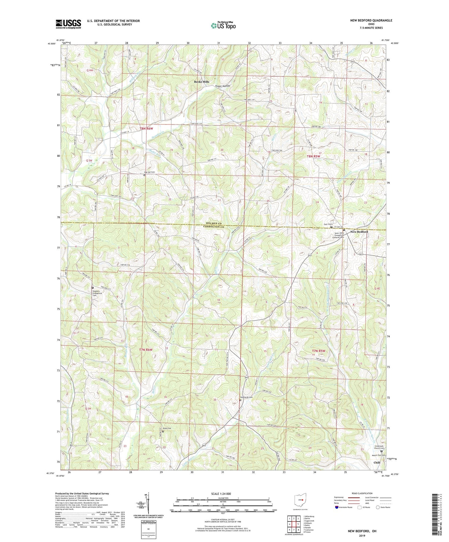
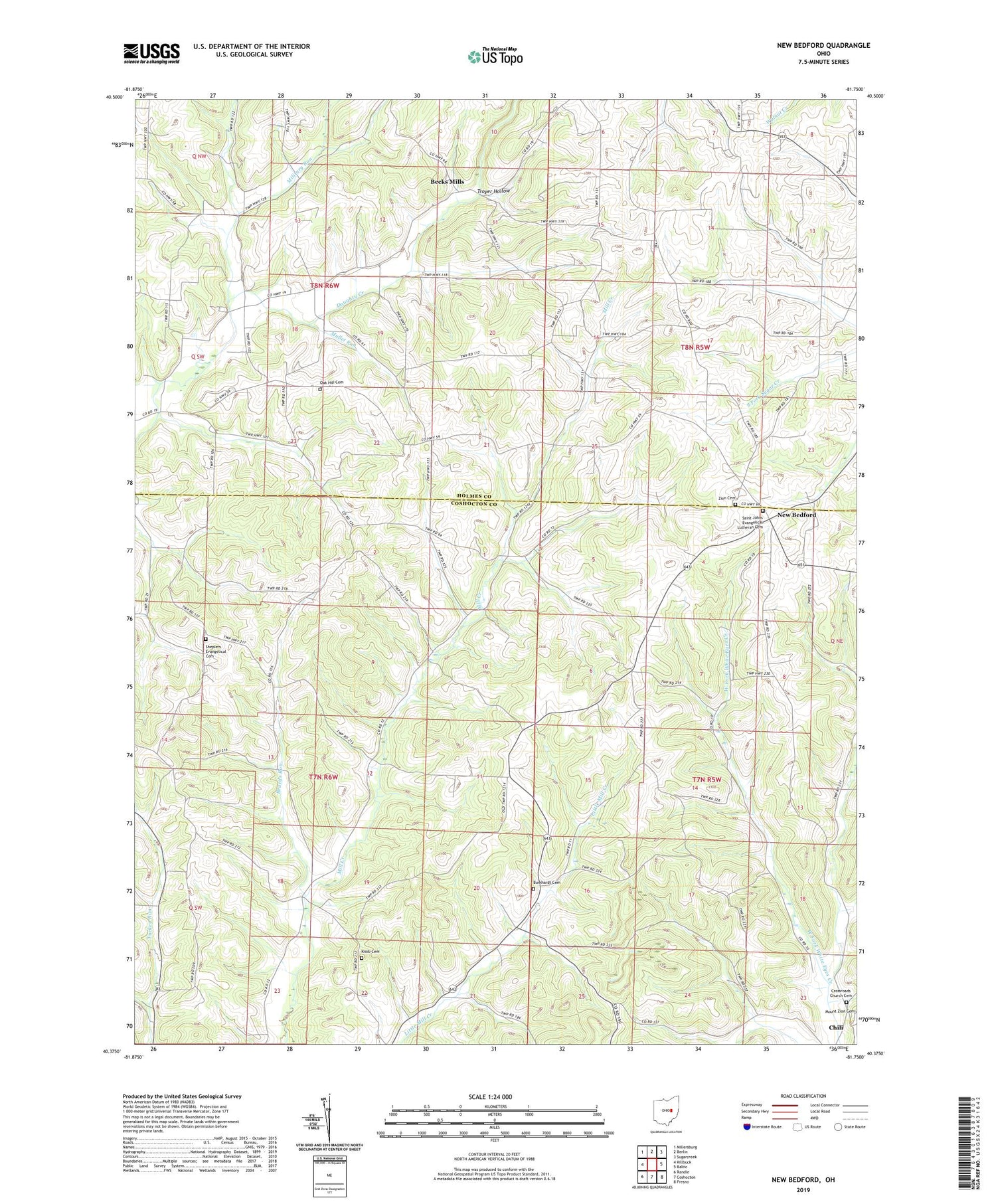
2019 topographic map quadrangle New Bedford in the state of Ohio. Scale: 1:24000. Based on the newly updated USGS 7.5' US Topo map series, this map is in the following counties: Coshocton, Holmes. The map contains contour data, water features, and other items you are used to seeing on USGS maps, but also has updated roads and other features. This is the next generation of topographic maps. Printed on high-quality waterproof paper with UV fade-resistant inks.
Quads adjacent to this one:
West: Killbuck
Northwest: Millersburg
North: Berlin
Northeast: Sugarcreek
East: Baltic
Southeast: Fresno
South: Coshocton
Southwest: Randle
Contains the following named places: Beards Run, Beck Mills Post Office, Becks Mills, Beech Grove School, Burkhardt Cemetery, Burkhart Church, Center School, Chili Crossroads Church, Crossroads Church Cemetery, Fairview School, Flat Ridge Middle School, Grade School, Green Hill School, Knob Cemetery, Knob School, Military Run, Mound, Mound School, Mud Valley School, Mullet Run, New Bedford, New Bedford Post Office, Oak Hill Cemetery, Oak Hill Curch, Oak Valley School, Rock Valley School, Saint Johns Evangelical Lutheran Cemetery, Sheetz School, Shepler Church, Shepler School, Sheplers Evangelical Cemetery, Township of Crawford, Township of Mechanic, Township of Mill Creek, Troyer Hollow, WKLM-FM (Millersburg), Yoder School, Zion Cemetery, Zion Church, Zion United Church of Christ