MyTopo
Randle Ohio US Topo Map
Couldn't load pickup availability
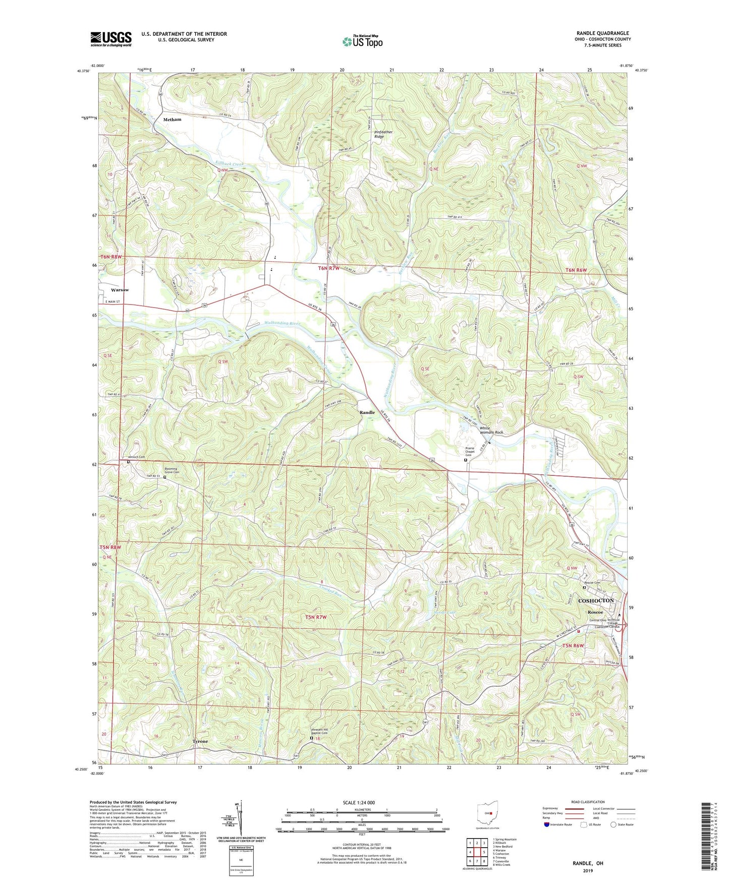
2023 topographic map quadrangle Randle in the state of Ohio. Scale: 1:24000. Based on the newly updated USGS 7.5' US Topo map series, this map is in the following counties: Coshocton. The map contains contour data, water features, and other items you are used to seeing on USGS maps, but also has updated roads and other features. This is the next generation of topographic maps. Printed on high-quality waterproof paper with UV fade-resistant inks.
Quads adjacent to this one:
West: Warsaw
Northwest: Spring Mountain
North: Killbuck
Northeast: New Bedford
East: Coshocton
Southeast: Wills Creek
South: Conesville
Southwest: Trinway
This map covers the same area as the classic USGS quad with code o40081c8.
Contains the following named places: Antioch Cemetery, Apache Number 1 Pit, Bantum School, Blooming Grove Cemetery, Bucklew Run, Christian Apostolic Church, Coshocton County, Crooked Run, Crooked Run Cross Roads, Dickerson Mobile Home Park, Edgewood Terrace, Jackson Township Fire Station, Johnson-Humrickhouse Museum, Killbuck Creek, Marshall School, Metham, Metham Post Office, Mill Creek, Mount Zion Church, Pinfeather Ridge, Pleasant Hill Baptist Cemetery, Pleasant Hill Church, Prairie Chapel Cemetery, Prairie Chapel United Methodist Church, Randle, River View High School, Roscoe, Roscoe Basin, Roscoe Cemetery, Roscoe Post Office, Roscoe School, Roscoe United Methodist Church, School Number 1, School Number 3, School Number 4, School Number 5, School Number 6, School Number 7, Simmons Run, Six Mile Reservoir, Sixmile Dam, Soggy Hill School, Sunset Lake, Sunset Lake Dam, Three Rivers Heliport, Township of Bethlehem, Township of Jackson, Tyrone, Tyrone Post Office, Walhonding Canal, Warsaw Post Office, White Womans Rock, White Womans Town, ZIP Code: 43812