MyTopo
New Riegel Ohio US Topo Map
Couldn't load pickup availability
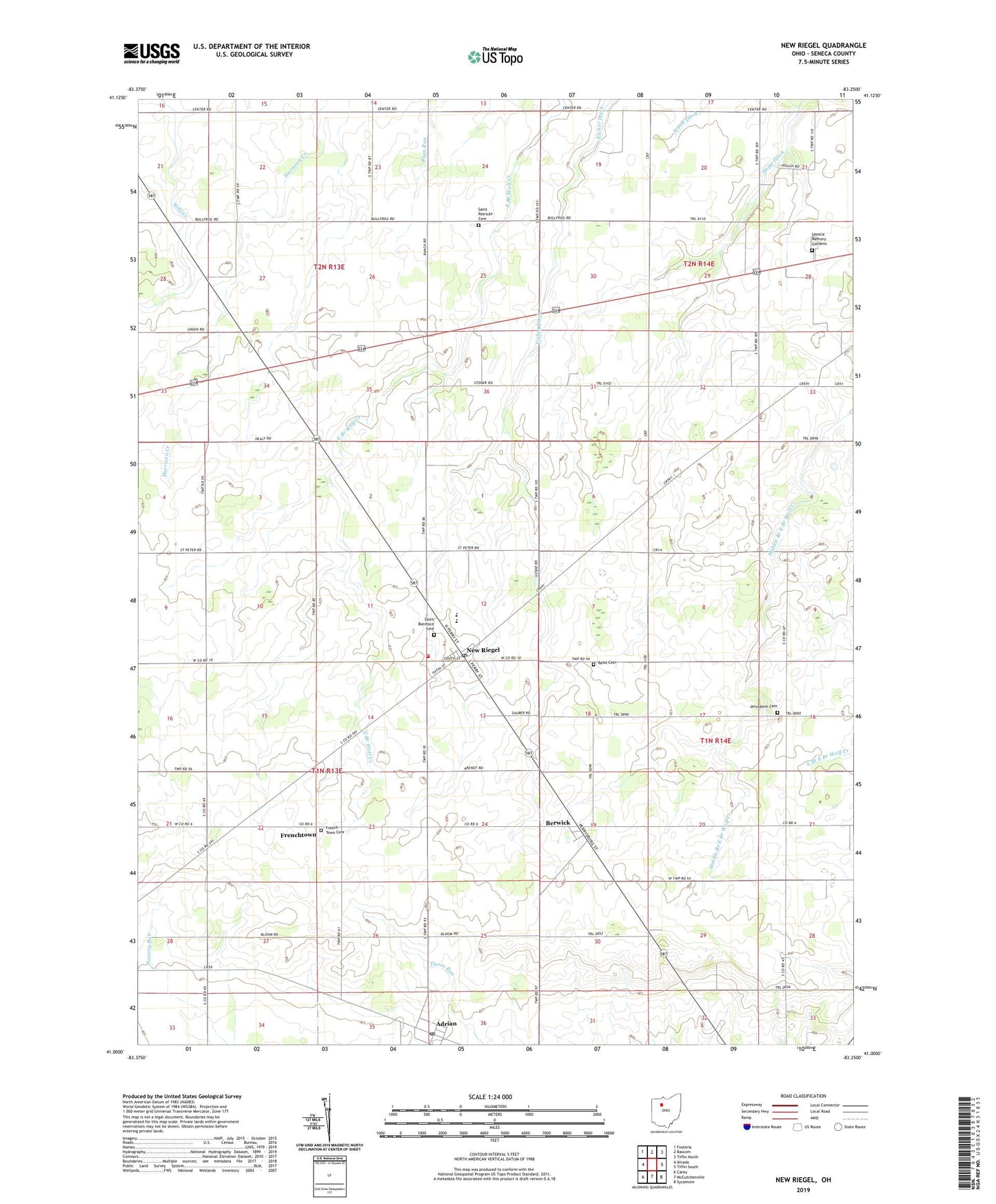
2019 topographic map quadrangle New Riegel in the state of Ohio. Scale: 1:24000. Based on the newly updated USGS 7.5' US Topo map series, this map is in the following counties: Seneca. The map contains contour data, water features, and other items you are used to seeing on USGS maps, but also has updated roads and other features. This is the next generation of topographic maps. Printed on high-quality waterproof paper with UV fade-resistant inks.
Quads adjacent to this one:
West: Alvada
Northwest: Fostoria
North: Bascom
Northeast: Tiffin North
East: Tiffin South
Southeast: Sycamore
South: McCutchenville
Southwest: Carey
Contains the following named places: Adrian, Adrian Post Office, Berwick, Berwick Post Office, Eicher Ditch, French Town Cemetery, Frenchtown, Greenwich Reservoir, Greenwich Reservoir Dam, Hepp Ditch, Jerusalem Cemetery, New Riegel, New Riegel Elementary School, New Riegel Fire Department, New Riegel High School, New Riegel Post Office, Nighswander Field, Reisz Cemetery, Saint Boniface Catholic Church, Saint Boniface Cemetery, Saint Boniface School, Saint James Church, Saint Nicholas, Saint Nicholas Catholic Church, Saint Nicholas Post Office, Saint Patricks Cemetery, Seneca Memory Gardens, Township of Big Spring, Township of Loudon, Village of New Riegel, ZIP Code: 44853