MyTopo
Alvada Ohio US Topo Map
Couldn't load pickup availability
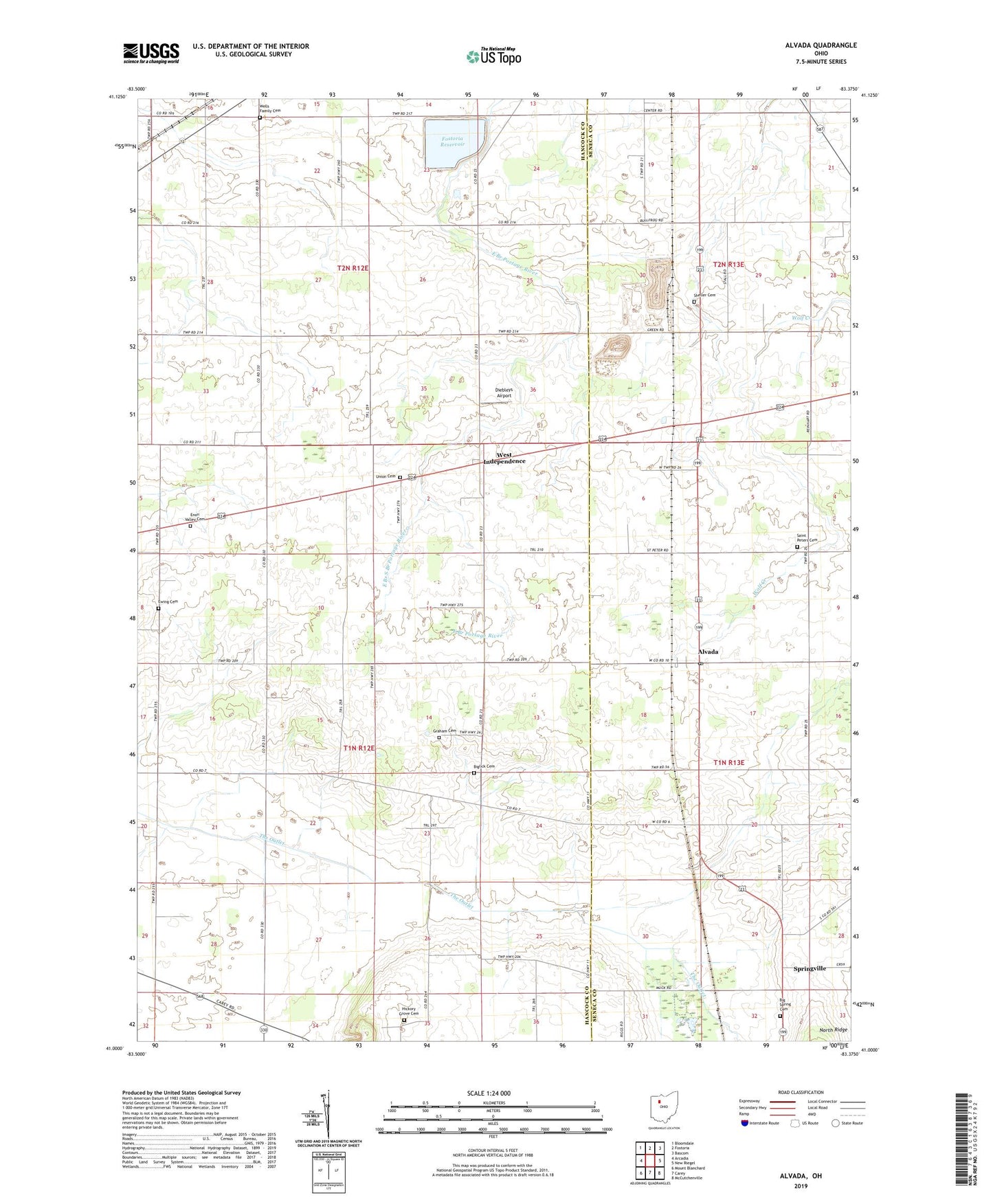
2023 topographic map quadrangle Alvada in the state of Ohio. Scale: 1:24000. Based on the newly updated USGS 7.5' US Topo map series, this map is in the following counties: Hancock, Seneca. The map contains contour data, water features, and other items you are used to seeing on USGS maps, but also has updated roads and other features. This is the next generation of topographic maps. Printed on high-quality waterproof paper with UV fade-resistant inks.
Quads adjacent to this one:
West: Arcadia
Northwest: Bloomdale
North: Fostoria
Northeast: Bascom
East: New Riegel
Southeast: McCutchenville
South: Carey
Southwest: Mount Blanchard
This map covers the same area as the classic USGS quad with code o41083a4.
Contains the following named places: Alvada, Alvada Post Office, Big Spring Cemetery, Biglick Cemetery, Diebleys Airport, Enon Valley Cemetery, Enon Valley Church, Ewing Cemetery, Fostoria Reservoir, Fostoria Upground Reservoir Dam, German Baptist Church, Graham Cemetery, Hickory Grove Cemetery, Lakeland Golf Course, Saint Peters Cemetery, Saints Peter and Paul Church, Sheller Cemetery, Springville, Springville Marsh State Natural Area, Springville Post Office, Stone Airport, Sunny Farms Landfill, The Outlet, Township of Biglick, Township of Washington, Union Cemetery, WBVI-FM (Fostoria), Wells Family Cemetery, West Independence, West Independence Post Office, Weston Airport, WFOB-AM (Fostoria), ZIP Code: 44802