MyTopo
North Lewisburg Ohio US Topo Map
Couldn't load pickup availability
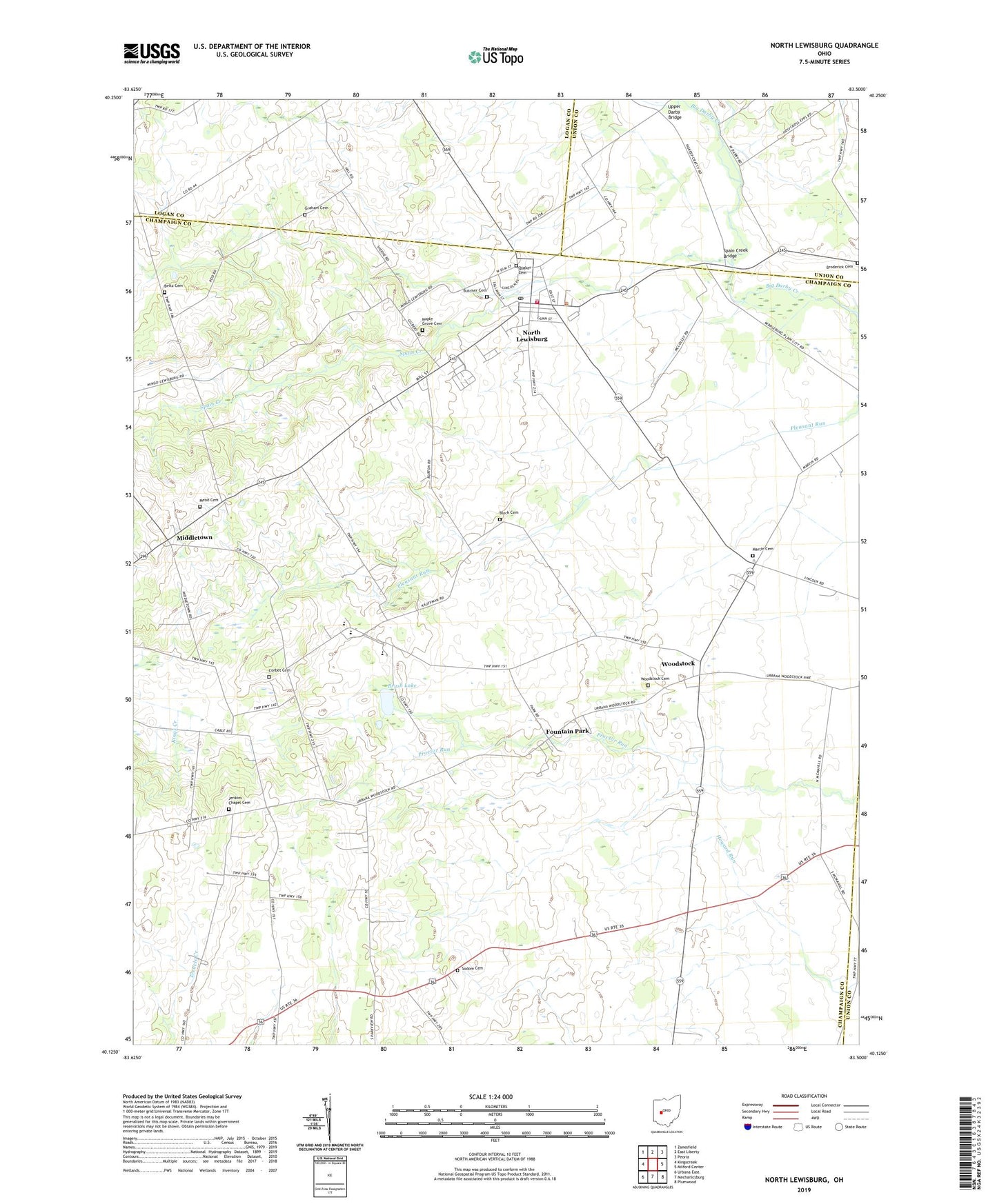
2019 topographic map quadrangle North Lewisburg in the state of Ohio. Scale: 1:24000. Based on the newly updated USGS 7.5' US Topo map series, this map is in the following counties: Champaign, Logan, Union. The map contains contour data, water features, and other items you are used to seeing on USGS maps, but also has updated roads and other features. This is the next generation of topographic maps. Printed on high-quality waterproof paper with UV fade-resistant inks.
Quads adjacent to this one:
West: Kingscreek
Northwest: Zanesfield
North: East Liberty
Northeast: Peoria
East: Milford Center
Southeast: Plumwood
South: Mechanicsburg
Southwest: Urbana East
Contains the following named places: Beltz Cemetery, Black Cemetery, Broderick Cemetery, Brush Lake, Butcher Cemetery, Corbet Cemetery, Crimville, Darby Church, Fountain Park, Fountain Park Post Office, Friends Cemetery, Graham Cemetery, Immaculate Conception Church, Jenkins Chapel, Jenkins Chapel Cemetery, Maple Grove Cemetery, Martin Cemetery, Mead Cemetery, Meadows of North Lewisburg, Middletown, North East Champaign County Fire District, North Lewisburg, North Lewisburg Post Office, Sodom Cemetery, Spain Creek, Spain Creek Bridge, Township of Rush, Triad Elementary School, Triad High School, Triad School, Upper Darby Bridge, Village of North Lewisburg, Village of Woodstock, White School, Woodstock, Woodstock Cemetery, Woodstock Post Office, ZIP Codes: 43060, 43084