MyTopo
Olive Green Ohio US Topo Map
Couldn't load pickup availability
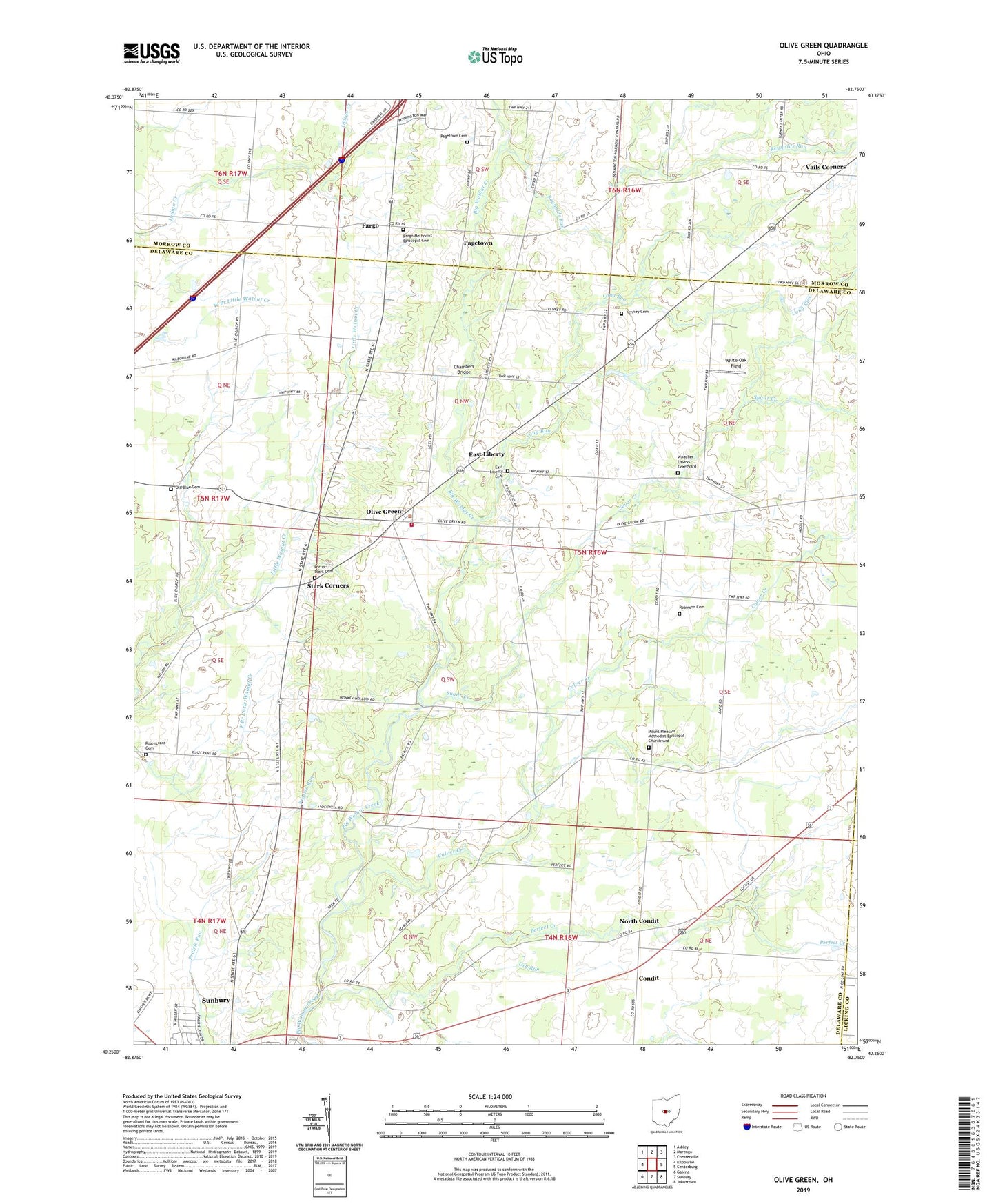
2019 topographic map quadrangle Olive Green in the state of Ohio. Scale: 1:24000. Based on the newly updated USGS 7.5' US Topo map series, this map is in the following counties: Delaware, Morrow, Licking, Knox. The map contains contour data, water features, and other items you are used to seeing on USGS maps, but also has updated roads and other features. This is the next generation of topographic maps. Printed on high-quality waterproof paper with UV fade-resistant inks.
Quads adjacent to this one:
West: Kilbourne
Northwest: Ashley
North: Marengo
Northeast: Chesterville
East: Centerburg
Southeast: Johnstown
South: Sunbury
Southwest: Galena
Contains the following named places: Ach Nursery, Advent Church, Beacon School, Big Walnut Golf Course, Blue Church, Center School, Chambers Bridge, Condit, Condit Post Office, Culver Creek, Dry Run, East Liberty, East Liberty Cemetery, East Porter School, Fargo, Fargo Methodist Episcopal Cemetery, Fargo Post Office, Fargo Wesleyan Church, Fisher School, Fox School, Hawkins School, Kenney Cemetery, Long Run, Mount Pleasant Community Church, Mount Pleasant Methodist Episcopal Churchyard, Mount Pleasant School, North Condit, North Condit School, North Taway School, Old Blue Cemetery, Old Stone School, Olive Green, Pagetown, Pagetown Cemetery, Pagetown Post Office, Peerless, Peerless Post Office, Perfect Creek, Perfect School, Pleasant Hill School, Porter - Kingston Fire District, Porter-Stark Cemetery, Preacher Daveys Graveyard, Reynolds Run, Robinson Cemetery, Rosencrans Cemetery, Schaefer School, Stark Corners, Stark School, Sugar Creek, Sunbury Estates, Sunbury Industrial Park, Township of Porter, Vails Corners, White Oak Field, Zurik Airport, ZIP Code: 43074