MyTopo
Perry Ohio US Topo Map
Couldn't load pickup availability
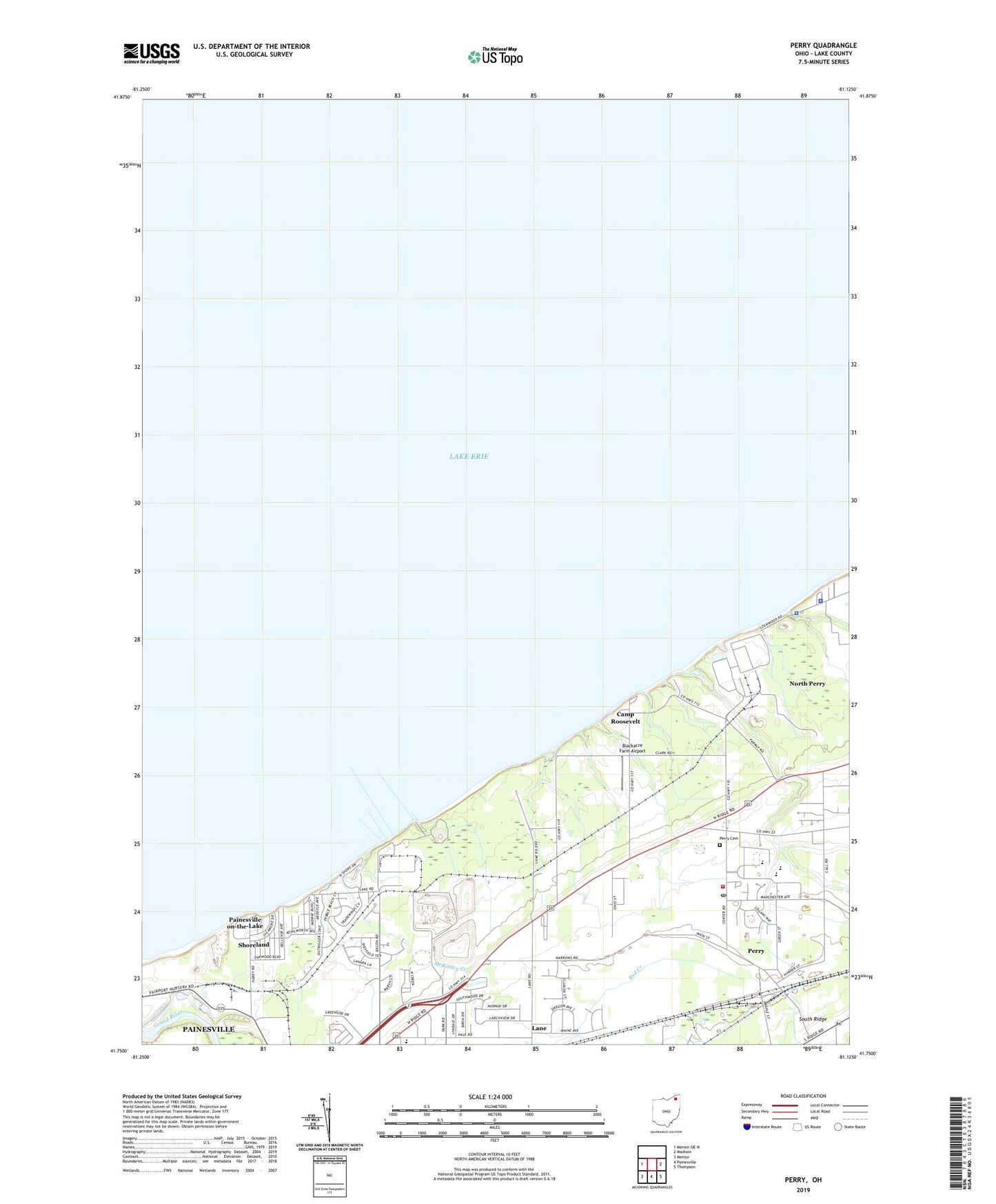
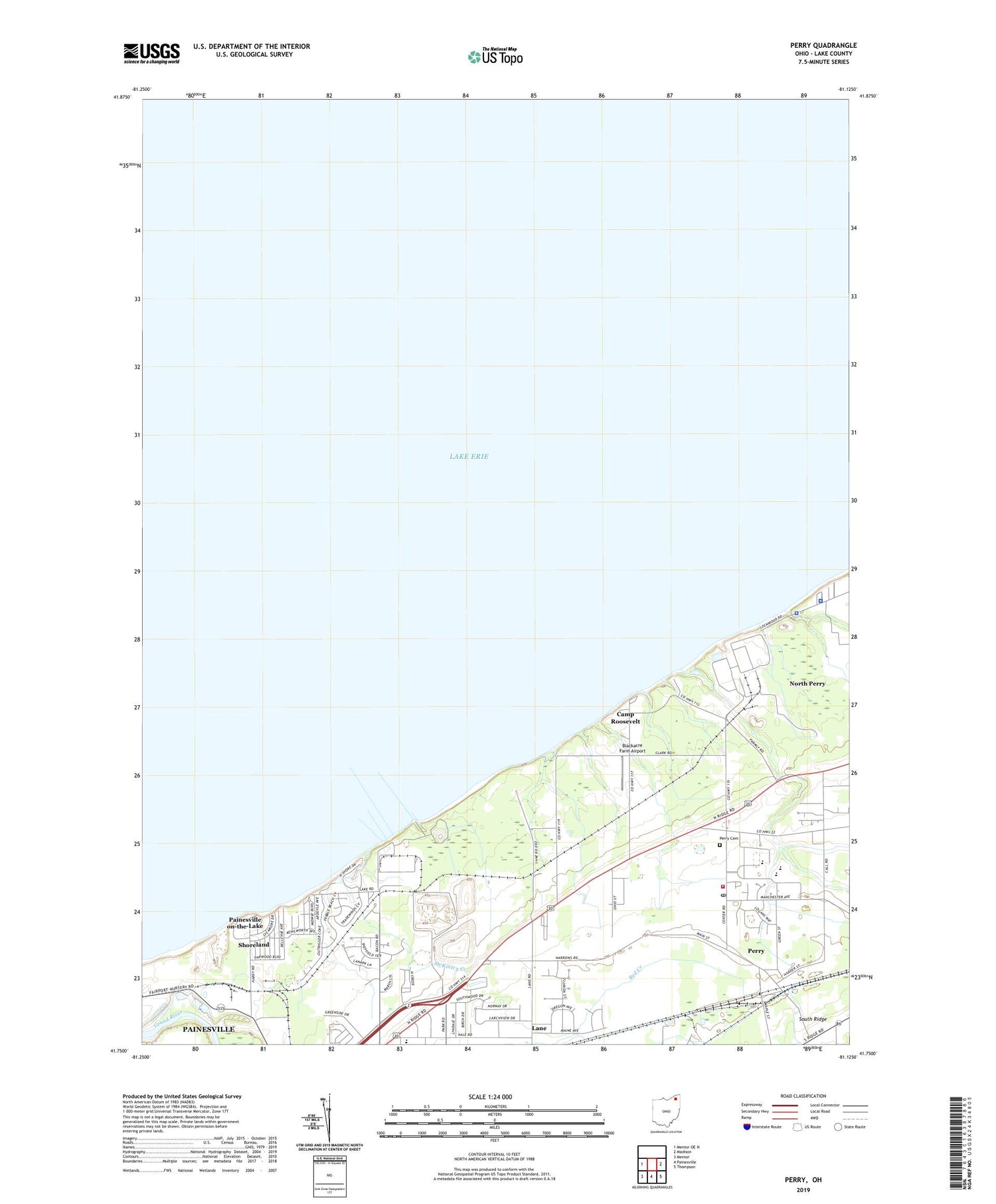
2019 topographic map quadrangle Perry in the state of Ohio. Scale: 1:24000. Based on the newly updated USGS 7.5' US Topo map series, this map is in the following counties: Lake. The map contains contour data, water features, and other items you are used to seeing on USGS maps, but also has updated roads and other features. This is the next generation of topographic maps. Printed on high-quality waterproof paper with UV fade-resistant inks.
Quads adjacent to this one:
West: Mentor OE N
East: Madison
Southeast: Thompson
South: Painesville
Southwest: Mentor
Contains the following named places: Beardslee Nursery, Blackacre Farm Airport, Buena Vista Beach, Camp Roosevelt, Camp Wise, Center Road Elementary School, Community Christian Church, Fairway Pines Golf Course, First Baptist Church, Golfway Pines, Hale Road Elementary School, Lake County Solid Waste Facility, Lake County Water Service Center, Lakeside Church, Lambo Nursery, Lane, Lane Post Office, Long Meadow Square Shopping Center, Manchester Elementary School, Martin's Nursery, McKinley Creek, Moretti Nursery, North Perry, North Perry Park, North Perry Police Department, North Perry Post Office, North Perry Village Hall, Painesville on-the-Lake, Painesville Township Park, Parmly Park, Perry, Perry Cemetery, Perry Christian Church, Perry High School, Perry Historical Museum, Perry Joint Fire District - Station 1 Headquarters, Perry Middle School, Perry Mobile Homes, Perry Nuclear Power Plant, Perry Nuclear Power Plant Heliport, Perry Post Office, Perry Township Park, Perry Township Town Hall, Perry United Methodist Church, Perry Village Hall, Shoreland, Springlake Nursery, Township Park, Village of Perry, West Orchards, ZIP Code: 44081