MyTopo
Painesville Ohio US Topo Map
Couldn't load pickup availability
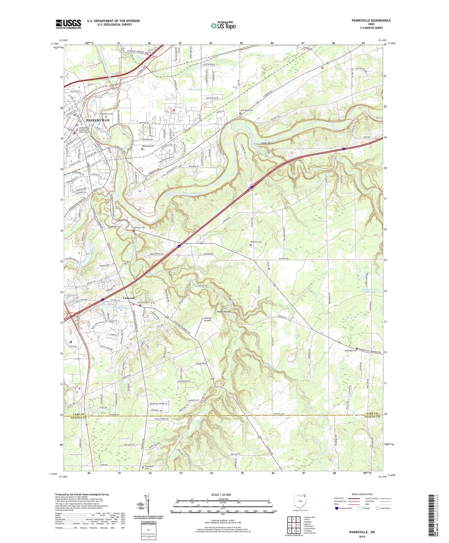
2023 topographic map quadrangle Painesville in the state of Ohio. Scale: 1:24000. Based on the newly updated USGS 7.5' US Topo map series, this map is in the following counties: Lake, Geauga. The map contains contour data, water features, and other items you are used to seeing on USGS maps, but also has updated roads and other features. This is the next generation of topographic maps. Printed on high-quality waterproof paper with UV fade-resistant inks.
Quads adjacent to this one:
West: Mentor
Northwest: Mentor OE N
North: Perry
Northeast: Madison
East: Thompson
Southeast: East Claridon
South: Chardon
Southwest: Chesterland
This map covers the same area as the classic USGS quad with code o41081f2.
Contains the following named places: Avery Terrace, Aylworth Creek, Big Creek, Bowhall Fire Station, Brakeman Cemetery, Camp Klein, Cascade Falls, Casement Airport, Casement Golf Club, Casement Golf Course, Cedarbrook Elementary School, Church of the Nazarene, Church of the Word, Clarks, Cloverdale Lake, Cloverdale Lake Dam, Concord, Concord Airpark, Concord Elementary School, Concord Post Office, Concord Township Cemetery, Concord Township Fire Department Station 1, Concord Township Town Hall, Concord Woods Nature Park, East Branch Chagrin River, East Creek, Evergreen Cemetery, First Baptist Church of Painesville, First Church of Christ Scientist, First Congregational Church, Five Points, Girdled Road Reservation, Greig Pond, Gristmill Village Shopping Center, Harvey High School, Helen Hazen Wyman Metropolitan Park, Henry F Lamuth Middle School, Huntoon Cemetery, Indian Point, Indian Point Metropolitan Park, Jenks Creek, John R Williams Junior High School, Jordan Creek, Kellogg Creek, Lake County Courthouse, Lake County Home, Lake County Jail, Lake County Sheriff's Office, Lake County Vocational School, Lake East Hospital, Lane Road Cemetery, Leroy Center, Leroy Elementary School, Leroy Township Fire Department, Lusard Place, Madison Avenue Elementary School, Masons Landing Metropolitan Park, Mather Camp, Morley Library, Mountain View Country Club, New Market Mall Shopping Center, Paine Creek, Paine Falls Metropolitan Park, Painesville, Painesville City Fire Department, Painesville City Hall, Painesville Country Club, Painesville Police Department, Painesville Post Office, Painesville United Methodist Church, Pease Hollow, Pease Mill, Perkins Camp, Perry Joint Fire District Station 2, Protestant Cemetery, Quail Hollow Golf Course, Quail Hollow Lake, Quail Hollow Lake Dam, Red Creek, Riverside Campus, Riverside Cemetery, Russell F Hobart Middle School, Saint Clair Elementary School, Saint James Church, Saint Johns Home, Saint Mary Catholic Church, Saint Marys School, Saint Pauls Church, Springlake Trailer Park, State Street Elementary School, Township of Concord, Township of Leroy, Tripoint Medical Center, Victoria Place Park, WBKC-AM (Painesville), Williams Cemetery, ZIP Code: 44077