MyTopo
Port Jefferson Ohio US Topo Map
Couldn't load pickup availability
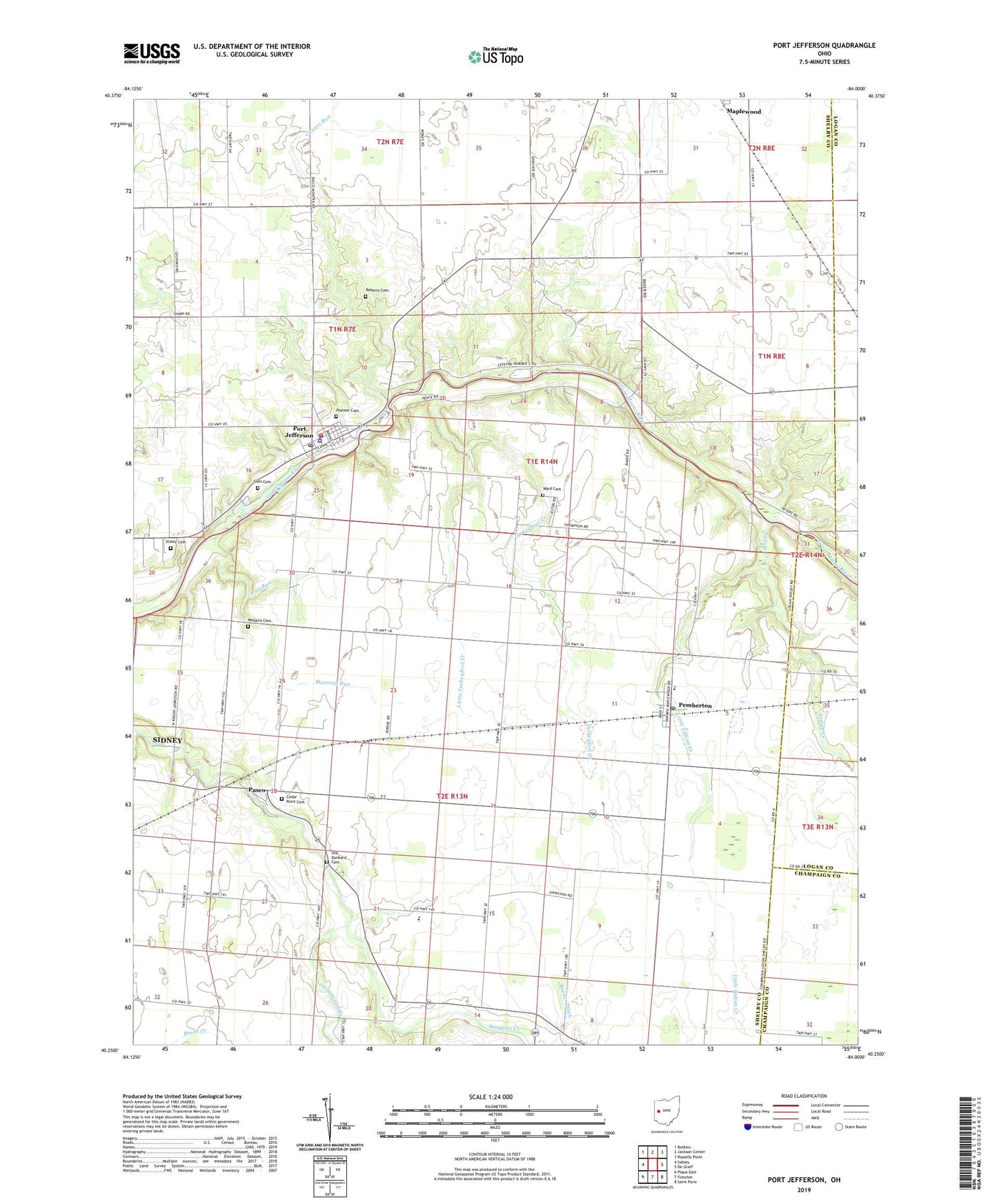
2019 topographic map quadrangle Port Jefferson in the state of Ohio. Scale: 1:24000. Based on the newly updated USGS 7.5' US Topo map series, this map is in the following counties: Shelby, Logan, Champaign. The map contains contour data, water features, and other items you are used to seeing on USGS maps, but also has updated roads and other features. This is the next generation of topographic maps. Printed on high-quality waterproof paper with UV fade-resistant inks.
Quads adjacent to this one:
West: Sidney
Northwest: Botkins
North: Jackson Center
Northeast: Russells Point
East: De Graff
Southeast: Saint Paris
South: Fletcher
Southwest: Piqua East
Contains the following named places: Allen School, Carmony School, Cedar Point Cemetery, Counts Run, Dunkard Cemetery, Fairlawn Elementary School, Fairlawn High School, Glen Cemetery, Indian Creek, Leatherwood Creek, Line Run, Little Indian Creek, Little Turkeyfoot Creek, Lockard School, Manning Run, Medaris Cemetery, Mill Valley Farms, Mosquito Creek, Pasco, Pasco Post Office, Pasco United Methodist Church, Pemberton, Pemberton Post Office, Perry Port Salem Rescue, Pioneer Cemetery, Port Jefferson, Port Jefferson Community Fire Company, Port Jefferson Police Department, Port Jefferson Post Office, Port Jefferson School, Port Jefferson United Methodist Church, Reeder Ditch, Roberts Cemetery, School Number 3, School Number 4, School Number 5, School Number 6, School Number 7, Staley Cemetery, Township of Perry, Township of Salem, Turkeyfoot Creek, Village of Port Jefferson, Walnut Grove School, Ward Cemetery, ZIP Codes: 45340, 45353, 45360