MyTopo
De Graff Ohio US Topo Map
Couldn't load pickup availability
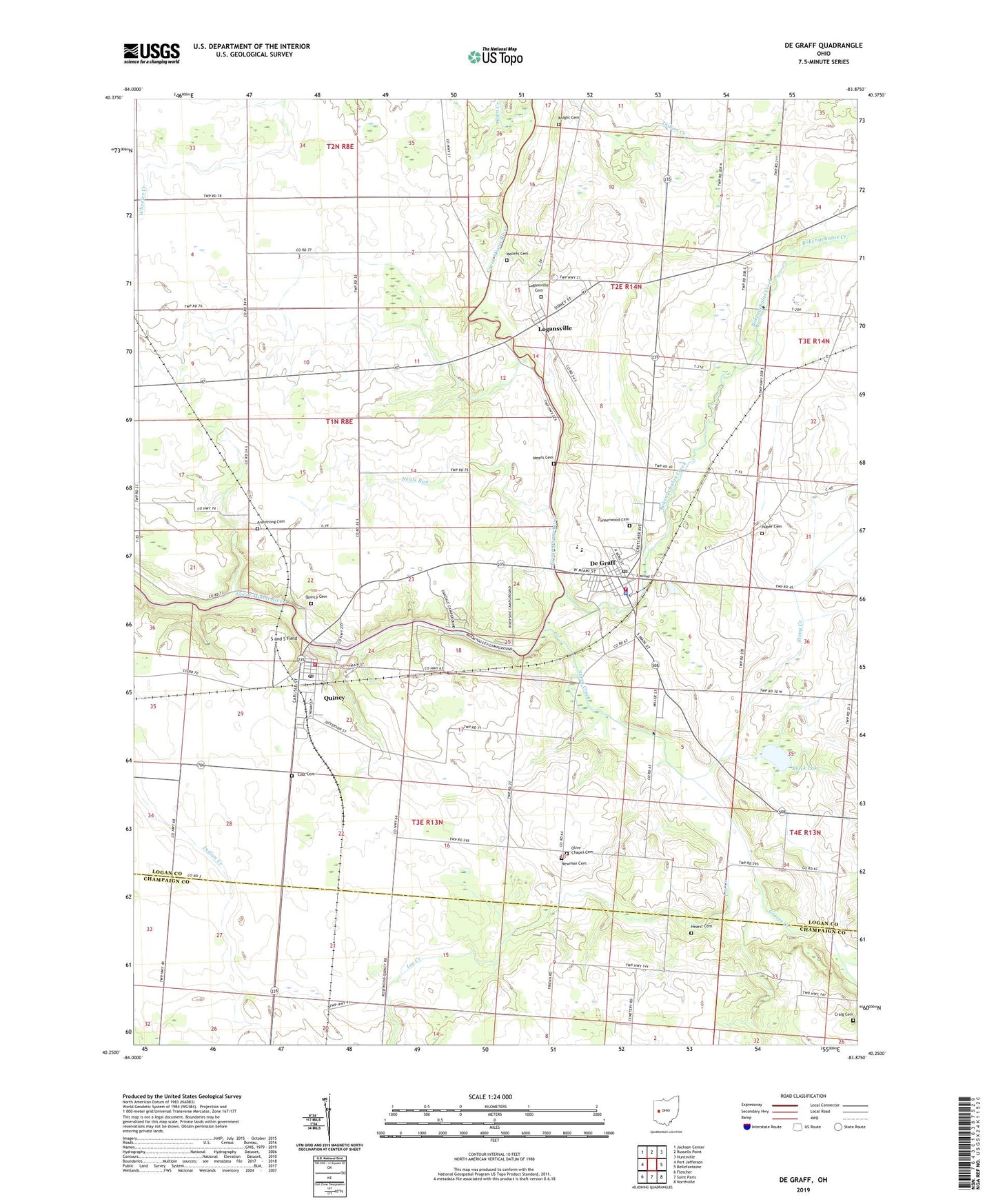
2023 topographic map quadrangle De Graff in the state of Ohio. Scale: 1:24000. Based on the newly updated USGS 7.5' US Topo map series, this map is in the following counties: Logan, Champaign. The map contains contour data, water features, and other items you are used to seeing on USGS maps, but also has updated roads and other features. This is the next generation of topographic maps. Printed on high-quality waterproof paper with UV fade-resistant inks.
Quads adjacent to this one:
West: Port Jefferson
Northwest: Jackson Center
North: Russells Point
Northeast: Huntsville
East: Bellefontaine
Southeast: Northville
South: Saint Paris
Southwest: Fletcher
This map covers the same area as the classic USGS quad with code o40083c8.
Contains the following named places: Armstrong Cemetery, Baughman School, Black Lake, Black Lake School, Bokengehalas Creek, Cost Cemetery, Craig Cemetery, De Graff, De Graff Baptist Church, De Graff Branch Logan County District Library, De Graff Fire Department, De Graff United Methodist Church, Degraff Police Department, DeGraff Post Office, Graves Creek, Greenwood Cemetery, Hearst Cemetery, Huber Cemetery, Knight Cemetery, Lee Creek, Logansville, Logansville Cemetery, Logansville Community Church, Loganville Post Office, Means Cemetery, Miami Valley Camp, Moores Cemetery, Neals Run, Newman Cemetery, North Lake School, Olive Chapel Cemetery, Pleasant View Mobile Home Park, Quincy, Quincy - Miami Township Fire Department, Quincy Cemetery, Quincy Post Office, Riverside Elementary School, Riverside Emergency Medical Services, Riverside High School, Rum Creek, S and S Field, School Number 1, School Number 2, School Number 3, School Number 4, School Number 5, School Number 6, School Number 7, School Number 9, Shady Bowl Speedway, Stony Creek, Township of Miami, Township of Pleasant, Village of De Graff, Village of Quincy, WDEQ-FM (De Graff), ZIP Codes: 43318, 43343