MyTopo
Ratcliffburg Ohio US Topo Map
Couldn't load pickup availability
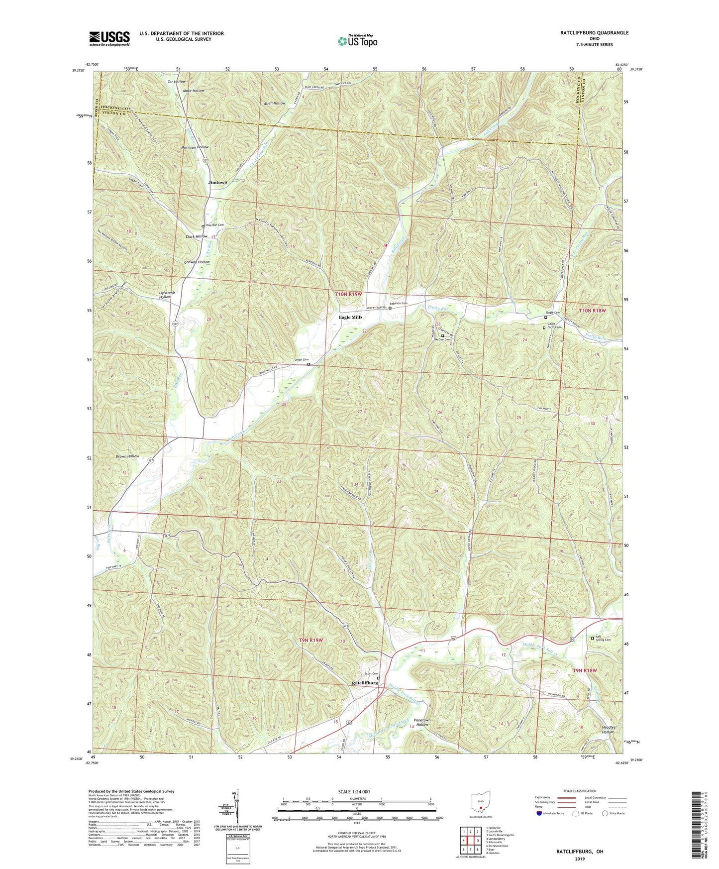
2019 topographic map quadrangle Ratcliffburg in the state of Ohio. Scale: 1:24000. Based on the newly updated USGS 7.5' US Topo map series, this map is in the following counties: Vinton, Hocking, Ross. The map contains contour data, water features, and other items you are used to seeing on USGS maps, but also has updated roads and other features. This is the next generation of topographic maps. Printed on high-quality waterproof paper with UV fade-resistant inks.
Quads adjacent to this one:
West: Londonderry
Northwest: Hallsville
North: Laurelville
Northeast: South Bloomingville
East: Allensville
Southeast: Hamden
South: Byer
Southwest: Richmond Dale
Contains the following named places: Allen Hollow, Beech Grove School, Brown Hollow, Clark Hollow, Clark School, Conway Hollow, Cox, Dry Branch, Eagle Chapel, Eagle Mills, Eagle School, East Fork Pike Run, Headleg Hollow, High Hill School, Jimtown, Kelley Branch, Laurelville Fire Department Station 3, Lebanon Cemetery, Lebanon Church, Lipscomb Hollow, Mace Hollow, Macedonia Church, McGee Cemetery, Morrison Hollow, North Branch Pretty Run, Persimmon School, Pike Run, Pike Run Cemetery, Pike Run Church, Pilgrim Church, Pine Ridge School, Pleasant Valley Church, Ponetown Hollow, Pretty Run, Ratcliffburg, Saint Pauls Church, Salt Spring Cemetery, Scott Cemetery, Slagle Cemetery, Slagle Farm Cemetery, Stevens Branch, Tar Hollow, Timmons School, Township of Eagle, Union Cemetery, Union Church, ZIP Code: 45647