MyTopo
Hallsville Ohio US Topo Map
Couldn't load pickup availability
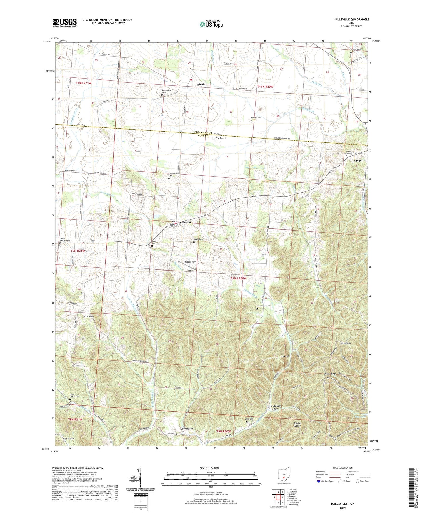
2023 topographic map quadrangle Hallsville in the state of Ohio. Scale: 1:24000. Based on the newly updated USGS 7.5' US Topo map series, this map is in the following counties: Ross, Pickaway. The map contains contour data, water features, and other items you are used to seeing on USGS maps, but also has updated roads and other features. This is the next generation of topographic maps. Printed on high-quality waterproof paper with UV fade-resistant inks.
Quads adjacent to this one:
West: Kingston
Northwest: Circleville
North: Stoutsville
Northeast: Clearport
East: Laurelville
Southeast: Ratcliffburg
South: Londonderry
Southwest: Chillicothe East
This map covers the same area as the classic USGS quad with code o39082d7.
Contains the following named places: Beech Fork, Brush Ridge, Brush Ridge Lookout Tower, Bull Creek, Coey Hollow, Colerain Church, Colerain Township Fire Department, Dresbach Creek, Green Summit Cemetery, Hallsville, Hallsville Post Office, Hickle Cemetery, Jobs Knob, Jones Cemetery, Leasure Cemetery, Maple Grove Cemetery, Mission Field, Monnett Cemetery, Oakgrove School, Pikehole Creek, Pleasant Valley Church, Plum Run, Prairieview Cemetery, Rock Hill, Salem Reform Cemetery, Salem Reformed Church, Saltcreek - Tarlton Volunteer Fire Department Station 2, Slickaway Hollow, Stumpf Cemetery, Swamp Ditch, Swamp School, The Prairie, Throckmorton Cemetery, Township of Colerain, Union Chapel, Union Chapel Cemetery, Walnut Valley Church, Whisler, Whisler Post Office, ZIP Code: 45644