MyTopo
Reily Ohio US Topo Map
Couldn't load pickup availability
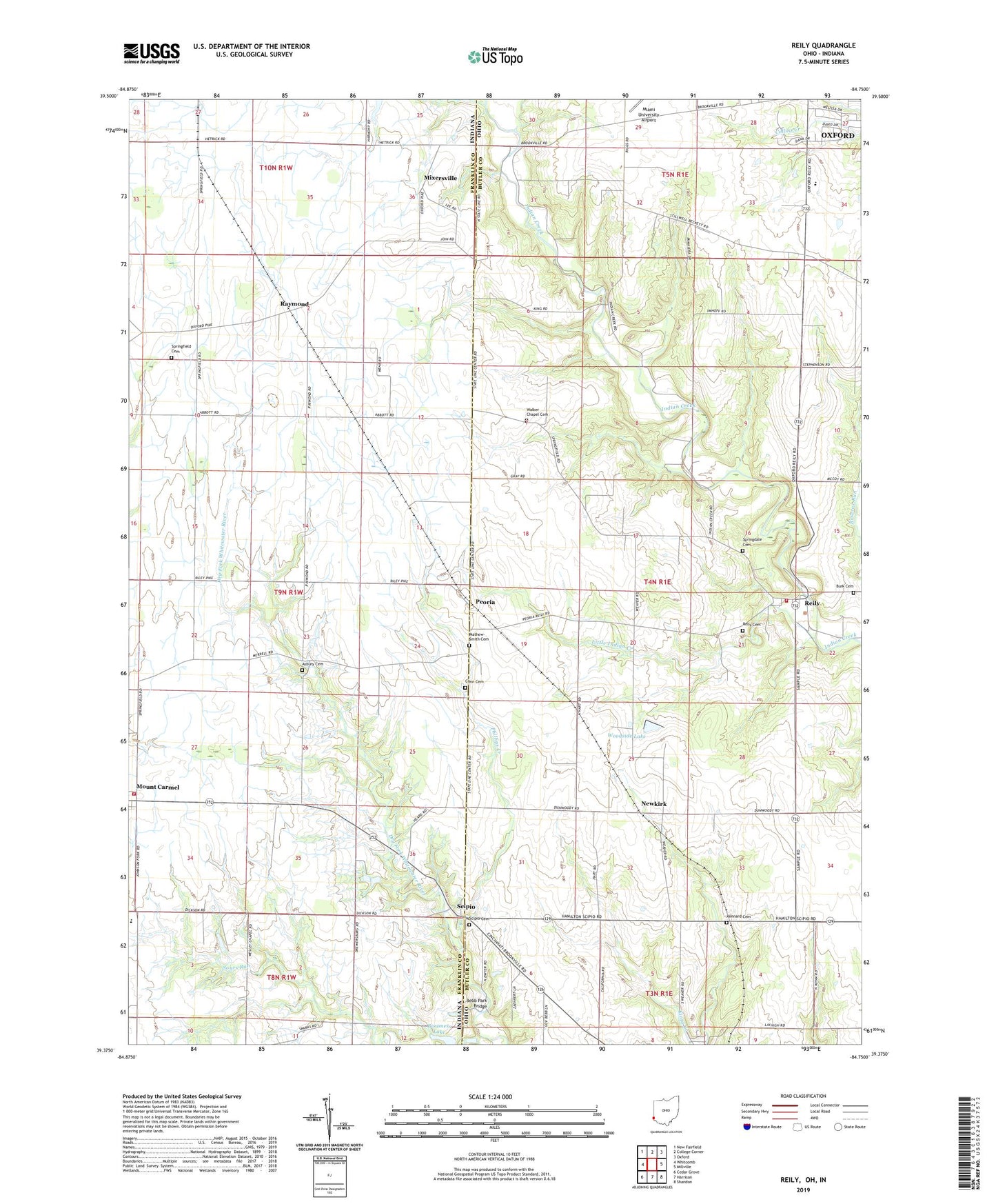
2019 topographic map quadrangle Reily in the states of Ohio, Indiana. Scale: 1:24000. Based on the newly updated USGS 7.5' US Topo map series, this map is in the following counties: Butler, Franklin. The map contains contour data, water features, and other items you are used to seeing on USGS maps, but also has updated roads and other features. This is the next generation of topographic maps. Printed on high-quality waterproof paper with UV fade-resistant inks.
Quads adjacent to this one:
West: Whitcomb
Northwest: New Fairfield
North: College Corner
Northeast: Oxford
East: Millville
Southeast: Shandon
South: Harrison
Southwest: Cedar Grove
Contains the following named places: Asbury Cemetery, Bartmess Lake, Bartmess Lake Dam, Bebb Park Bridge, Burk Cemetery, Buttermilk Ridge Stock Farm, Conn Cemetery, Davis School, Drewersburg Volunteer Fire Department Station 2, Harmony Church, Indian Creek Baptist Cemetery, Indian Creek Pioneer Church, Indian Creek Preserve, Kennard Cemetery, King Knoll Airport, Little Indian Creek, Mathew-Smith Cemetery, Mixersville, Mount Carmel, Newkirk, Peoria, Phillips Creek, Raymond, Reily, Reily Cemetery, Reily Post Office, Reily Township Fire Department Station 1, School Number 2, School Number 3, School Number 4, School Number 5, School Number 6, School Number 7, School Number 8, School Number 9, Scipio, Scipio Union Cemetery, Springdale Cemetery, Springfield Cemetery, Springfield Church, Springfield Post Office, Tent Brook, Township of Reily, Township of Springfield, Vanness School, Walker Chapel Cemetery, Walker Church, Wesley Chapel, Woodside Lake, WOXY-FM (Oxford)