MyTopo
Cedar Grove Indiana US Topo Map
Couldn't load pickup availability
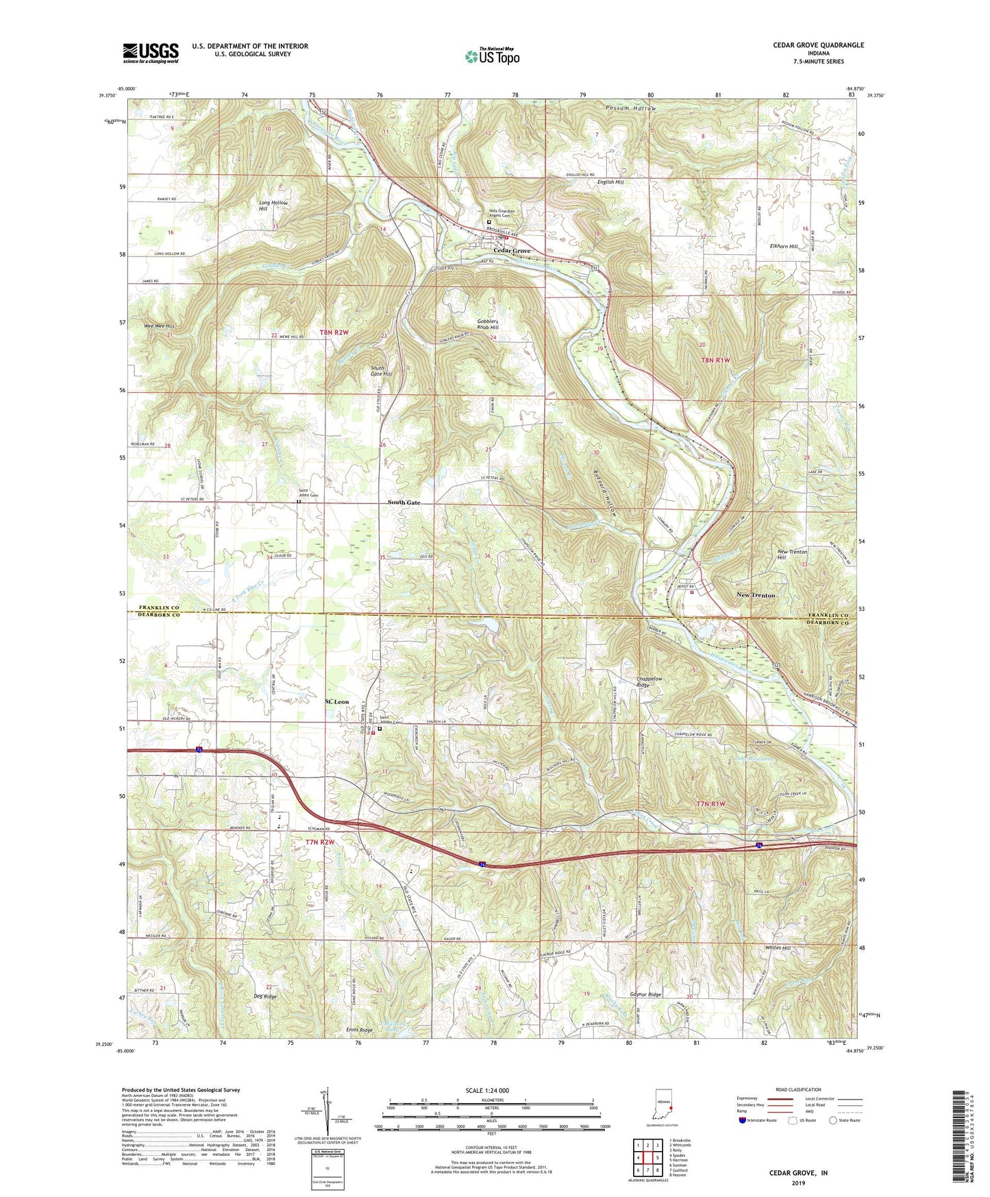
2022 topographic map quadrangle Cedar Grove in the state of Indiana. Scale: 1:24000. Based on the newly updated USGS 7.5' US Topo map series, this map is in the following counties: Franklin, Dearborn. The map contains contour data, water features, and other items you are used to seeing on USGS maps, but also has updated roads and other features. This is the next generation of topographic maps. Printed on high-quality waterproof paper with UV fade-resistant inks.
Quads adjacent to this one:
West: Spades
Northwest: Brookville
North: Whitcomb
Northeast: Reily
East: Harrison
Southeast: Hooven
South: Guilford
Southwest: Sunman
This map covers the same area as the classic USGS quad with code o39084c8.
Contains the following named places: Ashby, Big Cedar Creek, Blackburn Creek, Bull Run, Buzzard Hollow, Camp Lenmary, Camp Olden, Cedar Grove, Cedar Grove Post Office, Cedar Grove Volunteer Fire Department, Chappelow Ridge, Dog Ridge, East Central High School, Elkhorn Creek, Elkhorn Hill, English Hill, Ennis Ridge, Faith Church, Franklin County Emergency Medical Services Station 4, Gaynor Ridge, Gobblers Knob Hill, Gobbles Creek, Holy Guardian Angels Cemetery, J Maxwell Pond, J Maxwell Pond Dam, Lake Roseanna, Logan Creek Church, Long Hollow Hill, McCann Creek, Minneman School, Mount Carmel School, New Trenton, New Trenton Census Designated Place, New Trenton Hill, New Trenton Volunteer Fire Department, Ramsey Creek, Richland Creek, Saint Johns Cemetery, Saint Joseph Cemetery, Saint Leon, Saint Leon Volunteer Fire Department, Shingle Creek, Smyrna Church, South Gate, South Gate Hill, Town of Cedar Grove, Town of Saint Leon, Township of Kelso, Township of Logan, Wee Wee Hill, Whistle Creek, Whites Hill, Whitewater School, ZIP Codes: 47016, 47035, 47060