MyTopo
Shauck Ohio US Topo Map
Couldn't load pickup availability
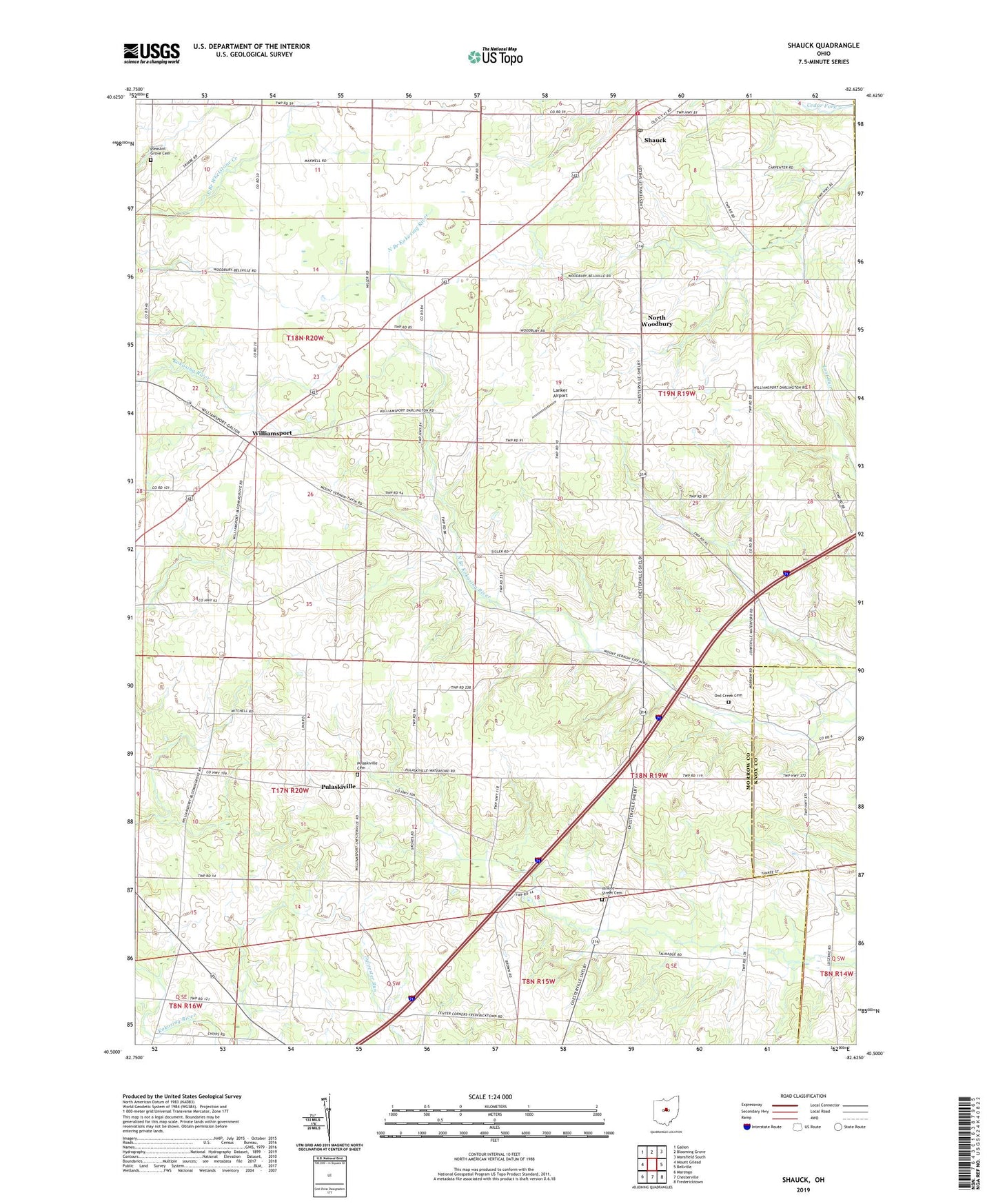
2019 topographic map quadrangle Shauck in the state of Ohio. Scale: 1:24000. Based on the newly updated USGS 7.5' US Topo map series, this map is in the following counties: Morrow, Knox, Richland. The map contains contour data, water features, and other items you are used to seeing on USGS maps, but also has updated roads and other features. This is the next generation of topographic maps. Printed on high-quality waterproof paper with UV fade-resistant inks.
Quads adjacent to this one:
West: Mount Gilead
Northwest: Galion
North: Blooming Grove
Northeast: Mansfield South
East: Bellville
Southeast: Fredericktown
South: Chesterville
Southwest: Marengo
Contains the following named places: Cedar Creek Airport, Center Corners, Country Estates Mobile Home Park, East Miller School, Harmony Church, Johnsville Elementary School, Johnsville Fire Department, Kelker Post Office, Kellker, Lanker Airport, Miller School, Miracle School, Morrow County Emergency Medical Services, Mount Gilead Church, Mount Pleasant School, North Woodbury, Owl Creek Cemetery, Owl Creek Prairie, Peoples School, Pleasant Grove Cemetery, Pleasant Grove Church, Pulaskiville, Pulaskiville Cemetery, Pulaskiville Community Bible Church, Pulaskiville Post Office, Saint Johns Lutheran Church of North Woodbury, School Number 1, School Number 4, Shauck, Shauck Village Post Office, South Miller School, Stackhouse School, Township of Congress, Township of Franklin, Township of Perry, Walnut Hill School, Williamsport, Williamsport United Methodist Church, Yankee Street Cemetery