MyTopo
Toboso Ohio US Topo Map
Couldn't load pickup availability
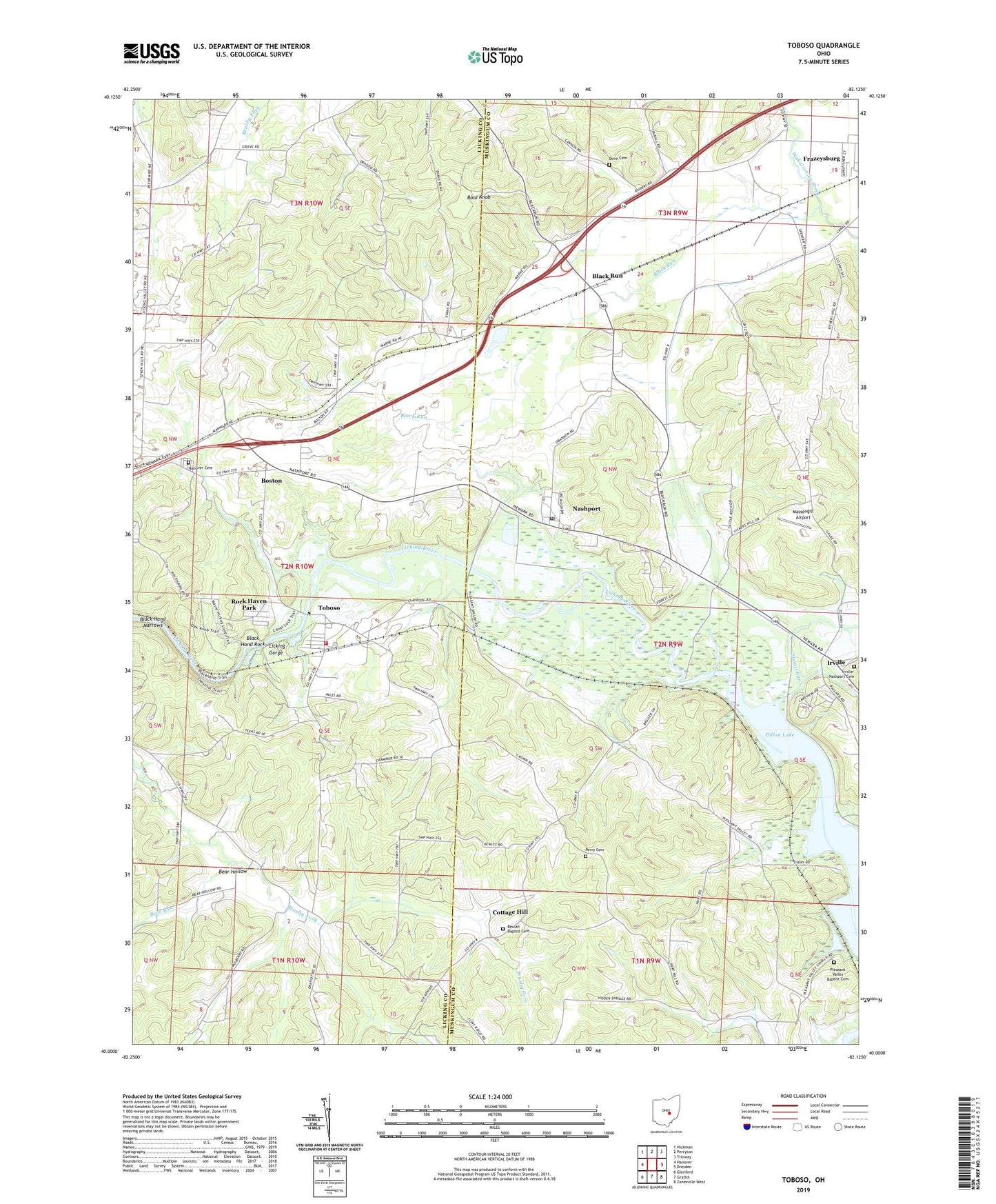
2019 topographic map quadrangle Toboso in the state of Ohio. Scale: 1:24000. Based on the newly updated USGS 7.5' US Topo map series, this map is in the following counties: Muskingum, Licking. The map contains contour data, water features, and other items you are used to seeing on USGS maps, but also has updated roads and other features. This is the next generation of topographic maps. Printed on high-quality waterproof paper with UV fade-resistant inks.
Quads adjacent to this one:
West: Hanover
Northwest: Hickman
North: Perryton
Northeast: Trinway
East: Dresden
Southeast: Zanesville West
South: Gratiot
Southwest: Glenford
Contains the following named places: Bald Knob, Bear Hollow, Bear Run, Beulah Baptist Cemetery, Black Hand Narrows, Black Hand Rock, Black Hand State Nature Preserve, Black Run, Boston, Browns School, Claypool School, Claypools, Cottage Hill, Cottagehill Post Office, Dillon Reservoir Wildlife Area, Dillon State Park, Dove Cemetery, Flint Ridge School, Hanover Cemetery, Hanover Volunteer Fire Department Station 801, Highland Church, Hillery School, Irville, Irville Post Office, Irville-Nashport Cemetery, Licking Gorge, Massengill Airport, Nashport, Nashport Census Designated Place, Nashport Community Church, Nashport Dike, Nashport Post Office, Nashport Station, Norman Farms, Old Stone Church of Christ Cemetery, Perry Cemetery, Pleasant Valley, Pleasant Valley Baptist Cemetery, Pleasant Valley Baptist Church, Pleasant Valley Post Office, Ridge School, Rock Haven Park, Rolling Brook Farm, Shadley Cemetery, Stone Church, Stump Run, Toboso, Toboso Elementary School, Toboso Post Office, Township of Hanover, Township of Licking, Varner Airport, Vensil Farms Airport, ZIP Code: 43830