MyTopo
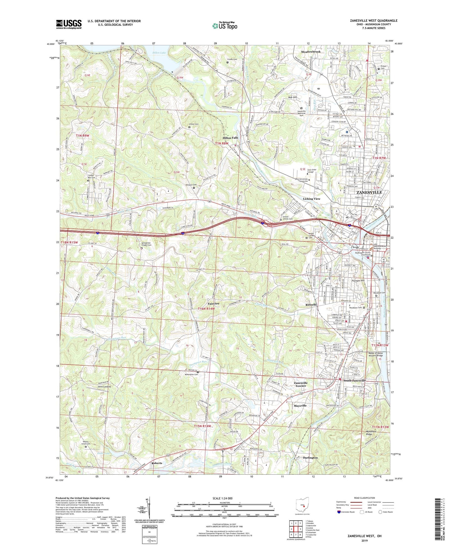
Zanesville West Ohio US Topo Map
Couldn't load pickup availability
2023 topographic map quadrangle Zanesville West in the state of Ohio. Scale: 1:24000. Based on the newly updated USGS 7.5' US Topo map series, this map is in the following counties: Muskingum. The map contains contour data, water features, and other items you are used to seeing on USGS maps, but also has updated roads and other features. This is the next generation of topographic maps. Printed on high-quality waterproof paper with UV fade-resistant inks.
Quads adjacent to this one:
West: Gratiot
Northwest: Toboso
North: Dresden
Northeast: Adamsville
East: Zanesville East
Southeast: Philo
South: Crooksville
Southwest: Fultonham
This map covers the same area as the classic USGS quad with code o39082h1.
Contains the following named places: Apostolic Christian Church, Apostolic Church of God, Avalon Heights, Bartlett Run, Bell Elementary School, Bethesda Hospital Helistop, Bible Baptist Church, Brighton, Brighton Presbyterian Church, Brighton-Drydon Historic District, Buchanan Square Shopping Center, Bucks County School, Calvary Baptist Church, Camp Goddard, Central Presbyterian Church, Central Trinity Methodist Church, Chaps Run, Chaps Run Park, Church of God and Saints of Christ, City of Zanesville, Cleveland Junior High School, Coburn United Methodist Church, Colony Centre Shopping Center, Colony Court Shopping Center, Colony Square Mall Post Office, Colony Square Mall Shopping Center, Community Ambulance Service, Country Fair Shopping Center, Crooks Cemetery, Darlington, Diehr Lake, Diehr Lake Dam, Dillon Dam, Dillon Elementary School, Dillon Falls, Dillon State Wildlife Area, Dillon View, Dixon Park, Elizabeth, Euclid Methodist Church, Fair Oaks Baptist Church, Fairmont Avenue Historic District, Fairview, Falls Township Volunteer Fire Department, Falls Township Volunteer Fire Department Station 2, Finley Cemetery, Finley Methodist Church, First Assemlby of God Church, First Baptist Church, First Christian Church, First Church of Christ Scientist, First Church of God, First Church of the Nazarene, First Congregational Church, First Evangelical United Brethren Church, First Interdenominational Full Gospel Holiness Church, First United Methodist Church, First United Presbyterian Church, Forest Avenue Presbyterian Church, Garfield Elementary School, Genesis Hospital, Good Samaritan Hospital, Grace Gospel Mission, Grace United Methodist Church, Grant School, Hancock Junior High School, Harding Heights, Hibbs Run, Highland Community United Presbyterian Church, Howes Seminary, Immanuel United Church of Christ, Joes Run, John McIntire Public Library, Johns Landing, Johnson School, Kingdom Hall of Jehovahs Witnesses, Laurel Ridge, Lewis, Licking River, Licking View, Licking View School, Lincoln School, Madison School, Market Street Baptist Church, Maysville, Maysville High School, Maysville Junior High School, McIntire Academy, McIntire Elementary School, McIntire Terrace Historic District, McKendree Cemetery, McKendree School, Meadow Farm, Meadow Farm Methodist Protestant Church, Meadow Farm Post Office, Meadowbrook, Medal of Honor Winners Bridge, Mount Calvary Cemetery, Moxahala Cemetery, Moxahala Creek, Moxahala Park, Moxahala Ridge, Munson Elementary School, Muskingum, Muskingum County Courthouse, Muskingum County Home, Muskingum County Law Library, Muskingum County Technical College, Muskingum River Lock and Dam Number, Muskingum River Lock and Dam Number 10, Nob Hill, North Side Church of the Nazarene, North Terrace Church of Christ, North Zanesville, Northwood, Norval Park Church of Christ, Norval Park School, Ohio University at Zanesville, Old Stone Academy, Olde Falls Village, Pentecostal Church of Christ, Pentecostal Church of God, Pilgrim Holiness Church, Pine Ridge, Pine Street Wesleyan Methodist Church, Pioneer Elementary School, Prosser Cemetery, Putnam, Putnam Hill, Putnam Hill Park, Putnam Historic District, Putnam Landing Park, Putnam Post Office, Putnam Presbyterian Church, Richey Elementary School, Roberts, Roosevelt Junior High School, Russell School, Russells, Saint James Episcopal Church, Saint Johns Lutheran Church, Saint Luke American Lutheran Church, Saint Nicholas Catholic Church, Saint Paul African Methodist Episcopal Church, Saint Thomas Aquinas Church, Saint Thomas School, Select Specialty Hospital - Zanesville, Shawnee Run, Smith School, South Zanesville, South Zanesville Church of the Nazarene, South Zanesville Elementary School, South Zanesville Fire Department, South Zanesville Methodist Church, Southern Hills, Springfield Chapel Cemetery, Springfield Elementary School, Starlight School, Terrace, Thompson Run, Timber Run, Timber Run Baptist Church, Timber Run Cemetery, Townsend School, Township of Falls, Township of Springfield, Trinity Evangelical Lutheran Church, Union Baptist Church, Union Tabernacle, United Jewish Cemetery, Village of South Zanesville, Walker School, Wesley Union Cemetery, Wesleyan Methodist Church, West Muskingum High School, West Muskingum Middle School, West Zanesville, West Zanesville Post Office, Westview Elementary School, Westwood, White Cottage Post Office, Williams Cemetery, Wilson Elementary School, Woodlawn Cemetery, Y Bridge, Yelptown School, Zane Plaza Shopping Center, Zanesville, Zanesville Art Center, Zanesville City Hall, Zanesville Country Club, Zanesville Fire Department Central Station, Zanesville Fire Department Station 2, Zanesville Fire Department Station 3, Zanesville High School, Zanesville Memorial Park, Zanesville Police Department, Zanesville Post Office, Zanesville Seventh Day Adventist Church, Zanesville Terrace, Zanesville Wastewater Treatment Plant


