MyTopo
Vermilion West Ohio US Topo Map
Couldn't load pickup availability
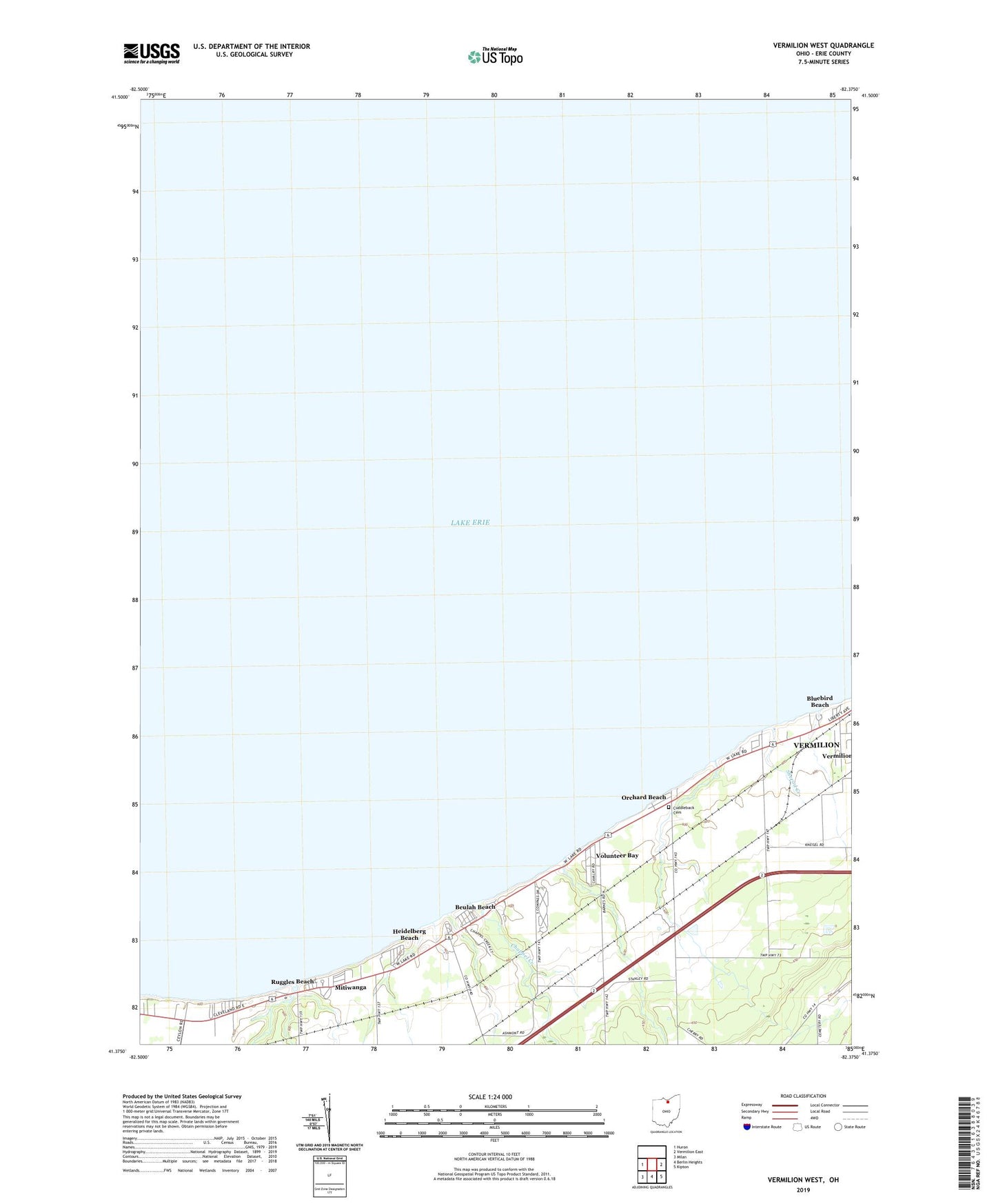
2019 topographic map quadrangle Vermilion West in the state of Ohio. Scale: 1:24000. Based on the newly updated USGS 7.5' US Topo map series, this map is in the following counties: Erie. The map contains contour data, water features, and other items you are used to seeing on USGS maps, but also has updated roads and other features. This is the next generation of topographic maps. Printed on high-quality waterproof paper with UV fade-resistant inks.
Quads adjacent to this one:
West: Huron
East: Vermilion East
Southeast: Kipton
South: Berlin Heights
Southwest: Milan
Contains the following named places: Ashmont, Ashmont Post Office, Beulah Beach, Beulah Beach Census Designated Place, Beulah Beach Post Office, Bluebird Beach, Ceylon Junction, Chappel Creek, Colonial Villa, Cranberry Creek, Darby Creek, Darby Place Mobile Home Park, Grace Church, Heidelberg Beach, Mitiwanga, Mitiwanga Census Designated Place, Mitiwanga Post Office, Orchard Beach, Orchard Beach Cemetery, Portland Court, Ruggles Beach, Sherod Creek, Sherod Park, Sugar Creek, Township of Vermilion, Vacationland Mobile Home Park, Vermilion Golf Course, Volunteer Bay, Waterwood Heliport, Willoway Nursery, ZIP Code: 44089