MyTopo
Wharton Ohio US Topo Map
Couldn't load pickup availability
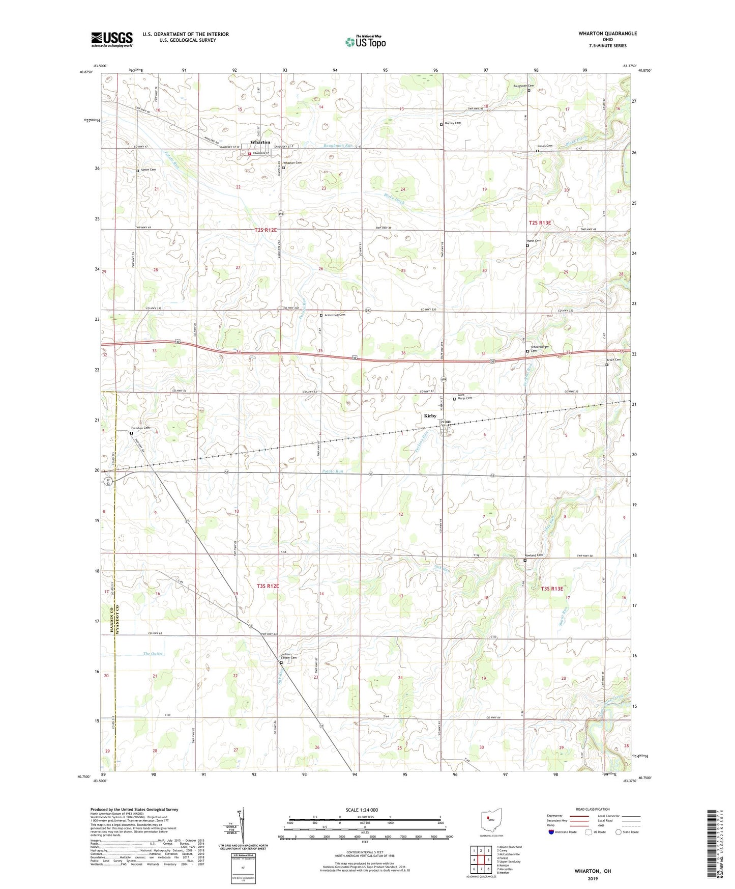
2019 topographic map quadrangle Wharton in the state of Ohio. Scale: 1:24000. Based on the newly updated USGS 7.5' US Topo map series, this map is in the following counties: Wyandot, Hardin. The map contains contour data, water features, and other items you are used to seeing on USGS maps, but also has updated roads and other features. This is the next generation of topographic maps. Printed on high-quality waterproof paper with UV fade-resistant inks.
Quads adjacent to this one:
West: Forest
Northwest: Mount Blanchard
North: Carey
Northeast: McCutchenville
East: Upper Sandusky
Southeast: Meeker
South: Marseilles
Southwest: Kenton
Contains the following named places: Armstrong Cemetery, Baughman Cemetery, Bethany Church, Big Oak Church, Big Oak School, Blake Ditch, Callahan Cemetery, Inman Cemetery, Jackson Center Cemetery, Jackson Center School, Kirby, Kirby Post Office, Krock Cemetery, Mann Cemetery, Murrey Cemetery, New Zion Church, North Jackson School, Olive Branch School, Perkins Run, Potato Creek Swamp, Rowland Cemetery, Saint Marys Catholic Church, Saint Marys Cemetery, Schoenberger Cemetery, Shiloh Church, Spoon Cemetery, Township of Jackson, Township of Richland, Village of Kirby, Village of Wharton, Wharton, Wharton - Richland Township Fire Department, Wharton Cemetery, Wharton Church of God, Wharton Middle School, Wharton Post Office, Wharton United Methodist Church, ZIP Codes: 43330, 43359