MyTopo
Mount Blanchard Ohio US Topo Map
Couldn't load pickup availability
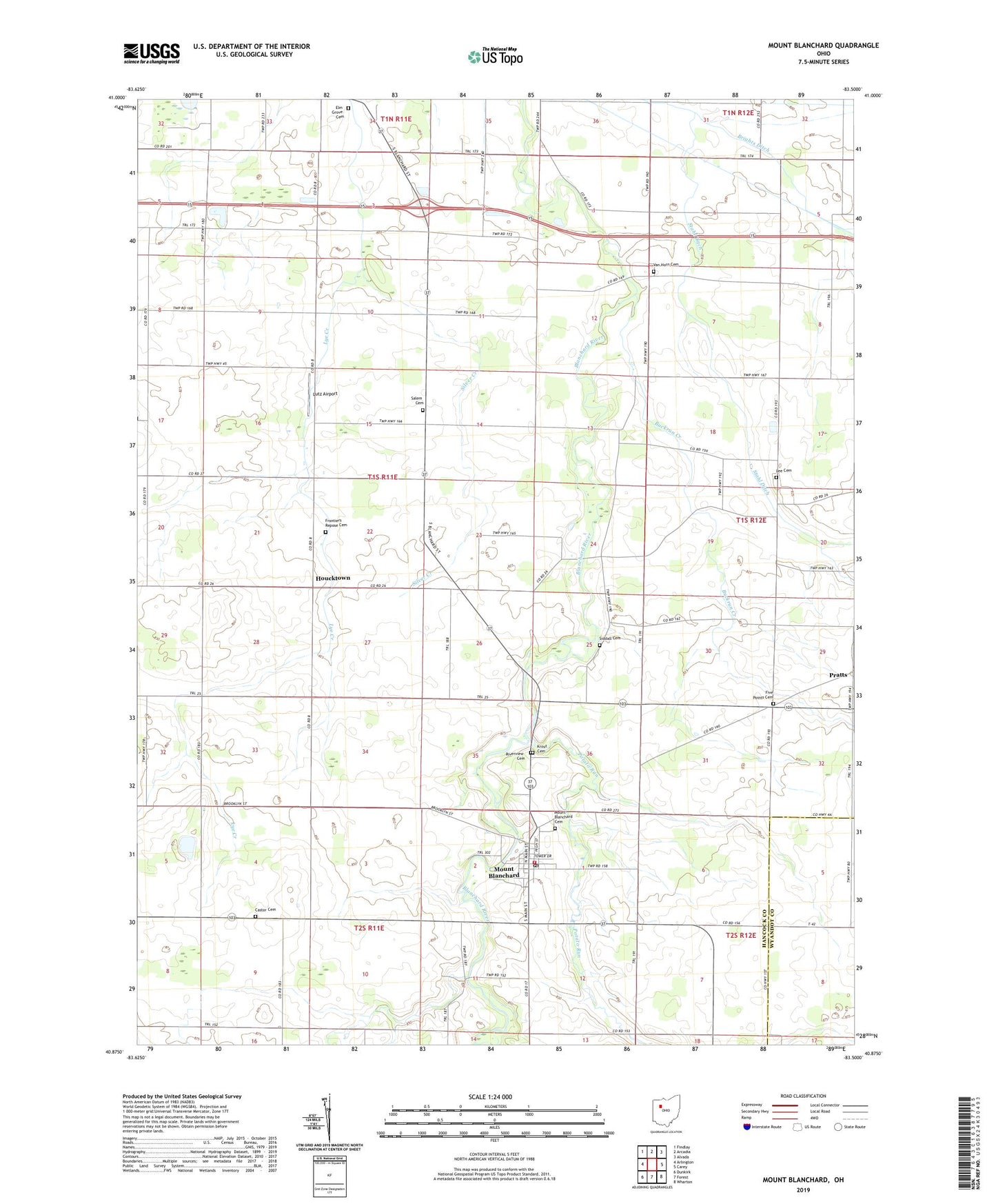
2023 topographic map quadrangle Mount Blanchard in the state of Ohio. Scale: 1:24000. Based on the newly updated USGS 7.5' US Topo map series, this map is in the following counties: Hancock, Wyandot. The map contains contour data, water features, and other items you are used to seeing on USGS maps, but also has updated roads and other features. This is the next generation of topographic maps. Printed on high-quality waterproof paper with UV fade-resistant inks.
Quads adjacent to this one:
West: Arlington
Northwest: Findlay
North: Arcadia
Northeast: Alvada
East: Carey
Southeast: Wharton
South: Forest
Southwest: Dunkirk
This map covers the same area as the classic USGS quad with code o40083h5.
Contains the following named places: Brights Ditch, Buckrun Creek, Castor Cemetery, Delaware Township Fire Department, Eagle Creek Church, Elm Grove Cemetery, Five Points Cemetery, Folk School, Frontiers Repose Cemetery, Hagerty Airport, Houcktown, Houcktown Post Office, Island Park, Krout Cemetery, Lackery School, Lee Cemetery, Lutz Airport, Miller School, Mount Blanchard, Mount Blanchard Branch Library, Mount Blanchard Cemetery, Mount Blanchard Elementary School, Mount Blanchard Nazarene Church, Mount Blanchard Post Office, Mount Blanchard United Methodist Church, Potato Run, Pratts, Riverdale High School, Riverview Cemetery, Salem Cemetery, Siddall Cemetery, Silver Creek, Stahl Ditch, Township of Amanda, Township of Jackson, Treece School, Union Church, Van Horn Cemetery, Village of Mount Blanchard, WKXA-FM (Findlay), ZIP Code: 45867