MyTopo
Bowring Oklahoma US Topo Map
Couldn't load pickup availability
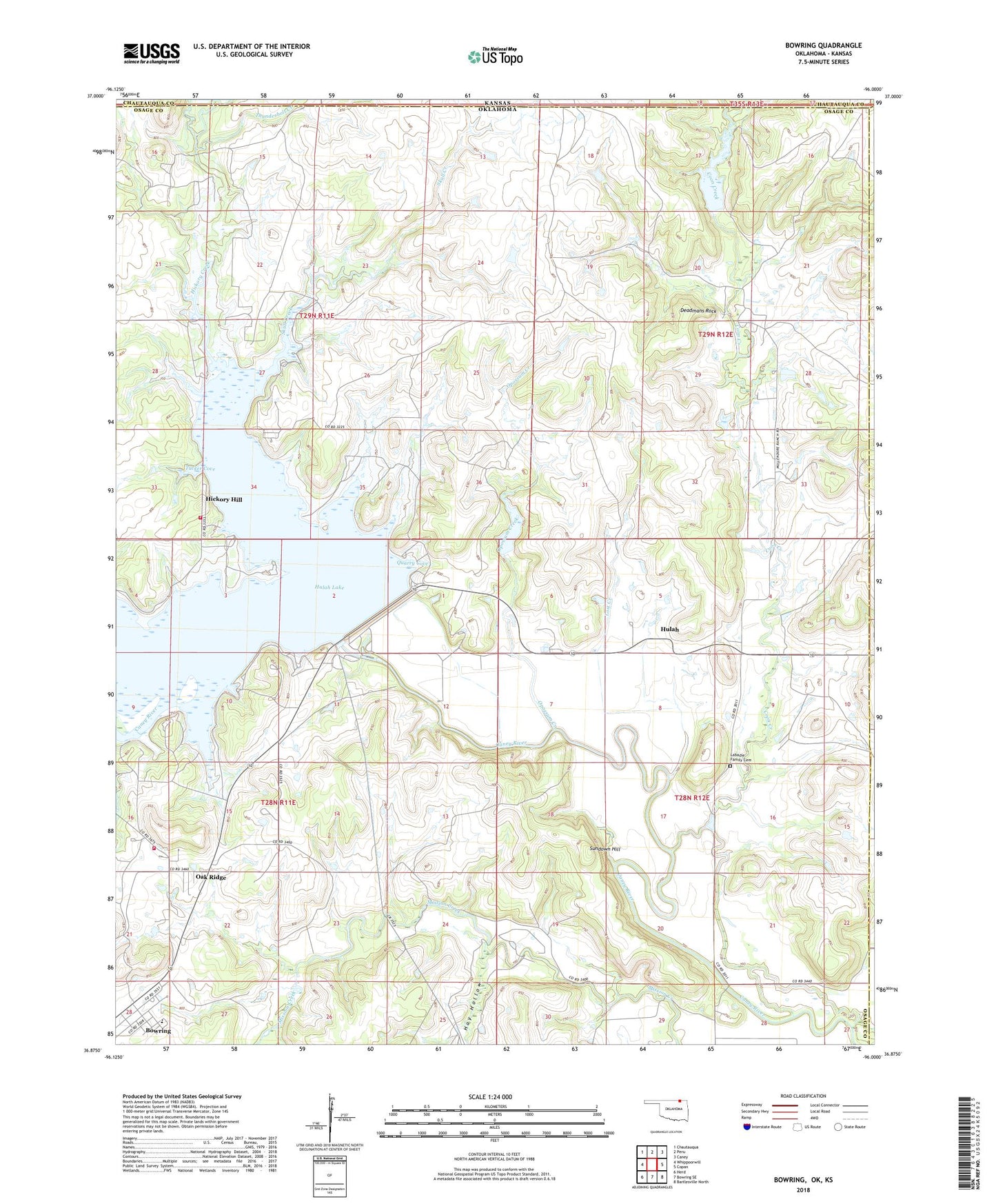
2018 topographic map quadrangle Bowring in the state of Oklahoma. Scale: 1:24000. Based on the newly updated USGS 7.5' US Topo map series, this map is in the following counties: Osage, Chautauqua, Washington. The map contains contour data, water features, and other items you are used to seeing on USGS maps, but also has updated roads and other features. This is the next generation of topographic maps. Printed on high-quality waterproof paper with UV fade-resistant inks.
Quads adjacent to this one:
West: Whippoorwill
Northwest: Chautauqua
North: Peru
Northeast: Caney
East: Copan
Southeast: Bartlesville North
South: Bowring SE
Southwest: Herd
Contains the following named places: Bowring, Bowring Census Designated Place, Bowring Elementary School, Caney Bend Public Use Area, Coon Creek, Cotton-Coon-Mission Creek Site 4 Dam, Cotton-Coon-Mission Creek Site 4 Reservoir, Cotton-Coon-Mission Creek Site 5 Dam, Cotton-Coon-Mission Creek Site 5 Reservoir, Deadmans Rock, East Hickory Creek, Hay Hollow, Hickory Creek, Hickory Hill, Hickory Hill Fire Department, Hulah, Hulah Cove Public Use Area, Hulah Dam, Hulah Lake, Hulah Volunteer Fire Department, Labadie Family Cemetery, Lost Creek, Oak Ridge, Oknoname 113003 Dam, Oknoname 113003 Reservoir, Oknoname 113005 Dam, Oknoname 113005 Reservoir, Oknoname 113006 Dam, Oknoname 113006 Reservoir, Oknoname 113008 Dam, Oknoname 113008 Reservoir, Oknoname 113009 Dam, Oknoname 113009 Reservoir, Oknoname 113010 Dam, Oknoname 113010 Reservoir, Oknoname 113011 Dam, Oknoname 113011 Reservoir, Oknoname 113013 Dam, Oknoname 113013 Reservoir, Opossum Creek, Quarry Cove, Skull Creek, Skull Creek Public Access, Sundown Hill, Thunderbolt Creek, Tucker Cove, Turkey Creek Point Public Use Area, West Hickory Creek