MyTopo
Whippoorwill Oklahoma US Topo Map
Couldn't load pickup availability
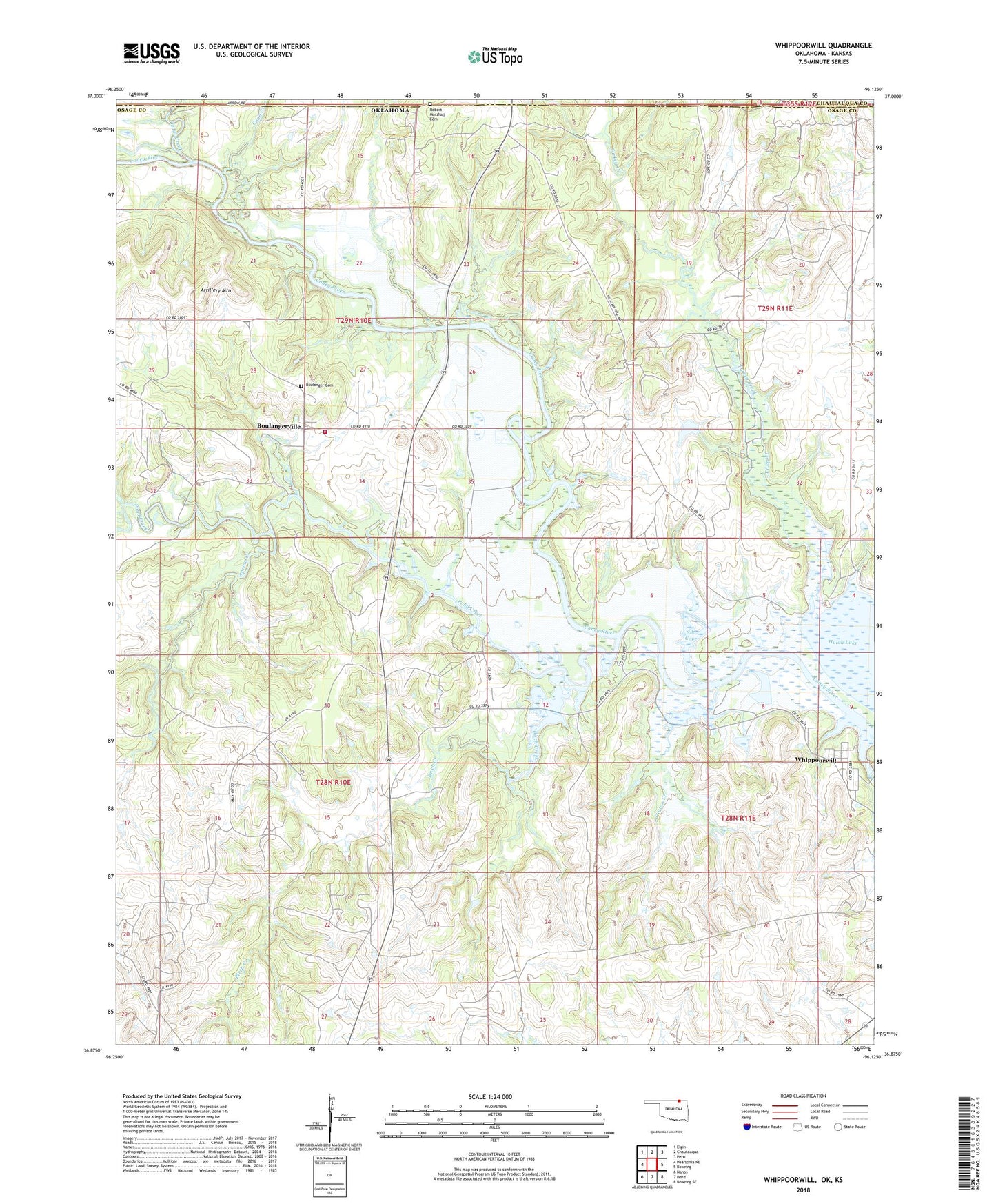
2022 topographic map quadrangle Whippoorwill in the state of Oklahoma. Scale: 1:24000. Based on the newly updated USGS 7.5' US Topo map series, this map is in the following counties: Osage, Chautauqua. The map contains contour data, water features, and other items you are used to seeing on USGS maps, but also has updated roads and other features. This is the next generation of topographic maps. Printed on high-quality waterproof paper with UV fade-resistant inks.
Quads adjacent to this one:
West: Pearsonia NE
Northwest: Elgin
North: Chautauqua
Northeast: Peru
East: Bowring
Southeast: Bowring SE
South: Herd
Southwest: Nanos
This map covers the same area as the classic USGS quad with code o36096h2.
Contains the following named places: Artillery Mountain, Birch Creek, Boulanger Cemetery, Boulanger Landing, Boulanger Rural Fire Department, Boulangerville, Caney River Park, Cedar Creek, Coon Creek, Cotton Creek, Hog Pen Public Access, Hulah Lake State Game Management Area, Hulah Lake State Waterfowl Refuge, Hulah Restocking Pond, Hulah Restocking Pond Dam, Oknoname 037023 Dam, Oknoname 037023 Reservoir, Oknoname 063038 Dam, Oknoname 063038 Reservoir, Oknoname 113015 Dam, Oknoname 113015 Reservoir, Oknoname 113016 Dam, Oknoname 113016 Reservoir, Oknoname 113017 Dam, Oknoname 113017 Reservoir, Oknoname 113018 Dam, Oknoname 113018 Reservoir, Pond Creek, Pond Creek Park, Silo Cove, Spring Creek, Township of Caney, Turkey Creek, Whippoorwill, Whippoorwill Census Designated Place