MyTopo
Canute Oklahoma US Topo Map
Couldn't load pickup availability
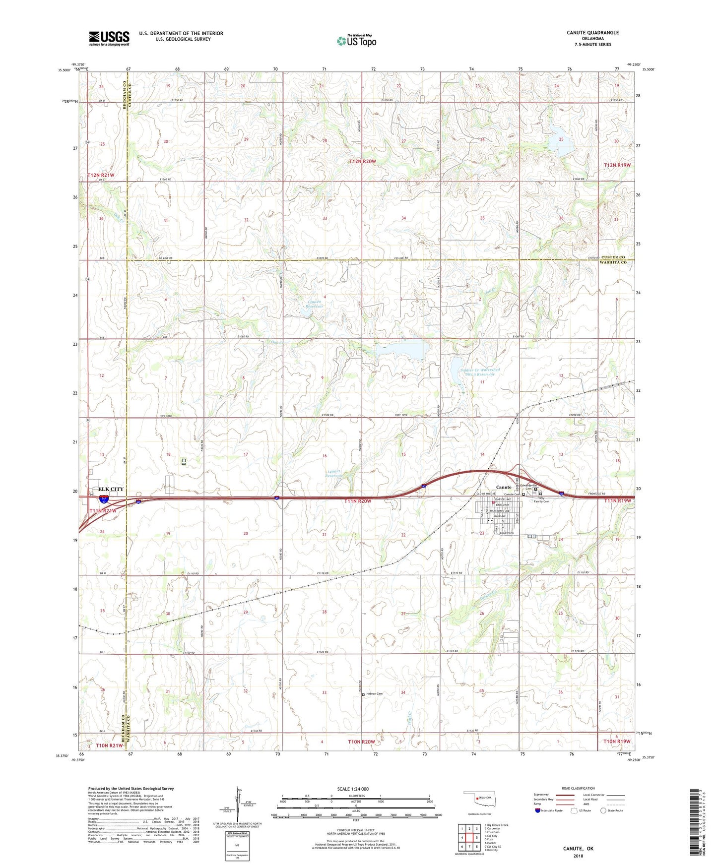
2018 topographic map quadrangle Canute in the state of Oklahoma. Scale: 1:24000. Based on the newly updated USGS 7.5' US Topo map series, this map is in the following counties: Washita, Custer, Beckham. The map contains contour data, water features, and other items you are used to seeing on USGS maps, but also has updated roads and other features. This is the next generation of topographic maps. Printed on high-quality waterproof paper with UV fade-resistant inks.
Quads adjacent to this one:
West: Elk City
Northwest: Big Kiowa Creek
North: Carpenter
Northeast: Foss Dam
East: Foss
Southeast: Dill City
South: Elk City SE
Southwest: Hocker
Contains the following named places: Canute, Canute Cemetery, Canute Elementary School, Canute Fire Department, Canute High School, Edwardsville Cemetery, Hebron Cemetery, Holy Family Cemetery, Oknoname 015004 Dam, Oknoname 015004 Reservoir, Oknoname 149020 Dam, Oknoname 149020 Reservoir, Oknoname 149021 Dam, Oknoname 149021 Reservoir, Saint Matthews Church, Soldier Creek Watershed Site 3 Dam, Soldier Creek Watershed Site 3 Reservoir, Soldier Creek Watershed Site 4 Dam, Soldier Creek Watershed Site 4 Reservoir, Soldier Creek Watershed Site 5 Dam, Soldier Creek Watershed Site 5 Reservoir, Town of Canute, Township of West Turkey Creek, ZIP Code: 73626