MyTopo
Dill City Oklahoma US Topo Map
Couldn't load pickup availability
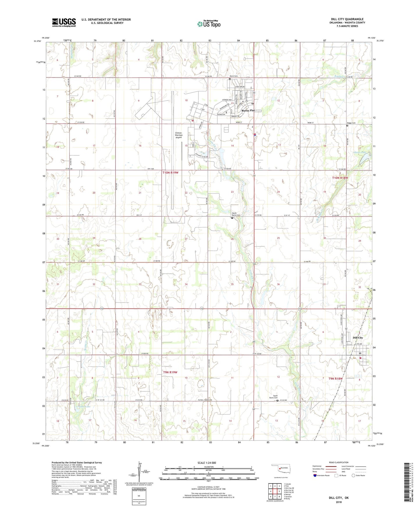
2022 topographic map quadrangle Dill City in the state of Oklahoma. Scale: 1:24000. Based on the newly updated USGS 7.5' US Topo map series, this map is in the following counties: Washita. The map contains contour data, water features, and other items you are used to seeing on USGS maps, but also has updated roads and other features. This is the next generation of topographic maps. Printed on high-quality waterproof paper with UV fade-resistant inks.
Quads adjacent to this one:
West: Elk City SE
Northwest: Canute
North: Foss
Northeast: Dill City NE
East: Dill City SE
Southeast: Rocky
South: Sentinel
Southwest: Retrop
This map covers the same area as the classic USGS quad with code o35099c2.
Contains the following named places: Adams Lake, Adams Lake City Park, Arrowhead Park, Boggy Cemetery, Burns Flat, Burns Flat - Dill City Secondary School, Burns Flat Police Department, Burns Flat Post Office, Burns Flat Volunteer Fire Department and Emergency Medical Services, Clinton Sherman Volunteer Fire Department, Clinton-Sherman Airport, Clinton-Sherman Industrial Park, Clinton-Sherman Reservoir Dam, Clinton-Sherman Reservoir Reservoir, Cordell Reservoir, Cordell Reservoir Dam, Crystal Lake, Dill City, Dill City Post Office, Dill City Volunteer Fire Department, Lynn Airfield, Naval Air Station Clinton, North Burns Cemetery, Novis Cemetery, Oknoname 149030 Dam, Oknoname 149030 Reservoir, Oknoname 149032 Dam, Oknoname 149032 Reservoir, Ross School, South Burns Cemetery, Town of Burns Flat, Town of Dill City, Western Technology Center, Will Rogers Elementary School, ZIP Codes: 73624, 73641