MyTopo
Centrahoma Oklahoma US Topo Map
Couldn't load pickup availability
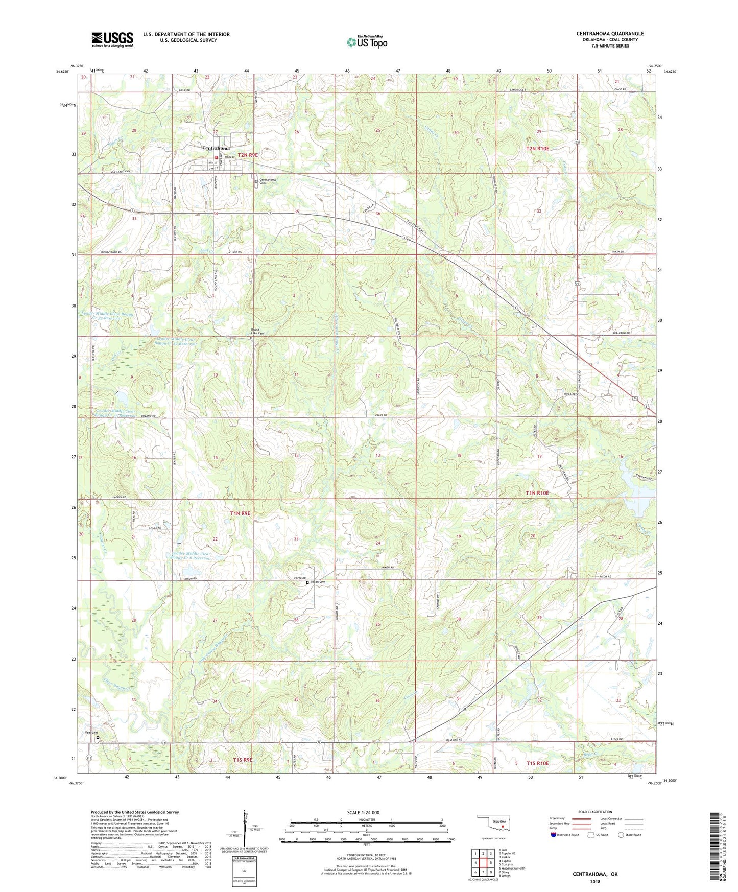
2018 topographic map quadrangle Centrahoma in the state of Oklahoma. Scale: 1:24000. Based on the newly updated USGS 7.5' US Topo map series, this map is in the following counties: Coal. The map contains contour data, water features, and other items you are used to seeing on USGS maps, but also has updated roads and other features. This is the next generation of topographic maps. Printed on high-quality waterproof paper with UV fade-resistant inks.
Quads adjacent to this one:
West: Tupelo
Northwest: Lula
North: Tupelo NE
Northeast: Parker
East: Coalgate
Southeast: Lehigh
South: Olney
Southwest: Wapanucka North
Contains the following named places: Caney-Coon Creek Site 1 Dam, Caney-Coon Creek Site 1 Reservoir, Centrahoma, Centrahoma Cemetery, City of Centrahoma, Coal County, Hazilton Mine, Keel Cemetery, Keystone Mine, Leader Creek, Leader Middle Clear Boggy Creek 34 Dam, Leader Middle Clear Boggy Creek 34 Reservoir, Leader Middle Clear Boggy Creek 35 Dam, Leader Middle Clear Boggy Creek 35 Reservoir, Leader Middle Clear Boggy Creek 36 Dam, Leader Middle Clear Boggy Creek 6 Reservoir, Little Caney Boggy Creek, Nixon Cemetery, Nixon Church, Oak Grove School, Oconee Oil Field, Phillips Mine, Round Lake Cemetery, Township of Jefferson, Township of Murray, Tupelo Fire Department Centrahoma Station, ZIP Codes: 74534, 74538