MyTopo
Parker Oklahoma US Topo Map
Couldn't load pickup availability
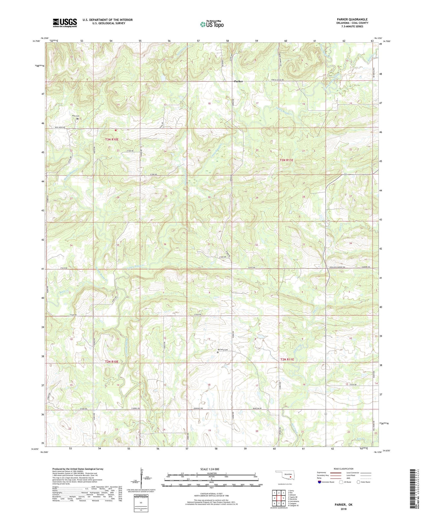
2022 topographic map quadrangle Parker in the state of Oklahoma. Scale: 1:24000. Based on the newly updated USGS 7.5' US Topo map series, this map is in the following counties: Coal. The map contains contour data, water features, and other items you are used to seeing on USGS maps, but also has updated roads and other features. This is the next generation of topographic maps. Printed on high-quality waterproof paper with UV fade-resistant inks.
Quads adjacent to this one:
West: Tupelo NE
Northwest: Gerty
North: Non
Northeast: Ashland
East: Wardville
Southeast: Coalgate SE
South: Coalgate
Southwest: Centrahoma
This map covers the same area as the classic USGS quad with code o34096f2.
Contains the following named places: Caney Boggy Creek, McCarty Cemetery, Parker, Pine / Parker Volunteer Fire Department, Pine Cemetery, Pine School, Ranch Creek, Rock Creek, Sweetwater Creek, Township of Haskell, Township of Jackson