MyTopo
Clinton Oklahoma US Topo Map
Couldn't load pickup availability
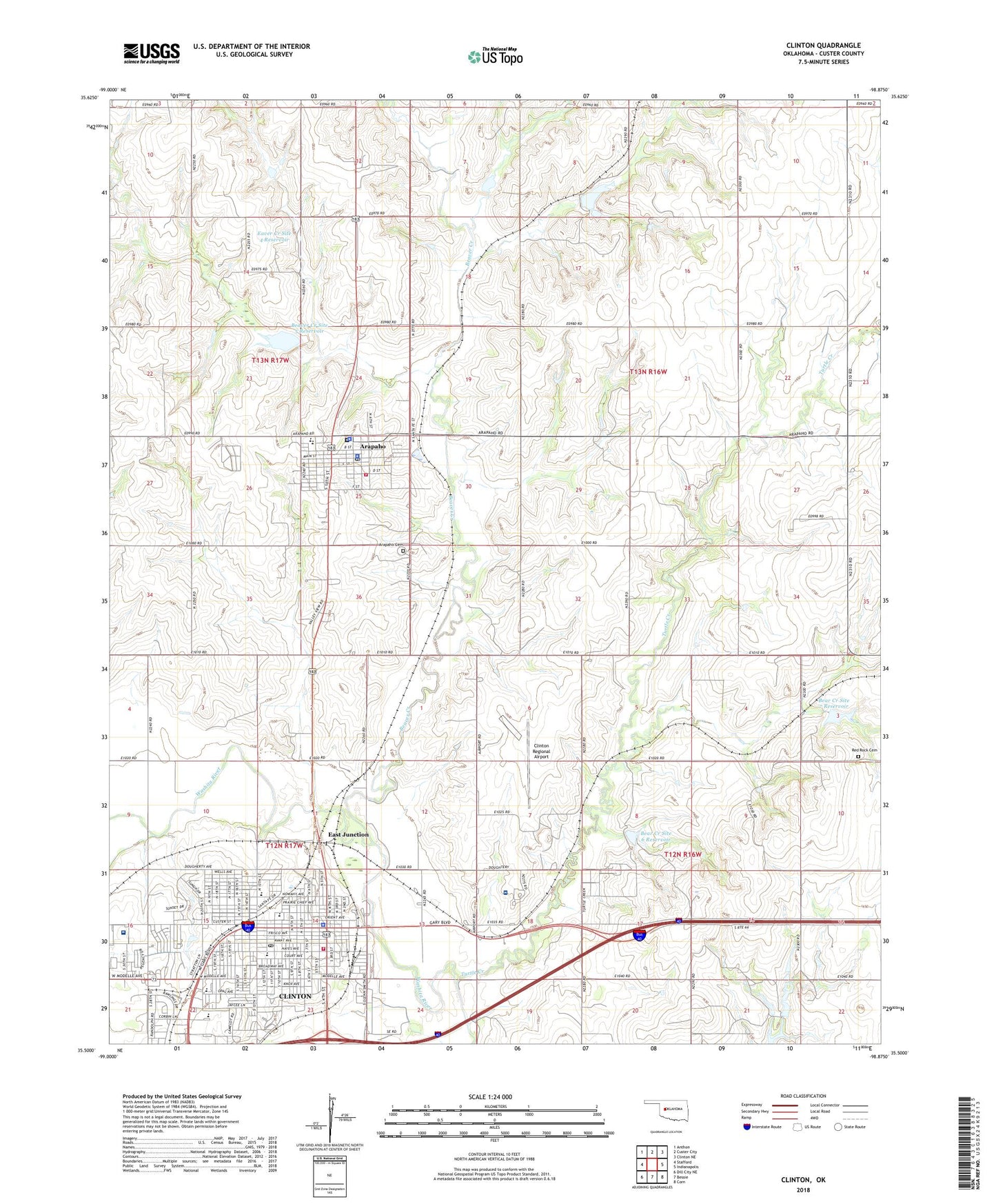
2018 topographic map quadrangle Clinton in the state of Oklahoma. Scale: 1:24000. Based on the newly updated USGS 7.5' US Topo map series, this map is in the following counties: Custer. The map contains contour data, water features, and other items you are used to seeing on USGS maps, but also has updated roads and other features. This is the next generation of topographic maps. Printed on high-quality waterproof paper with UV fade-resistant inks.
Quads adjacent to this one:
West: Stafford
Northwest: Anthon
North: Custer City
Northeast: Clinton NE
East: Indianapolis
Southeast: Corn
South: Bessie
Southwest: Dill City NE
Contains the following named places: AllianceHealth Clinton Hospital, Arapaho, Arapaho Cemetery, Arapaho City Police Department, Arapaho Elementary School, Arapaho High School, Arapaho Post Office, Arapaho Volunteer Fire Department, Baker Park, Baptist Hispanic Mission, Bear Creek Site 6 Dam, Bear Creek Site 6 Reservoir, Bear Creek Site 7 Dam, Bear Creek Site 7 Reservoir, Bear Creek Site 8 Dam, Bear Creek Site 8 Reservoir, Beaver Creek, Beaver Creek Site 10 Dam, Beaver Creek Site 10 Reservoir, Beaver Creek Site 12 Dam, Beaver Creek Site 12 Reservoir, Beaver Creek Site 13a Dam, Beaver Creek Site 4 Dam, Beaver Creek Site 5 Dam, Beaver Creek Site 5 Reservoir, Broadway Heights Baptist Church, Cheyenne and Arapaho Emergency Medical Services, Church of Christ, City of Clinton, City of Clinton Hospital Heliport, Clinton, Clinton Fire Department, Clinton High School, Clinton Indian Baptist Church, Clinton Indian Health Center, Clinton Indian Hospital Cemetery, Clinton Middle School, Clinton Police Department, Clinton Post Office, Clinton Regional Airport, Cumberland Presbyterian Church, Custer Avenue Baptist Church, Custer County Jail, Custer County Sheriff's Office, Dripping Springs Camp, East Junction, Eaver Creek Site 4 Reservoir, Faith Christian Fellowship, First Assembly of God, First Baptist Church, First Church of God, First Mennonite Church, First United Methodist Church, Klump Park, Lions Park, McLain Rogers Park, Nance Elementary School, Nance Park, Nazarene Church, Oklahoma State Highway Patrol Troop H, Pentecostal Holiness Church, Rainy Mountain Creek Site 35 Dam, Rainy Mountain Creek Site 35 Reservoir, Red Rock Cemetery, Saint Marys Catholic Church, Saint Pauls Episcopal Church, Sinor Emergency Medical Services Clinton Headquarters, Southwest Elementary School, Templo Monte Sinai Church, The Church of Jesus Christ of Latter Day Saints, Town of Arapaho, Township of Arapaho, Township of Clinton, Trinity Lutheran Church, Turtle Creek, Washington Elementary School