MyTopo
Delaware Oklahoma US Topo Map
Couldn't load pickup availability
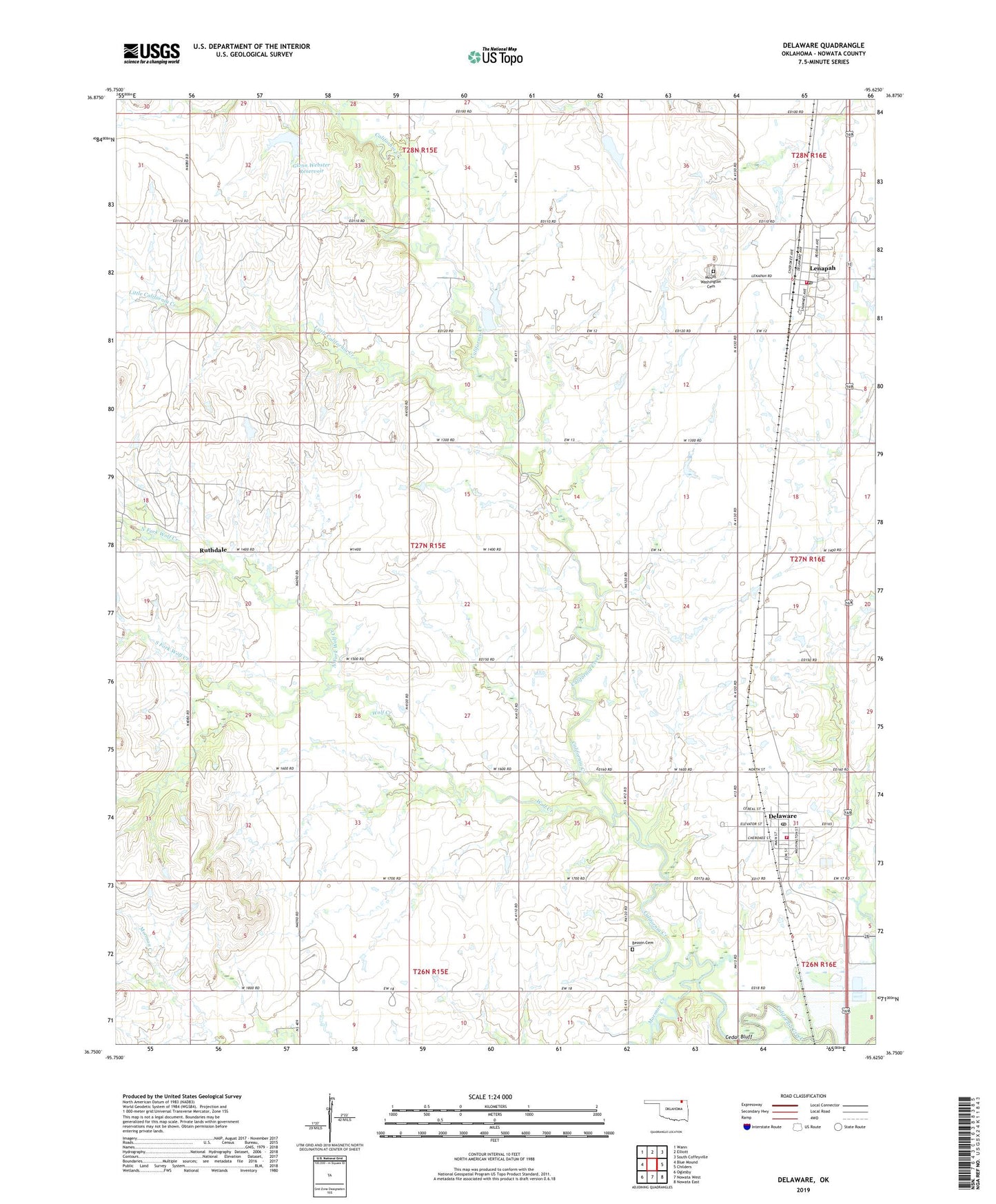
2019 topographic map quadrangle Delaware in the state of Oklahoma. Scale: 1:24000. Based on the newly updated USGS 7.5' US Topo map series, this map is in the following counties: Nowata. The map contains contour data, water features, and other items you are used to seeing on USGS maps, but also has updated roads and other features. This is the next generation of topographic maps. Printed on high-quality waterproof paper with UV fade-resistant inks.
Quads adjacent to this one:
West: Blue Mound
Northwest: Wann
North: Elliott
Northeast: South Coffeyville
East: Childers
Southeast: Nowata East
South: Nowata West
Southwest: Oglesby
Contains the following named places: Bezoin Cemetery, Cedar Bluff, Delaware, Delaware Fire Department, Delaware Post Office, Glenn Webster Dam, Glenn Webster Reservoir, Lenapah, Lenapah Fire Department, Lenapah Post Office, Little California Creek, Mormon Creek, Mount Washington Cemetery, North Fork Wolf Creek, Ruthdale, South Fork Wolf Creek, Town of Delaware, Town of Lenapah, Township of Lenapah, Wolf Creek