MyTopo
Wann Oklahoma US Topo Map
Couldn't load pickup availability
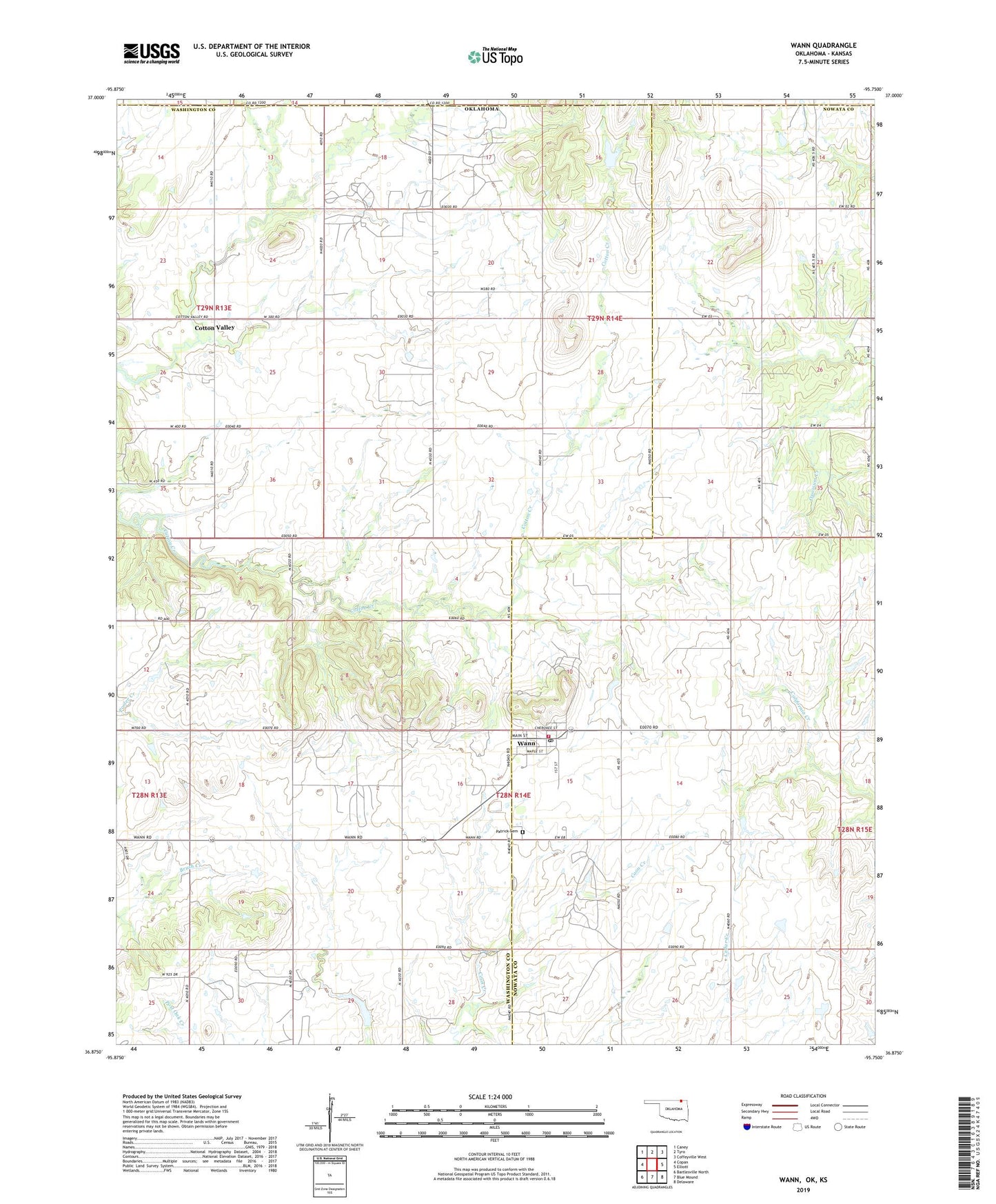
2022 topographic map quadrangle Wann in the state of Oklahoma. Scale: 1:24000. Based on the newly updated USGS 7.5' US Topo map series, this map is in the following counties: Washington, Nowata, Montgomery. The map contains contour data, water features, and other items you are used to seeing on USGS maps, but also has updated roads and other features. This is the next generation of topographic maps. Printed on high-quality waterproof paper with UV fade-resistant inks.
Quads adjacent to this one:
West: Copan
Northwest: Caney
North: Tyro
Northeast: Coffeyville West
East: Elliott
Southeast: Delaware
South: Blue Mound
Southwest: Bartlesville North
This map covers the same area as the classic USGS quad with code o36095h7.
Contains the following named places: Church of the Firstborn, Cotton Valley, Cotton-Coon-Mission Creek Site 11 Dam, Cotton-Coon-Mission Creek Site 11 Reservoir, Cotton-Coon-Mission Creek Site 7 Dam, Cotton-Coon-Mission Creek Site 7 Reservoir, Floyd Fitzsimmons Dam, Floyd Fitzsimmons Reservoir, Oakdale Church, Oakdale Free Holiness Church, Patrick Cemetery, Town of Wann, Wann, Wann Fire Department, Wann Post Office, ZIP Code: 74083