MyTopo
Doxey Oklahoma US Topo Map
Couldn't load pickup availability
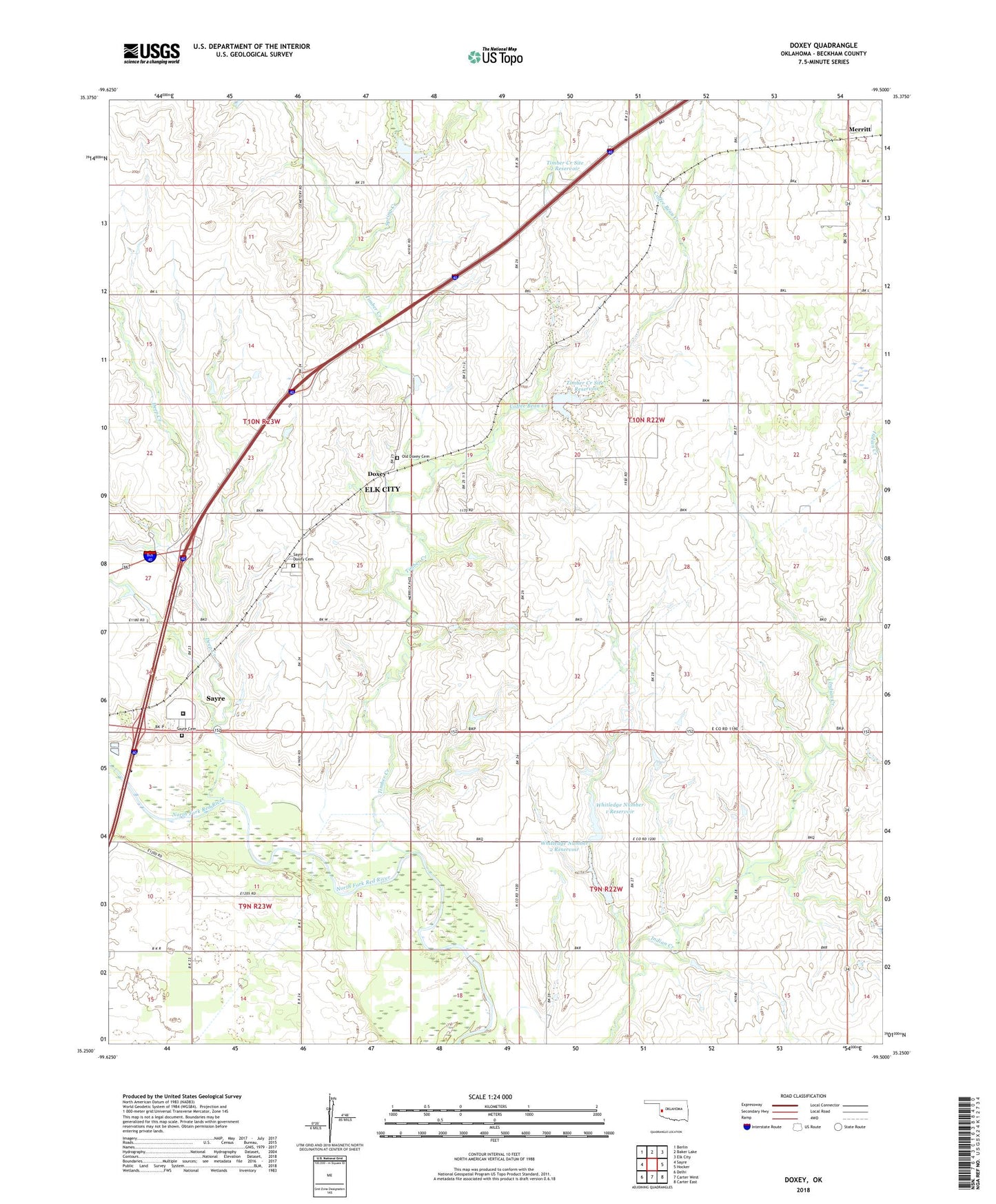
2018 topographic map quadrangle Doxey in the state of Oklahoma. Scale: 1:24000. Based on the newly updated USGS 7.5' US Topo map series, this map is in the following counties: Beckham. The map contains contour data, water features, and other items you are used to seeing on USGS maps, but also has updated roads and other features. This is the next generation of topographic maps. Printed on high-quality waterproof paper with UV fade-resistant inks.
Quads adjacent to this one:
West: Sayre
Northwest: Berlin
North: Baker Lake
Northeast: Elk City
East: Hocker
Southeast: Carter East
South: Carter West
Southwest: Delhi
Contains the following named places: Coffee Bean Creek, Deep Creek, Doxey, Doxey School, Elk City Oil Field, Merritt, North Fork Correctional Facility, O H Reid Dam, O H Reid Reservoir, Old Doxey Cemetery, Sayre - Doxey Cemetery, Sayre Cemetery, Spring Creek, Timber Creek, Timber Creek Site 1 Dam, Timber Creek Site 1 Reservoir, Timber Creek Site 2 Dam, Timber Creek Site 2 Reservoir, Timber Creek Site 3 Dam, Timber Creek Site 3 Reservoir, Whitledge Number 1 Dam, Whitledge Number 1 Reservoir, Whitledge Number 2 Dam, Whitledge Number 2 Reservoir