MyTopo
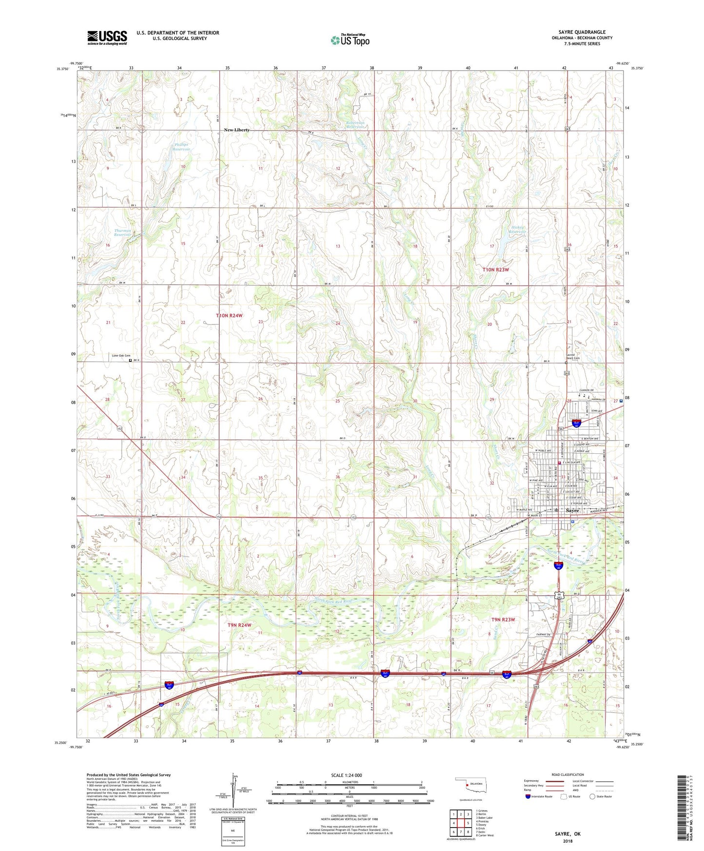
Sayre Oklahoma US Topo Map
Couldn't load pickup availability
2022 topographic map quadrangle Sayre in the state of Oklahoma. Scale: 1:24000. Based on the newly updated USGS 7.5' US Topo map series, this map is in the following counties: Beckham. The map contains contour data, water features, and other items you are used to seeing on USGS maps, but also has updated roads and other features. This is the next generation of topographic maps. Printed on high-quality waterproof paper with UV fade-resistant inks.
Quads adjacent to this one:
West: Prentiss
Northwest: Grimes
North: Berlin
Northeast: Baker Lake
East: Doxey
Southeast: Carter West
South: Delhi
Southwest: Erick
This map covers the same area as the classic USGS quad with code o35099c6.
Contains the following named places: Beckham County, Beckham County Jail, Beckham County Sheriff's Office, Beckham Mills Baptist Association Church, Church of Christ, City of Sayre, First Baptist Church, First Christian Church, Hickey Dam, Hickey Reservoir, Lone Oak Cemetery, Lone Oak Church, Long Creek, New Liberty, New Victory Church, Phillips Dam, Phillips Reservoir, Robertson Dam, Robertson Reservoir, Sacred Heart Cemetery, Saint Mathews Catholic Church, Sand Creek, Sayre, Sayre Division, Sayre Elementary School, Sayre Fire Department, Sayre High School, Sayre Memorial Hospital, Sayre Middle School, Sayre Police Department, Sayre Post Office, Short Creek, Sinor Emergency Medical Service, Southwest Oklahoma State University, Thurman Dam, Thurman Reservoir, Township of Sayre, Turkey Creek, United Methodist Church, Uptown Shopping Center, W D Lakey 5, W D Lakey 5 Dam, ZIP Code: 73662