MyTopo
Elk City SE Oklahoma US Topo Map
Couldn't load pickup availability
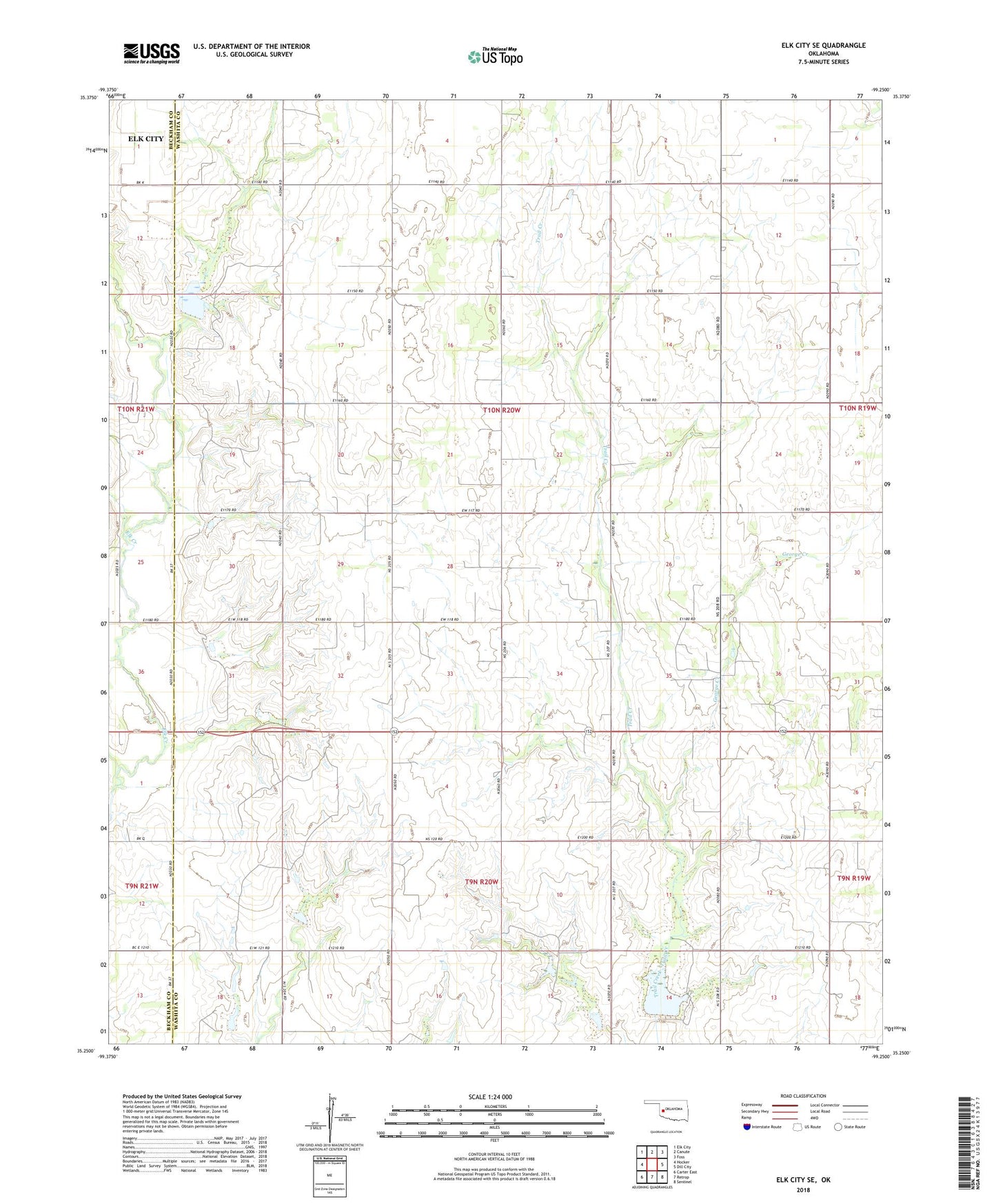
2018 topographic map quadrangle Elk City SE in the state of Oklahoma. Scale: 1:24000. Based on the newly updated USGS 7.5' US Topo map series, this map is in the following counties: Washita, Beckham. The map contains contour data, water features, and other items you are used to seeing on USGS maps, but also has updated roads and other features. This is the next generation of topographic maps. Printed on high-quality waterproof paper with UV fade-resistant inks.
Quads adjacent to this one:
West: Hocker
Northwest: Elk City
North: Canute
Northeast: Foss
East: Dill City
Southeast: Sentinel
South: Retrop
Southwest: Carter East
Contains the following named places: Elk Creek Church, Forty One, George Creek, Hefner Church, Upper Elk Creek Site 11 Dam, Upper Elk Creek Site 11 Reservoir, Upper Elk Creek Site 12 Dam, Upper Elk Creek Site 12 Reservoir, Upper Elk Creek Site 14 Dam, Upper Elk Creek Site 14 Reservoir, Upper Elk Creek Site 15 Dam, Upper Elk Creek Site 15 Reservoir, Upper Elk Creek Site 16 Dam, Upper Elk Creek Site 16 Reservoir, Upper Elk Creek Site 17 Dam, Upper Elk Creek Site 17 Reservoir, Upper Elk Creek Site 18 Dam, Upper Elk Creek Site 18 Reservoir, Upper Elk Creek Site 4 Dam, Upper Elk Creek Site 4 Reservoir