MyTopo
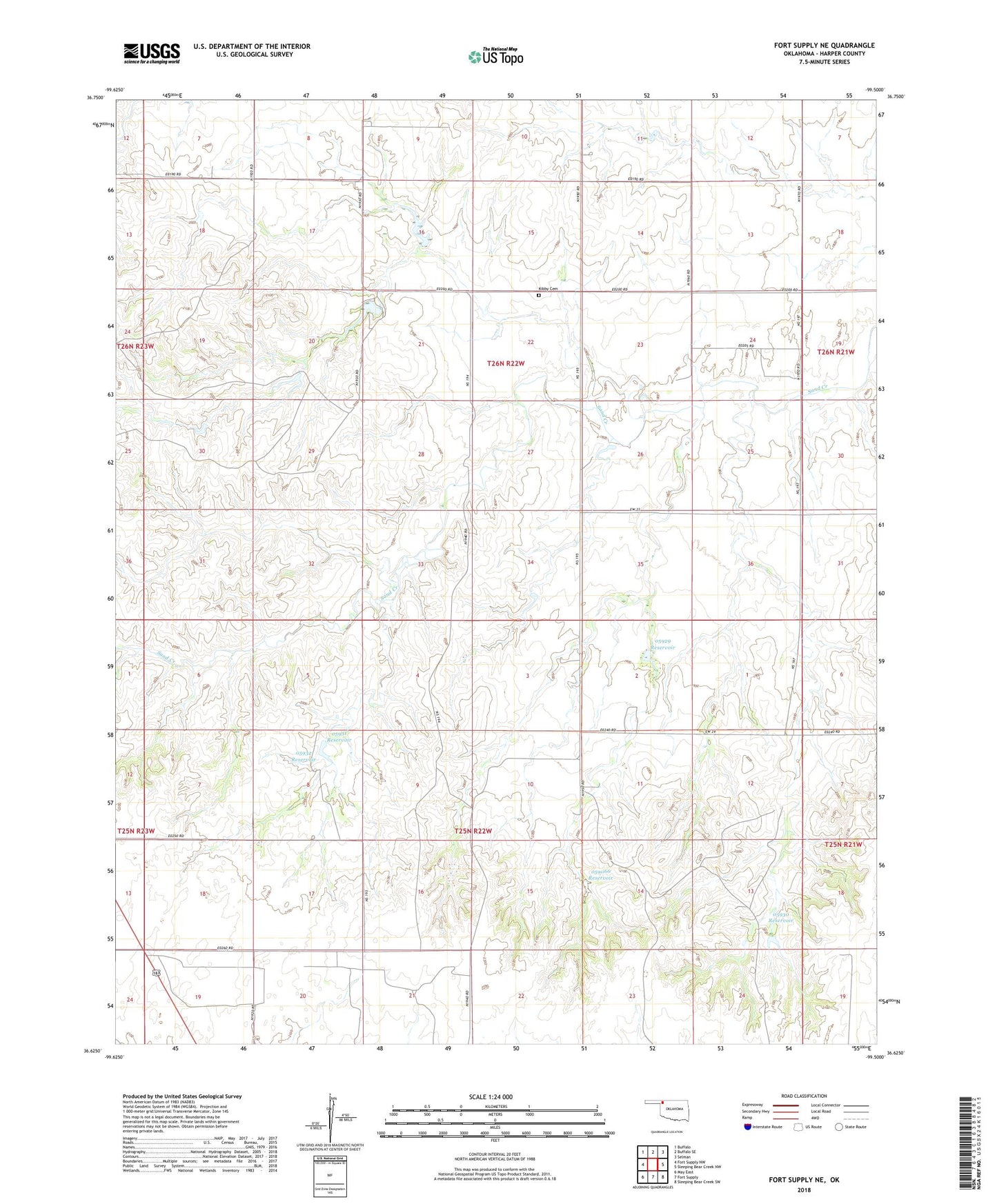
Fort Supply NE Oklahoma US Topo Map
Couldn't load pickup availability
2018 topographic map quadrangle Fort Supply NE in the state of Oklahoma. Scale: 1:24000. Based on the newly updated USGS 7.5' US Topo map series, this map is in the following counties: Harper. The map contains contour data, water features, and other items you are used to seeing on USGS maps, but also has updated roads and other features. This is the next generation of topographic maps. Printed on high-quality waterproof paper with UV fade-resistant inks.
Quads adjacent to this one:
West: Fort Supply NW
Northwest: Buffalo
North: Buffalo SE
Northeast: Selman
East: Sleeping Bear Creek NW
Southeast: Sleeping Bear Creek SW
South: Fort Supply
Southwest: May East
Contains the following named places: Kibby Cemetery, Oknoname 059066 Dam, Oknoname 059066 Reservoir, Oknoname 05926 Dam, Oknoname 05926 Reservoir, Oknoname 05927 Dam, Oknoname 05927 Reservoir, Oknoname 05928 Dam, Oknoname 05928 Reservoir, Oknoname 05929 Dam, Oknoname 05929 Reservoir, Oknoname 05930 Dam, Oknoname 05930 Reservoir, Oknoname 05931 Dam, Oknoname 05931 Reservoir, Oknoname 05932 Dam, Oknoname 05932 Reservoir, Owens 2 Dam, Owens 2 Reservoir, Randall 10 Dam, Randall 10 Reservoir, Randall 2 Dam, Randall 2 Reservoir