MyTopo
Buffalo Oklahoma US Topo Map
Couldn't load pickup availability
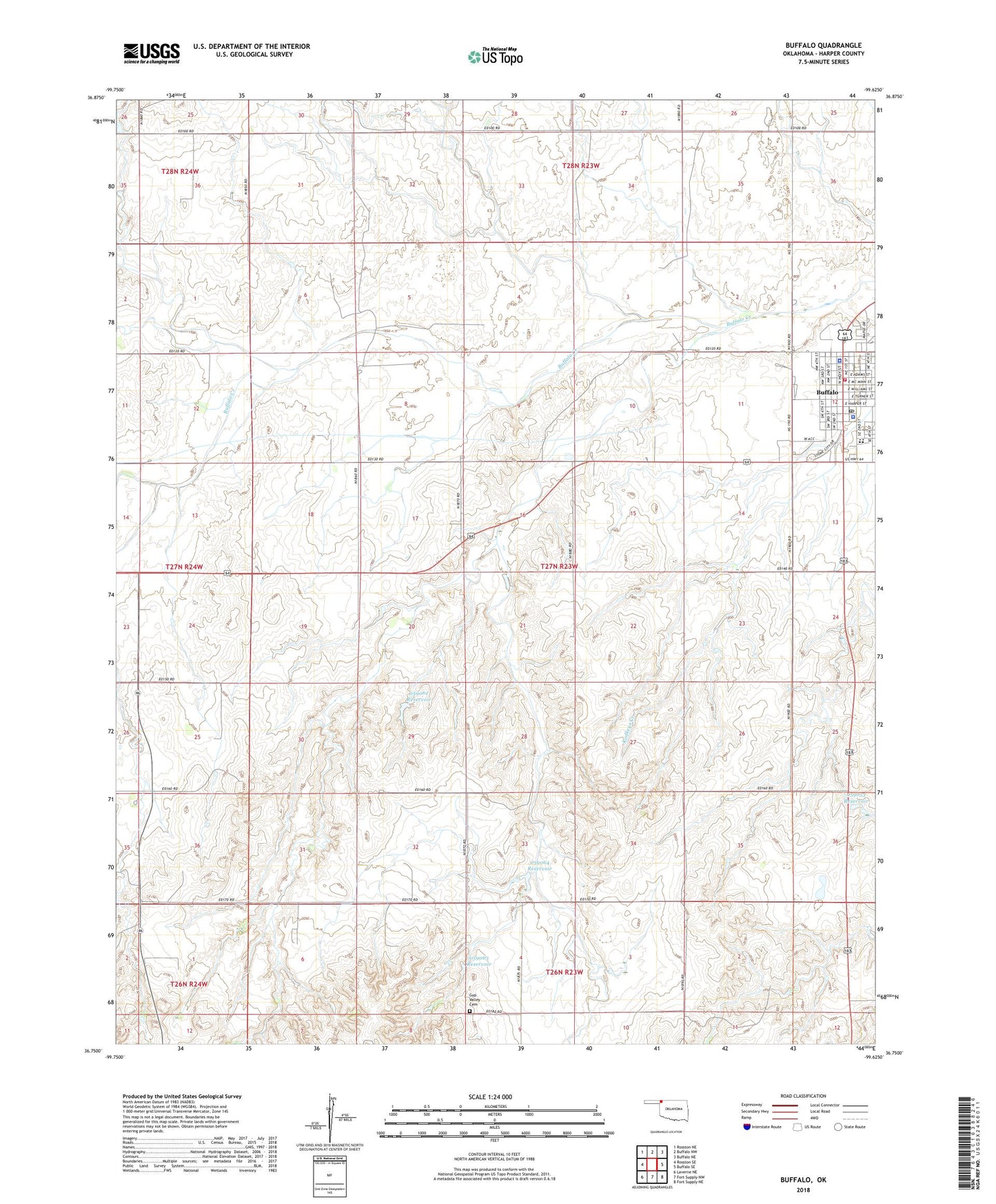
2022 topographic map quadrangle Buffalo in the state of Oklahoma. Scale: 1:24000. Based on the newly updated USGS 7.5' US Topo map series, this map is in the following counties: Harper. The map contains contour data, water features, and other items you are used to seeing on USGS maps, but also has updated roads and other features. This is the next generation of topographic maps. Printed on high-quality waterproof paper with UV fade-resistant inks.
Quads adjacent to this one:
West: Rosston SE
Northwest: Rosston NE
North: Buffalo NW
Northeast: Buffalo NE
East: Buffalo SE
Southeast: Fort Supply NE
South: Fort Supply NW
Southwest: Laverne NE
This map covers the same area as the classic USGS quad with code o36099g6.
Contains the following named places: Assembly of God Church, Buffalo, Buffalo Elementary School, Buffalo Emergency Medical Service, Buffalo Fire and Rescue, Buffalo High School, Buffalo Police Department, Buffalo Post Office, Gyp Valley Cemetery, Harper County, Harper County Community Hospital, Harper County Jail, Harper County Sheriff's Office, Oknoname 059039 Dam, Oknoname 059039 Reservoir, Oknoname 059053 Dam, Oknoname 059053 Reservoir, Oknoname 059062 Dam, Oknoname 059062 Reservoir, Oknoname 059063 Dam, Oknoname 059063 Reservoir, Oknoname 059064 Dam, Oknoname 059064 Reservoir, Oknoname 059065 Dam, Oknoname 059065 Reservoir, R Wickham Number 4 Dam, R Wickham Number 4 Reservoir, Town of Buffalo, Township of Buffalo