MyTopo
Healdton SW Oklahoma US Topo Map
Couldn't load pickup availability
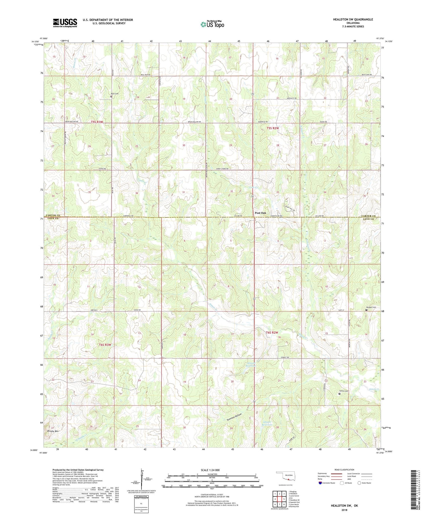
2018 topographic map quadrangle Healdton SW in the state of Oklahoma. Scale: 1:24000. Based on the newly updated USGS 7.5' US Topo map series, this map is in the following counties: Love, Carter. The map contains contour data, water features, and other items you are used to seeing on USGS maps, but also has updated roads and other features. This is the next generation of topographic maps. Printed on high-quality waterproof paper with UV fade-resistant inks.
Quads adjacent to this one:
West: Orr
Northwest: Ringling
North: Healdton
Northeast: Lone Grove
East: Healdton SE
Southeast: Burneyville
South: Leon North
Southwest: Spanish Fort
Contains the following named places: Brushy Mountain, Coon Creek, Lower Bayou Creek Site 13 Dam, Lower Bayou Creek Site 13 Reservoir, Lower Bayou Creek Site 14 Dam, Lower Bayou Creek Site 14 Reservoir, Lower Bayou Creek Site 15 Dam, Lower Bayou Creek Site Fifteen Reservoir, Lower Bayou Site Number 15 Dam, Morgan Cemetery, North Simon Creek, Oknoname 085007 Dam, Oknoname 085007 Reservoir, Oknoname 085008 Dam, Oknoname 085008 Reservoir, Post Oak, Reck, Reck Cemetery, Reck Church, Simon Cemetery, Townley Hollow, ZIP Code: 73463