MyTopo
Healdton SE Oklahoma US Topo Map
Couldn't load pickup availability
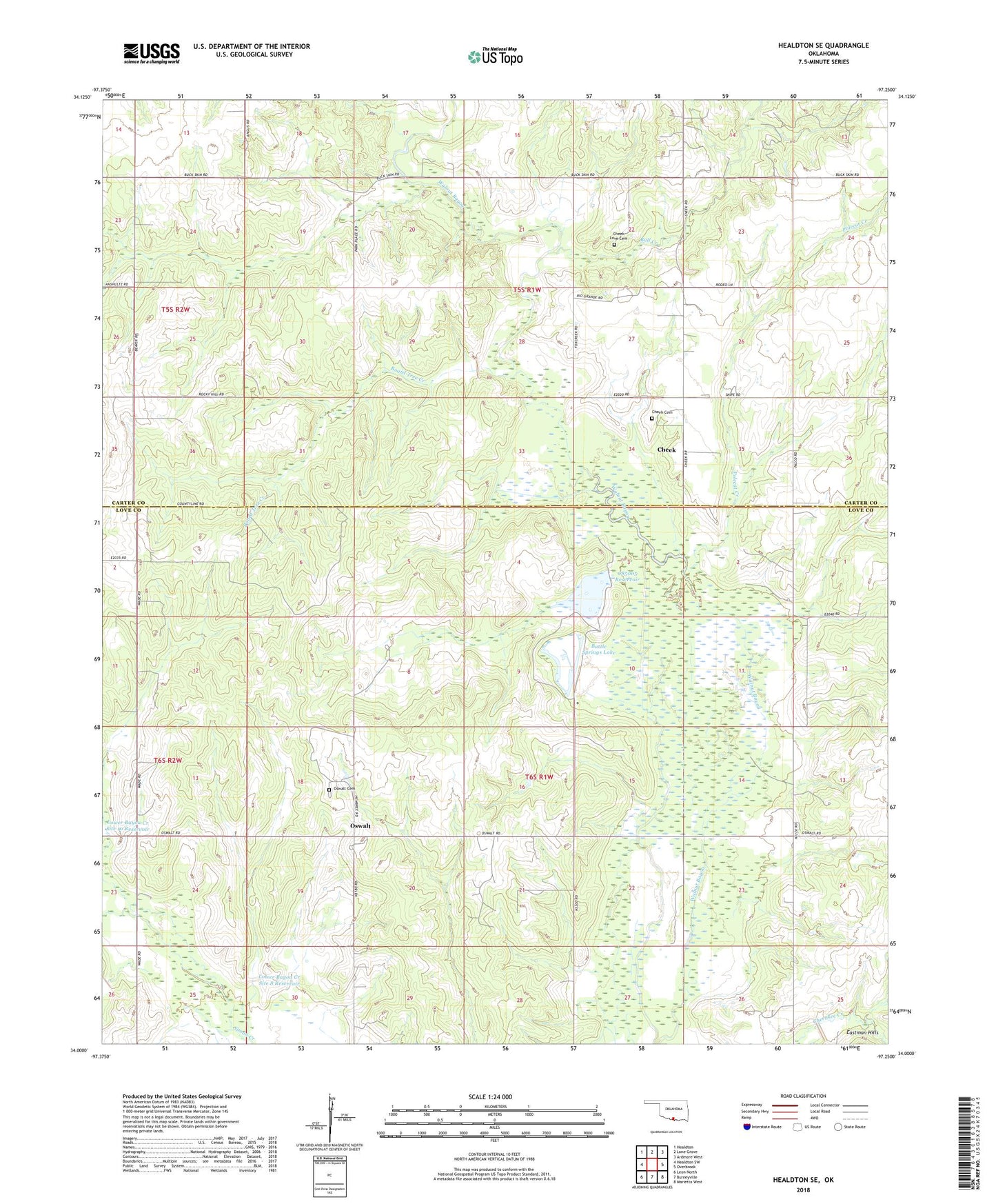
2022 topographic map quadrangle Healdton SE in the state of Oklahoma. Scale: 1:24000. Based on the newly updated USGS 7.5' US Topo map series, this map is in the following counties: Love, Carter. The map contains contour data, water features, and other items you are used to seeing on USGS maps, but also has updated roads and other features. This is the next generation of topographic maps. Printed on high-quality waterproof paper with UV fade-resistant inks.
Quads adjacent to this one:
West: Healdton SW
Northwest: Healdton
North: Lone Grove
Northeast: Ardmore West
East: Overbrook
Southeast: Marietta West
South: Burneyville
Southwest: Leon North
This map covers the same area as the classic USGS quad with code o34097a3.
Contains the following named places: Abner Church, Battle Springs Lake, Battle Springs Lake Dam, Board Tree Creek, Bull Creek, Cheek, Cheek Cemetery, Cheek Church, Cheek Love Cemetery, KICM-FM (Healdton), Lone Grove Church, Lower Bayou Creek Site 10 Dam, Lower Bayou Creek Site 10 Reservoir, Lower Bayou Creek Site 7 Dam, Lower Bayou Creek Site 7 Reservoir, Lower Bayou Creek Site 8 Dam, Lower Bayou Creek Site 8 Reservoir, Lower Bayou Creek Site 9 Dam, Lower Bayou Creek Site 9 Reservoir, Oknoname 085005 Dam, Oknoname 085005 Reservoir, Oswalt, Oswalt Cemetery, Polecat Creek, Upper Bayou Site Number 22 Dam, Upper Bayou Site Number 22 Reservoir