MyTopo
Herd Oklahoma US Topo Map
Couldn't load pickup availability
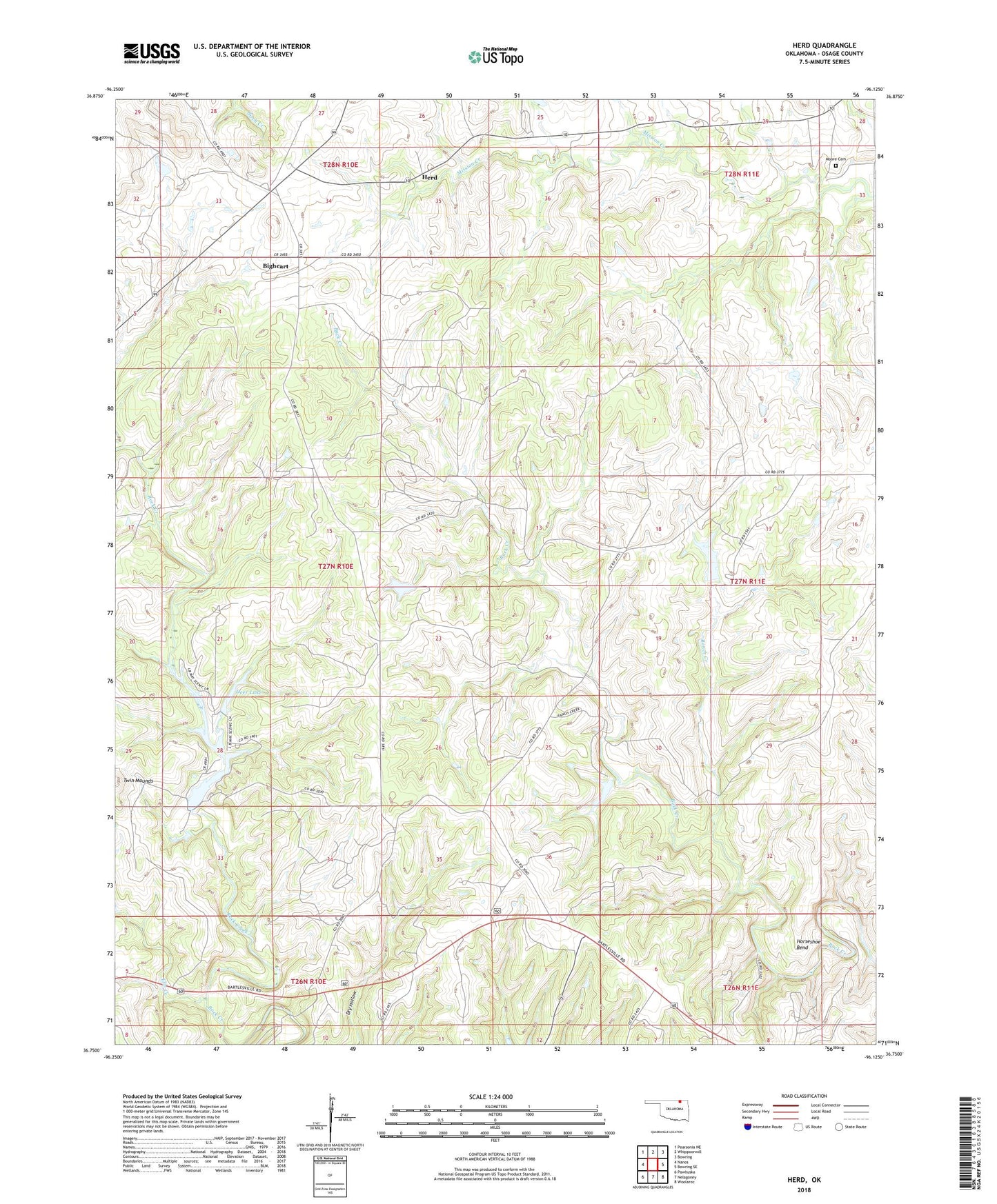
2018 topographic map quadrangle Herd in the state of Oklahoma. Scale: 1:24000. Based on the newly updated USGS 7.5' US Topo map series, this map is in the following counties: Osage. The map contains contour data, water features, and other items you are used to seeing on USGS maps, but also has updated roads and other features. This is the next generation of topographic maps. Printed on high-quality waterproof paper with UV fade-resistant inks.
Quads adjacent to this one:
West: Nanos
Northwest: Pearsonia NE
North: Whippoorwill
Northeast: Bowring
East: Bowring SE
Southeast: Woolaroc
South: Nelagoney
Southwest: Pawhuska
Contains the following named places: Bigheart, Deer Lake, Deer Lake Dam, Elm Creek, Herd, Horseshoe Bend, Moore Cemetery, Oknoname 113032 Dam, Oknoname 113032 Reservoir, Oknoname 113094 Dam, Oknoname 113094 Reservoir, Oknoname 113095 Dam, Oknoname 113095 Reservoir, Oknoname 113096 Dam, Oknoname 113096 Reservoir, Oknoname 113097 Dam, Oknoname 113097 Reservoir, Oknoname 113098 Dam, Oknoname 113098 Reservoir, Oknoname 113099 Dam, Oknoname 113099 Reservoir, Pawhuska Division, Ranch Creek, Spring Lake, Sunset Lake, Sunset Lake Dam, Twin Mounds